


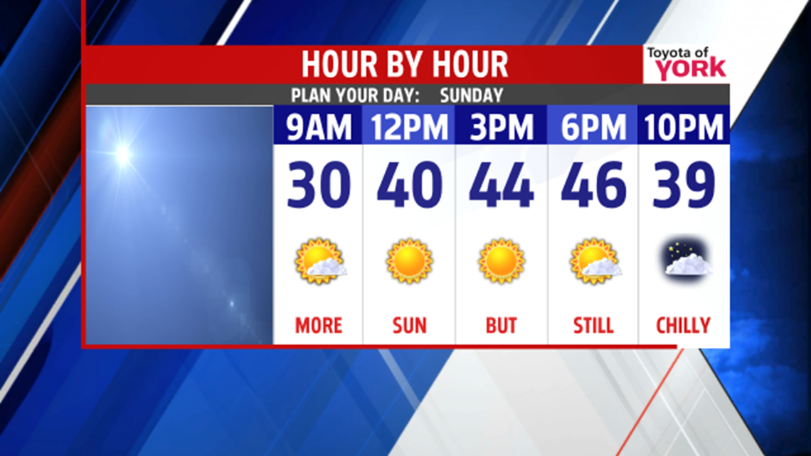
MORE SUN BUT NOT AS COLD
After a very cold Saturday, a frigid Saturday night is in store for our region. Temperatures quickly fall into the 20s this evening as skies begin to clear. The winds gradually fade through the night too. Overnight low temperatures fall into the upper teens to lower 20s. Plenty of sunshine is expected for Sunday. It’s less cold, but still pretty chilly by late March standards. Expect afternoon high temperatures in the middle to upper 40s.
EARLY WEEK SHOWER CHANCES
A few fast moving systems bring some spotty shower chances to the area for the beginning of next week. The first brings the chance for some early morning snow or rain showers Monday morning before temperatures quickly warm. Skies clear out by the afternoon, and temperatures rapidly rise to seasonable readings in the 50s. Tuesday, there’s a late chance for some showers. It’s a bit cooler, with temperatures in the upper 40s.
STAYING MILD

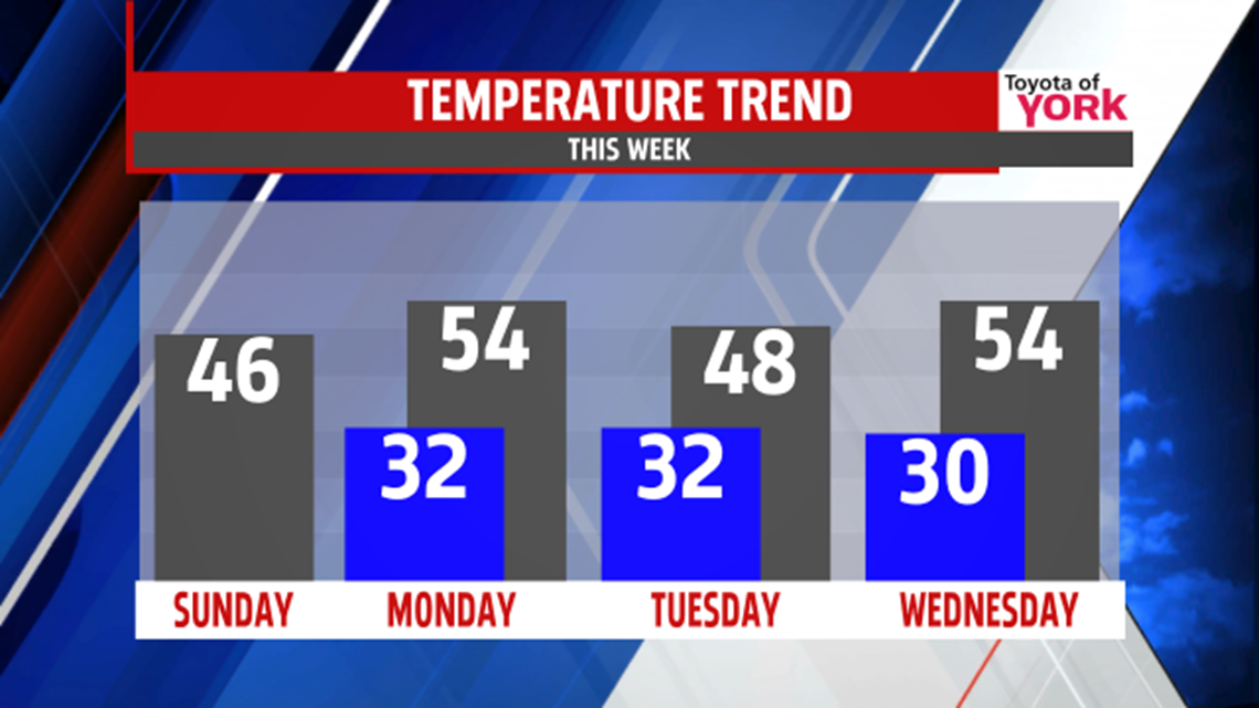
Wednesday high pressure takes control over the region, bringing full sunshine. It’s a seasonable day, with highs in the middle 50s. Temperatures continue to rise Thursday, but so do our shower chances. Clouds build through the day, and some late day showers are possible lasting into the night. High temperatures are in the lower to middle 60s! Friday a few showers are still possible, with temperatures still remaining mild near 60 degrees. The weekend looks to clear out, but temperatures fall back to seasonable levels in the 50s.
Enjoy the rest of your weekend!
-Andrea Michaels – FOX43 Weekend Meteorologist
Follow me on Twitter: @amichaelswx
Like me on Facebook: Andrea Michaels FOX43
