

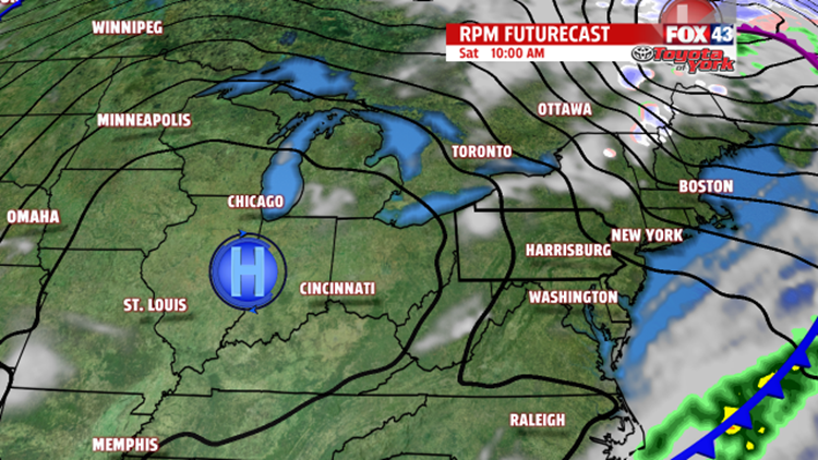

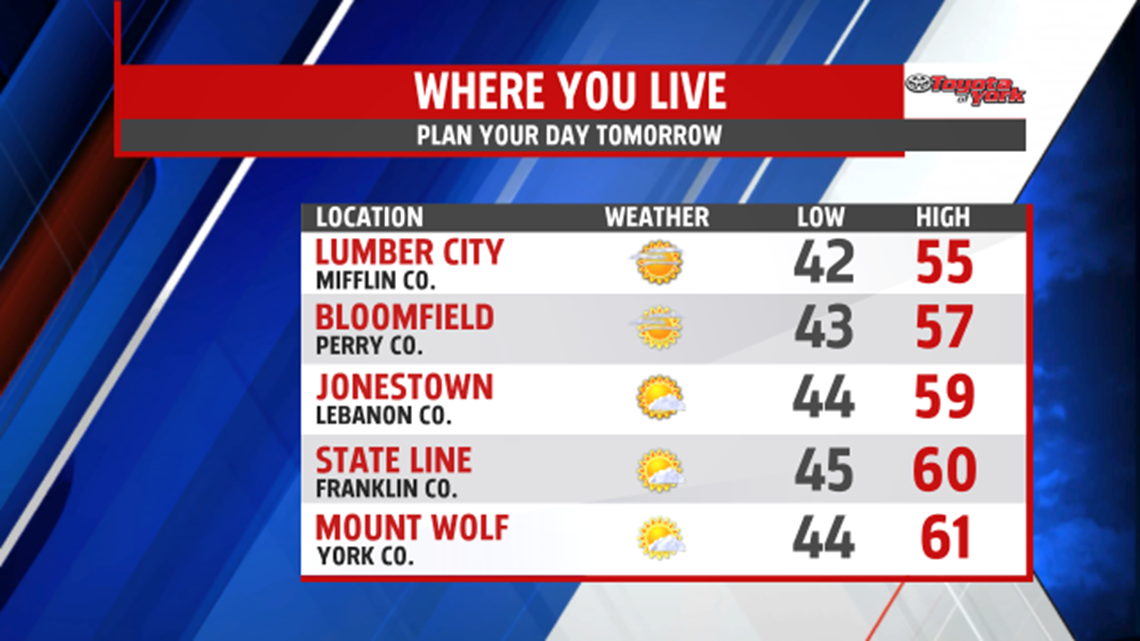

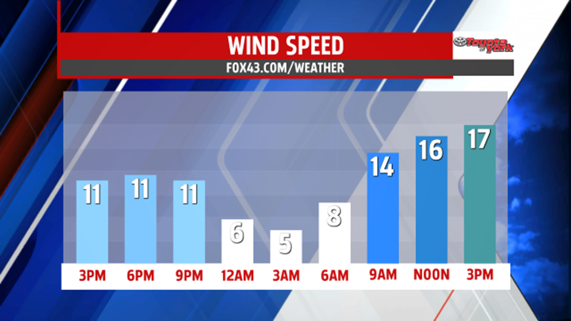
SUNSHINE RETURNS FOR WEEKEND: Showers and few rumbles push through into the early evening hours as a cold front crosses through. By about 7/8pm, the showers come to an end, and the rest of the evening is dry. Clouds begin to break apart too, and this lasts into the overnight period. Some afternoon clouds are possible Saturday, otherwise, expect plenty of sunshine through the day. It’s breezy to, with highs in the middle to upper 50s, and some reaching 60 degrees. Sunday the sunshine continues. It’s milder too, with highs in the lower to middle 60s.
EARLY NEXT WEEK: The mild temperatures continue into next week. Clouds build through the day as our next cold front approaches. Showers hold off until the evening, and they last through Tuesday morning. Sunshine returns by Tuesday afternoon. Highs are in the upper 60s lower 70s Monday, and fall into the middle 60s Tuesday.
STAYING MILD: Wednesday ample sunshine returns to the regions. We’re even dry Thursday as well, but clouds increase yet again through the daytime hours. Depending on the timing of the next cold front, showers will hold off until Thursday night. Either way, Friday brings the chance for showers as the front pushes through. Highs remain in the 60s to near 70 degree through the end of the week.
Have a great weekend!
-Andrea Michaels – FOX43 Weekend Meteorologist
Follow me on Twitter: @amichaelswx
Like me on Facebook: Andrea Michaels FOX43
