

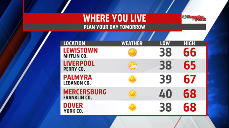

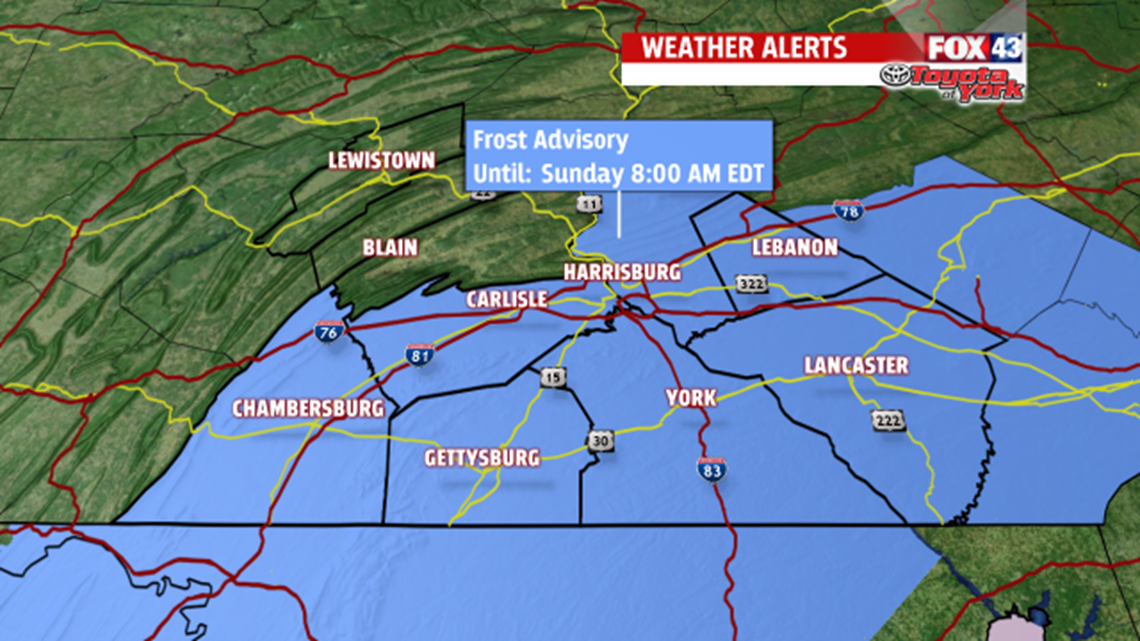

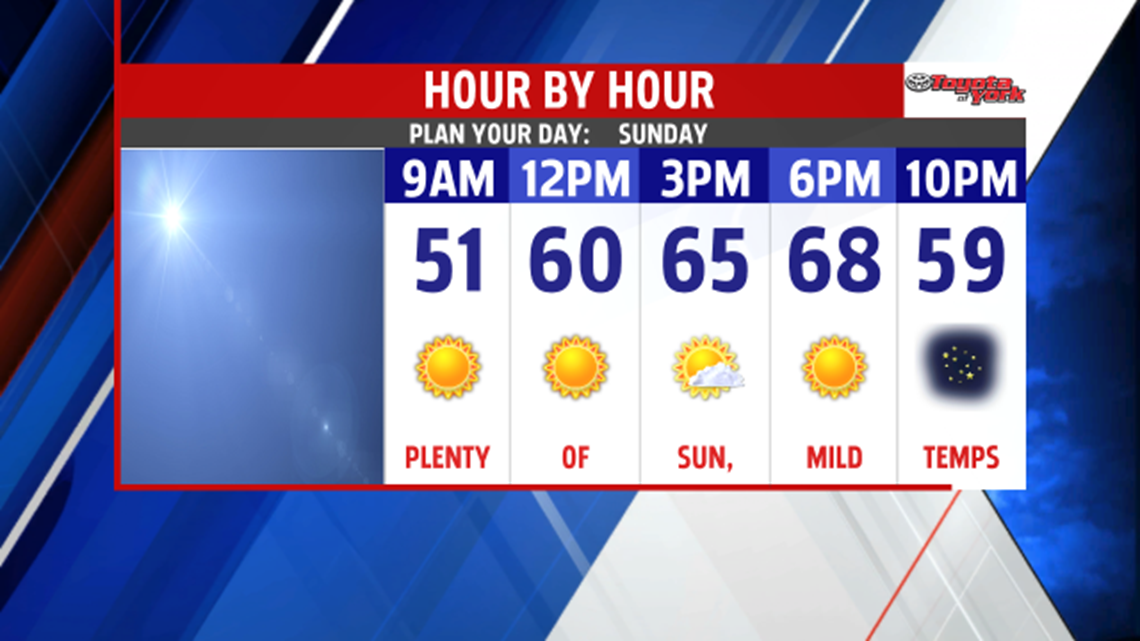
CHILLY START TO MILD DAY: High pressure is in complete control of the weather, and this keeps the skies clear through the evening and overnight period. The strong daytime breezes fade once the sun sets too. This setup allows for a very chilly night across the region, with temperatures falling into the 30s. Patchy areas of frost are possible, and a Frost Advisory is in effect for parts of the region from 2 A.M. to 8 A.M. Sunday morning. After the chilly start, temperatures are quick to spike Sunday. You can also expect abundant sunshine! It’s a milder day, with highs in the lower to middle 60s.
EARLY NEXT WEEK: The mild temperatures continue into next week. Clouds build through the day on Monday as our next cold front approaches. Showers hold off until the evening, and they last through Tuesday morning. Sunshine returns by Tuesday afternoon. Highs are in the upper 60s lower 70s Monday, and fall into the middle to upper 60s Tuesday.
STAYING MILD: Wednesday ample sunshine returns to the region. We’re even dry Thursday as well, but clouds increase yet again through the daytime hours. Depending on the timing of the next cold front, showers will hold off until Thursday night. Either way, Friday brings the chance for showers as the front pushes through. Saturday looks to bring a shower chance as well. Highs remain in the 60s to near 70 degree through the end of the week.
Enjoy the rest of your weekend!
-Andrea Michaels – FOX43 Weekend Meteorologist
Follow me on Twitter: @amichaelswx
Like me on Facebook: Andrea Michaels FOX43
