

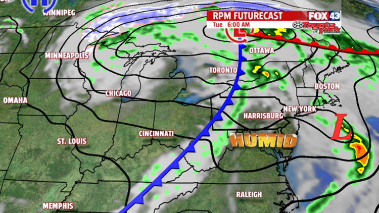

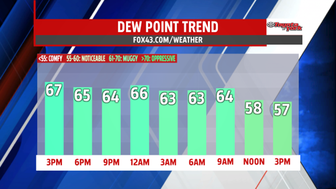

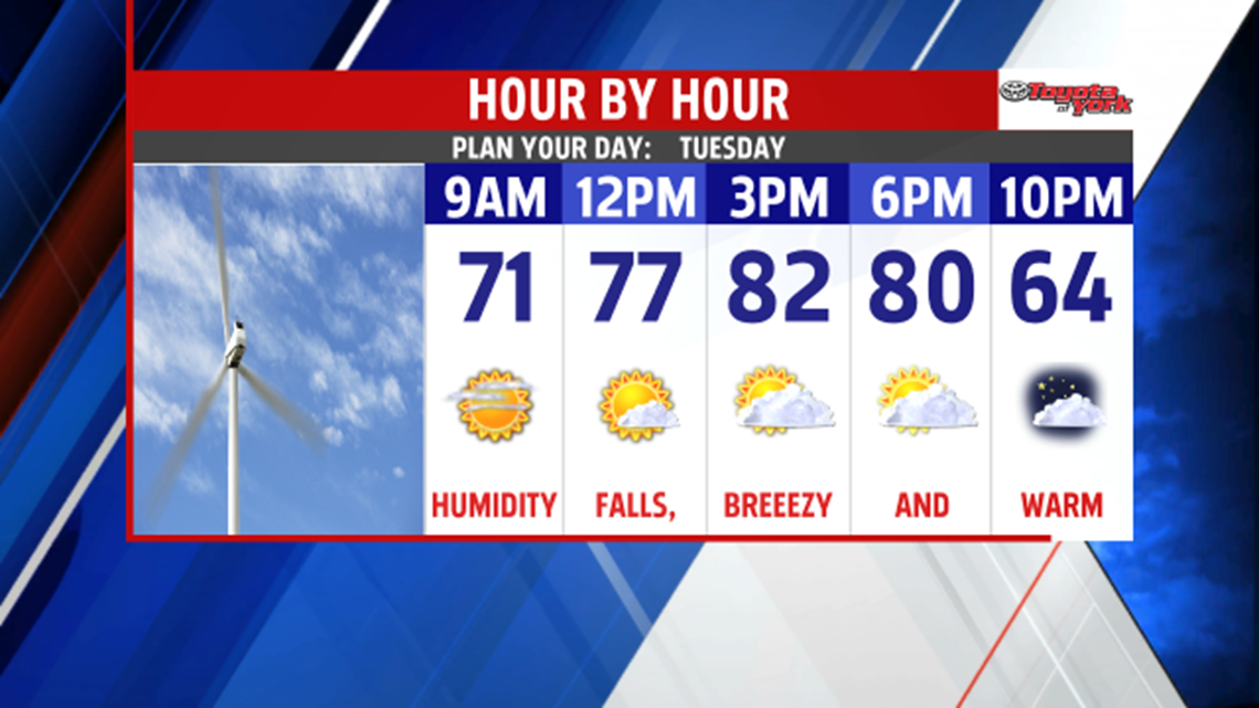
WARM AIR EXITS SOON: An approaching cold front and the remnants of Tropical Storm Ana work in conjunction to bring isolated shower and thunderstorm chances through the evening and overnight period. The brunt of the moisture from Ana affects mainly the eastern half of our area this evening. Overnight, as the cold front races through, isolated showers and thunderstorms are expected, but the activity out west is expected to fade as it approaches. It’s still warm and muggy with lows in the 60s. An isolated early shower is possible early Tuesday morning before the cold front exits. Winds pick up through the morning, and the humidity levels lower as drier air enters. Cooler air behind the front will take an extra day to reach us. In the meantime, temperatures are still in the lower to middle 80s.


COOLING DOWN: Cool Canadian high pressure moving in behind the cold front knocks temperatures to near seasonable averages for the middle of the week. Conditions remain comfortable with low humidity levels. Highs are in the middle to upper 60s degrees on Wednesday with partly cloudy skies and cool breezes. Thursday features plenty of sunshine, with highs in the lower to middle 70s. Clouds begin to build back into the area Friday as the pattern prepares to turn unsettled once more. A late day shower or thunderstorm is possible.
UNSETTLED WEEKEND: The weekend turns a bit on the unsettled side. There will be the chance for a few thunderstorms, mainly on Saturday. Saturday, temperatures continue to rise, with readings reaching the upper 70s to lower 80s. Sunday and Monday highs are in the upper 70s with isolated thunderstorm chances.
Have a great night!
