

AFTERNOON INTO THE EVENING
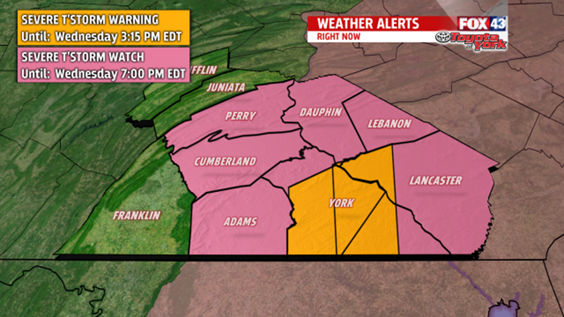
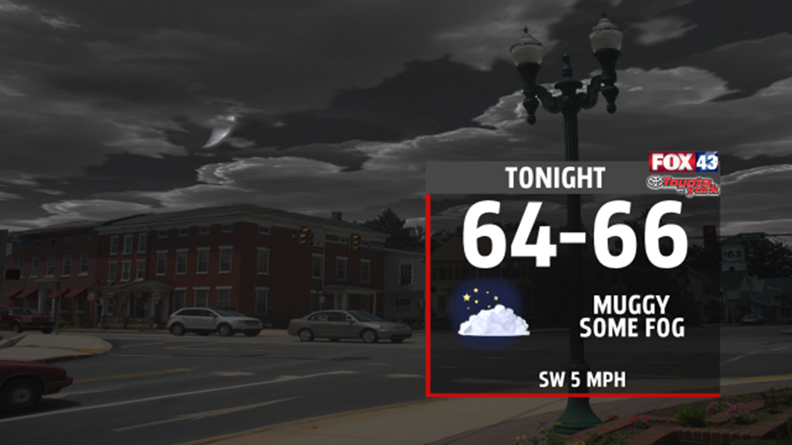
A line of showers and thunderstorms will roll through bringing heavy downpours and possible damaging winds. They look to exit the area late this afternoon. SEVERE THUNDERSTORM WATCH is in effect until 7pm. Storms have already produced over 2 inches in an hour in and around Harrisburg so a Flood Advisory for small creeks and streams has been issued until 3pm and may be issued for other areas as the storms continue to push east. Rain has cooled places from the 80s to the 70s but temps could rebound back to the low 80s late this afternoon. They will fall again once the sun sets.


OUTLOOK
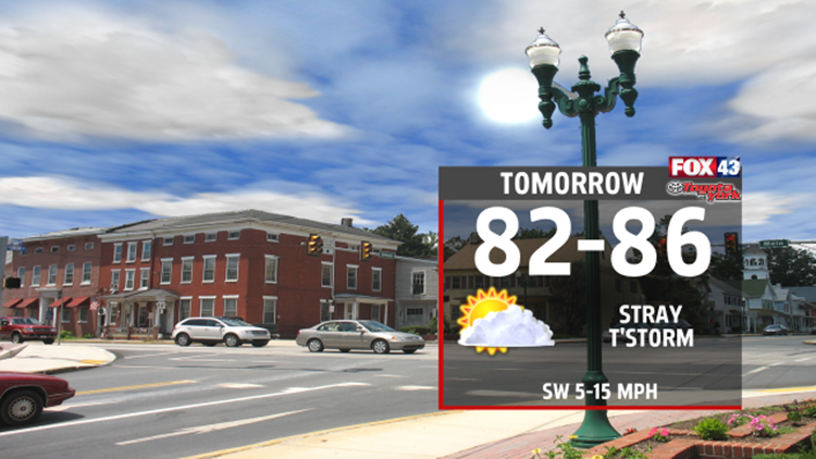
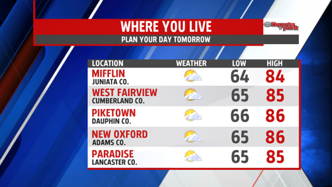
High pressure brings mostly sunny skies with a stray storm chance for Friday with highs in the 80s. For the weekend, Saturday looks to remain mostly dry but very warm and humid as the wind picks up out of the southwest. Highs will rise to the mid and upper 80s with late storms possible. A strong cold front will approach overnight bringing a better threat for showers and thunderstorms. It will slowly sag south but stalls across the area through early next keeping shower chances around. Temperatures will also fall back to near 80 on Sunday, 70s for early next week.
