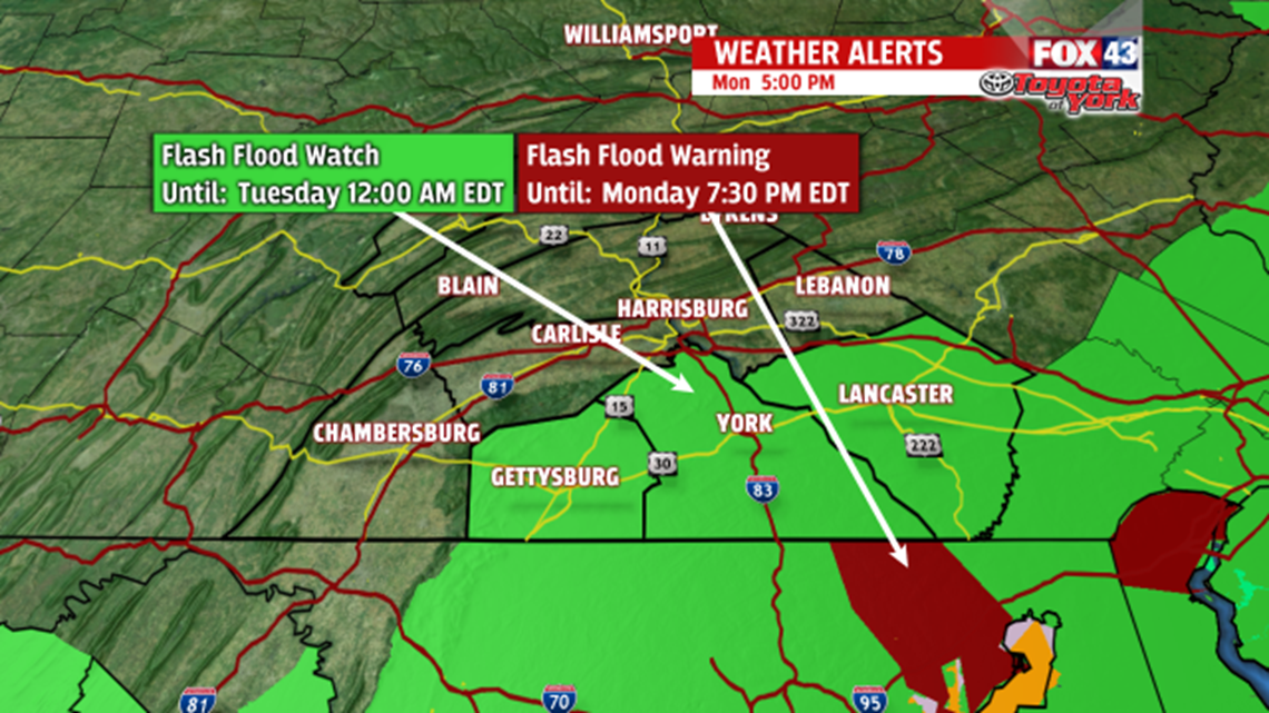
FLASH FLOOD WATCH until midnight for Adams, York and Lancaster.
Heavy rain continues to hammer these areas, which are already soaked from previous showers and thunderstorms. We’ll continue to see waves of heavy rain through the evening and overnight.


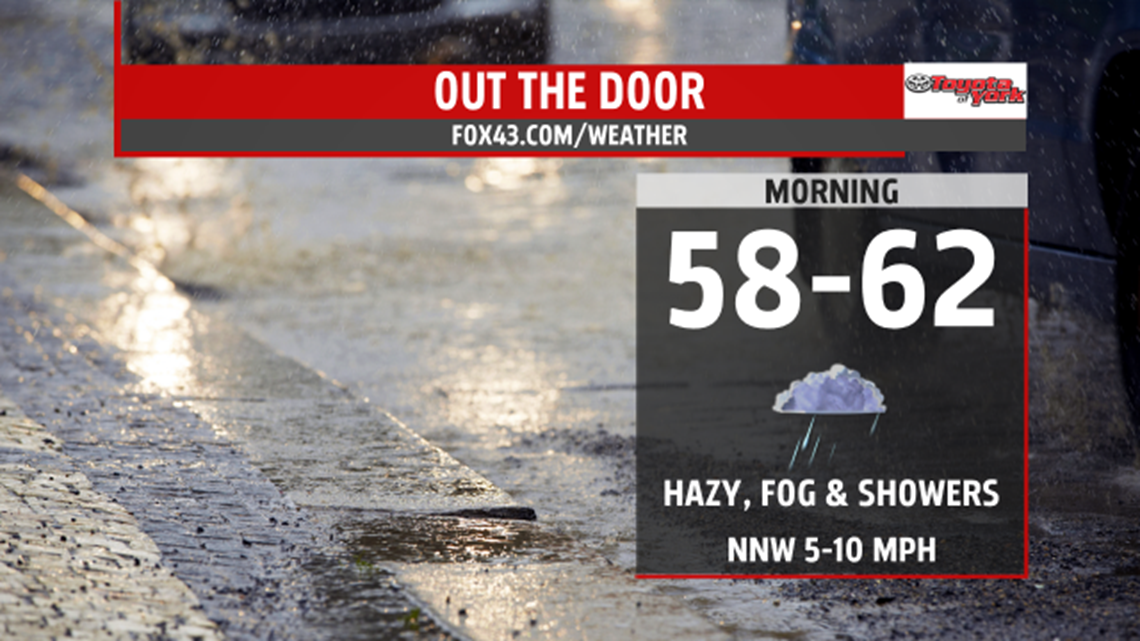
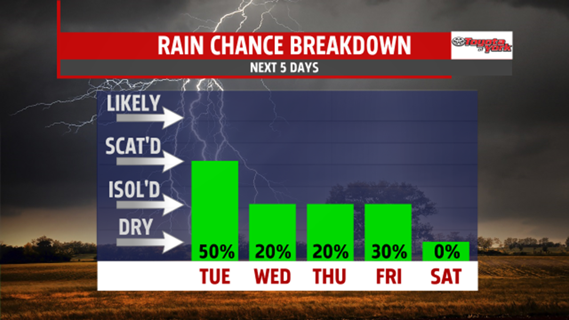
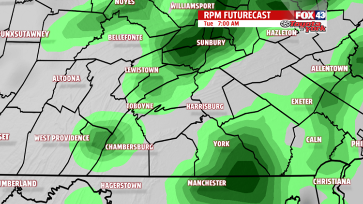
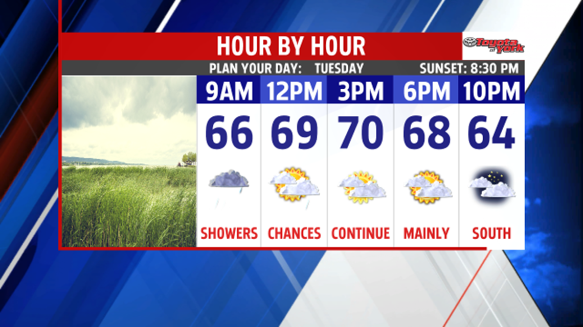
There is a chance for showers, especially in the morning. The south and southeastern areas south of the turnpike will keep the threat for showers around during the early afternoon. Most of the day will be mostly cloudy and cooler than average with highs in the mid to upper 60s to near 70.

OUTLOOK
High pressure will slide down some from the north helping to push the stationary boundary further away from us. However, we remain squeezed between the two systems keeping isolated showers in the forecast for much of the week. Chance for isolated showers for Wednesday and Thursday and highs will remain a few degrees below normal in the low to mid 70s. Few showers will be possible Friday with the next frontal system. Dry and warming for the weekend, and you can expect temperatures to warm to the upper 70s and low 80s. Showers and storms return for Monday.