


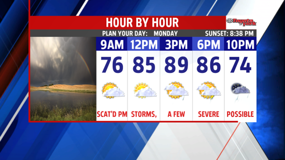

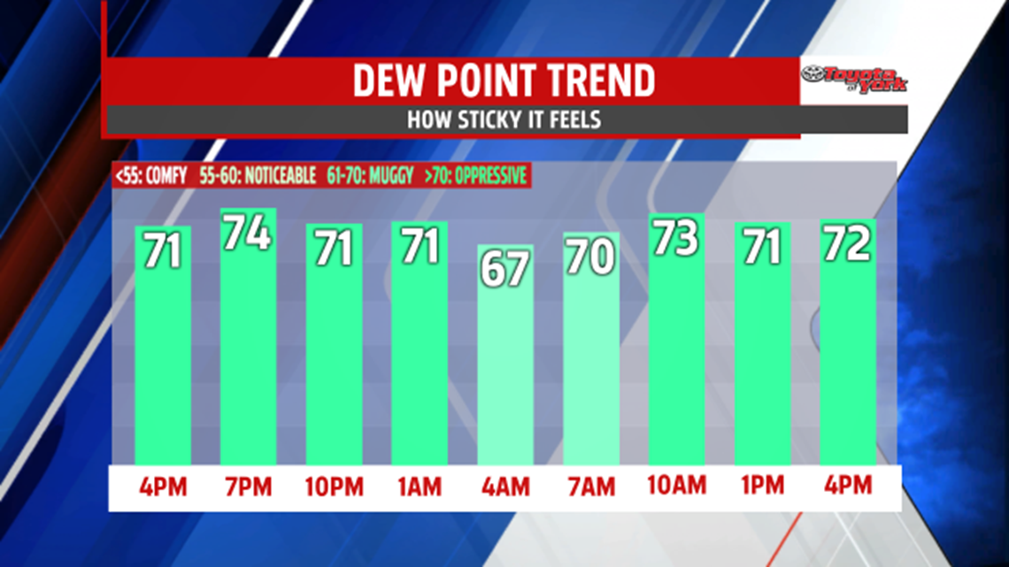


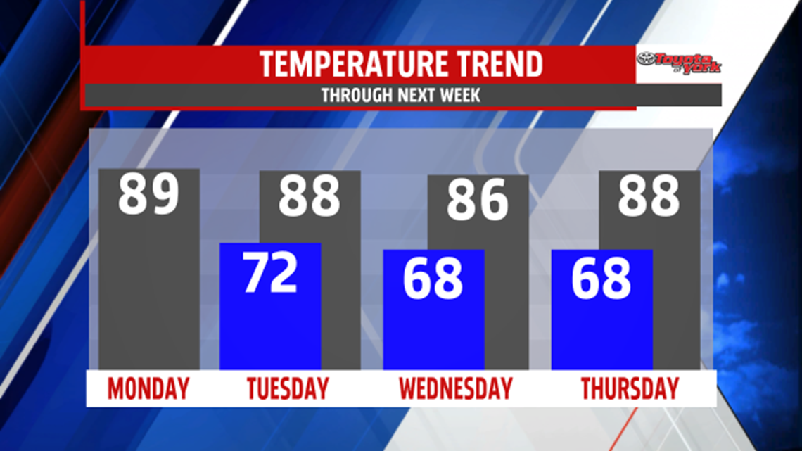
A BRIEF BREAK: High pressure builds in behind the cold front, but it will be brief. It does however provide some temporary relief, and it’s mainly from the humidity and not the warmth. It’s a dry day with some passing clouds. Highs are in the lower to middle 80s.
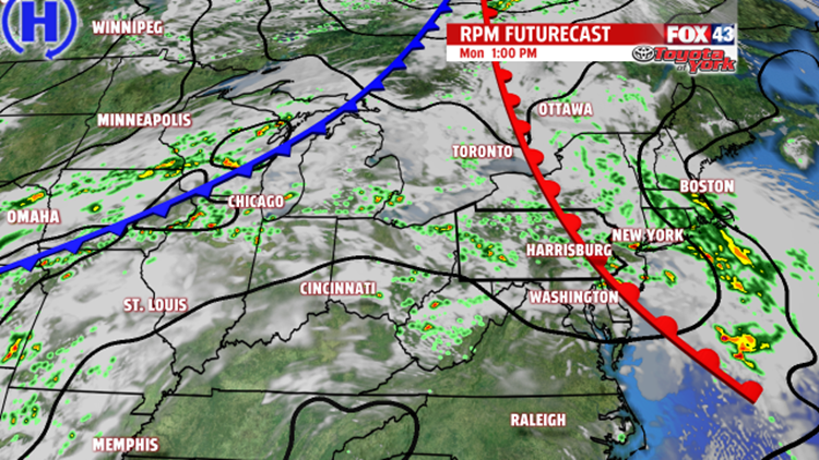
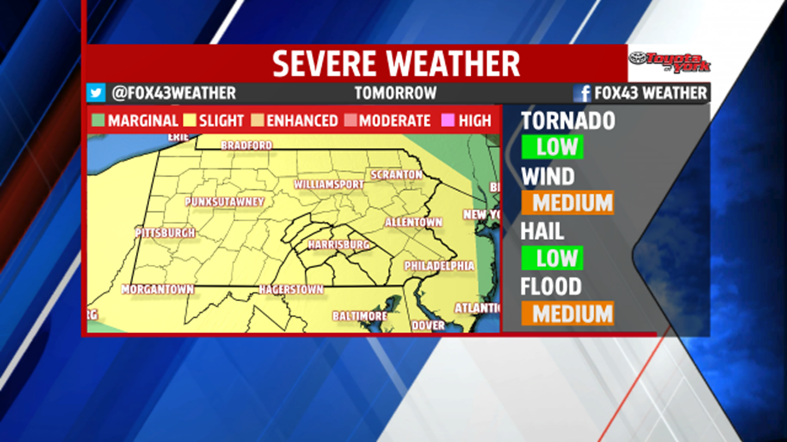
BACK TO SUMMER: The pattern quickly turns more unsettled once again through the weekend. A cold front approaches Thursday, and this brings back the chance for showers and thunderstorms. Highs are back into the middle to upper 80s. We’ll be closely monitoring a tiny disturbance’s path for the risk of showers and some thunderstorms into the weekend. As for now, thunderstorm chances should become more isolated in nature Friday and Saturday, if not zero depending on where the aforementioned disturbance tracks. Highs remain in the 80s. Sunday, which is also Father’s Day and the first day of Summer, looks to arrive appropriately so. It will be a hot and humid day, with highs likely reaching 90 degrees.
Have a great week!
