

STORMS
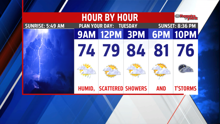
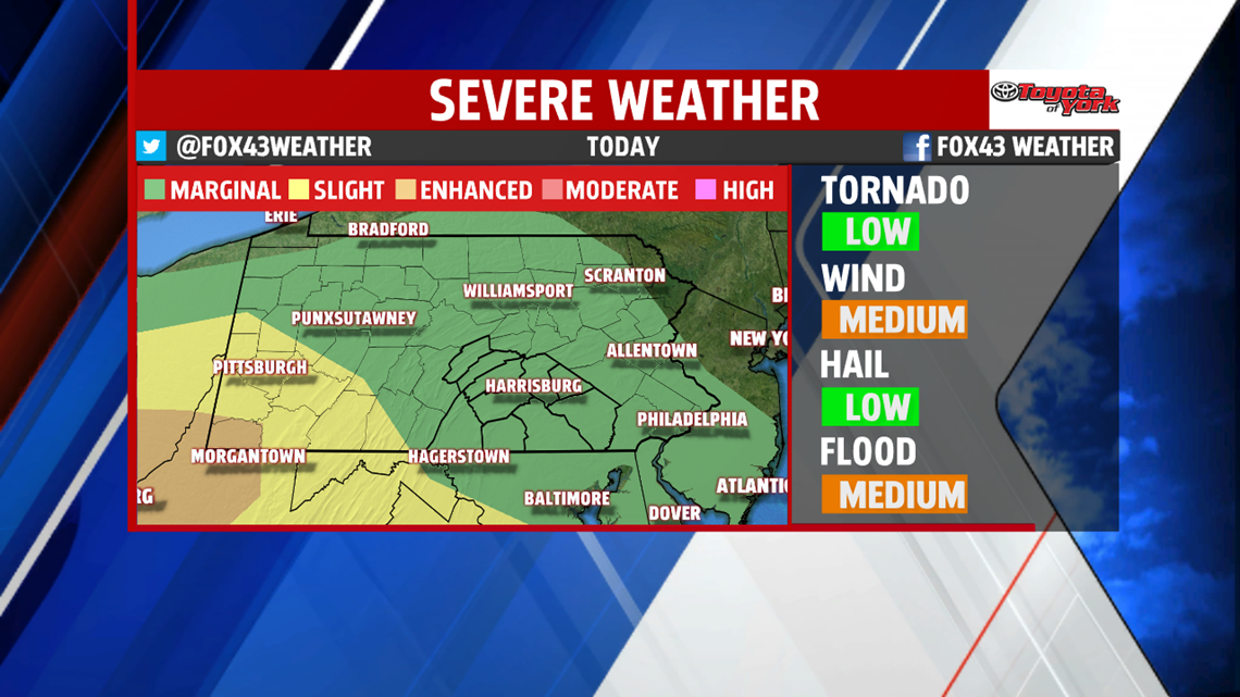
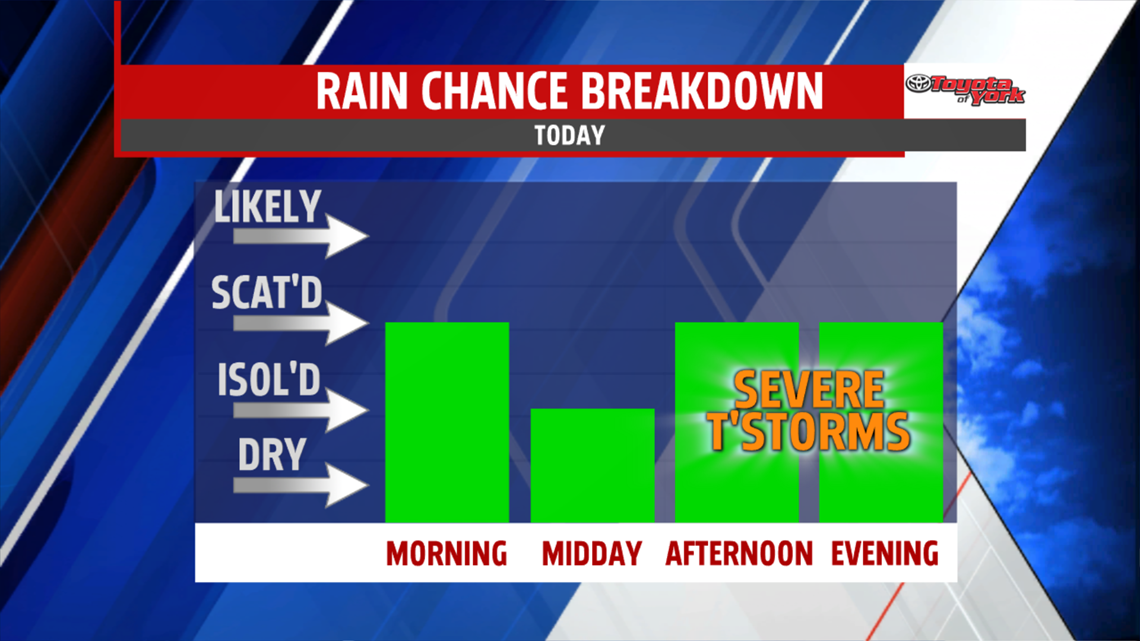
A warm front slips through today, keeping us mostly cloudy and adding more numerous showers and storms to the forecast by evening. Expect highs in the middle 80s. We'll watch storms roll through later in the evening after 6PM and ending by midnight. Expect some heavy downpours and the potential for severe weather with gusty winds the main threat.


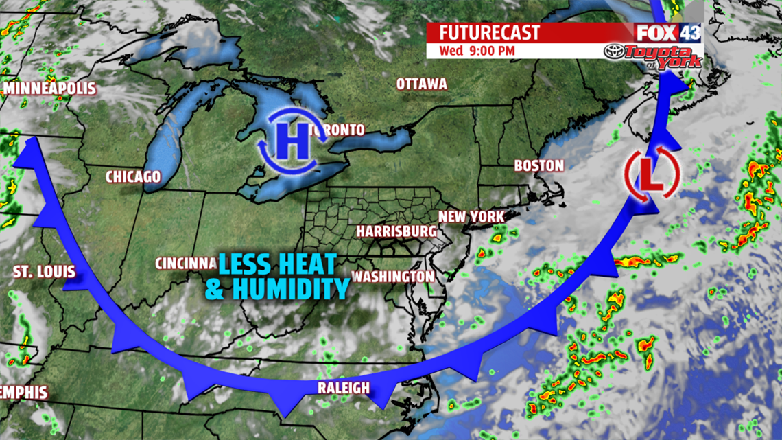
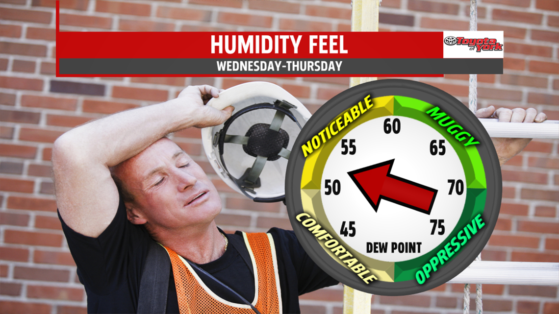
A cold front slips in overnight into Wednesday morning, which will keep some lingering shower chances in the forecast for Wednesday early as highs climb to the lower 80s. Skies clear later in the day as drier air starts to slide in to PA.

LATE WEEK
We dry out for late week with a drop in humidity too. Highs Thursday are only in the lower 80s with more sunshine than clouds. Overnight, we cool to the lower 60s. On Friday, we see mostly sunny skies with temps bumping to the middle 80s.

WEEKEND
A series of waves will ride along the edge of a warm ridge of high pressure. So expect mostly cloudy skies with warm and muggy air, along with daily chances for showers and storms. Highs will be in the middle to upper 80s.
Make it a terrific Tuesday!
“Always forgive your enemies. Nothing annoys them more.” – Oscar Wilde
