

CHANGES
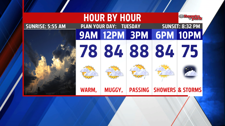
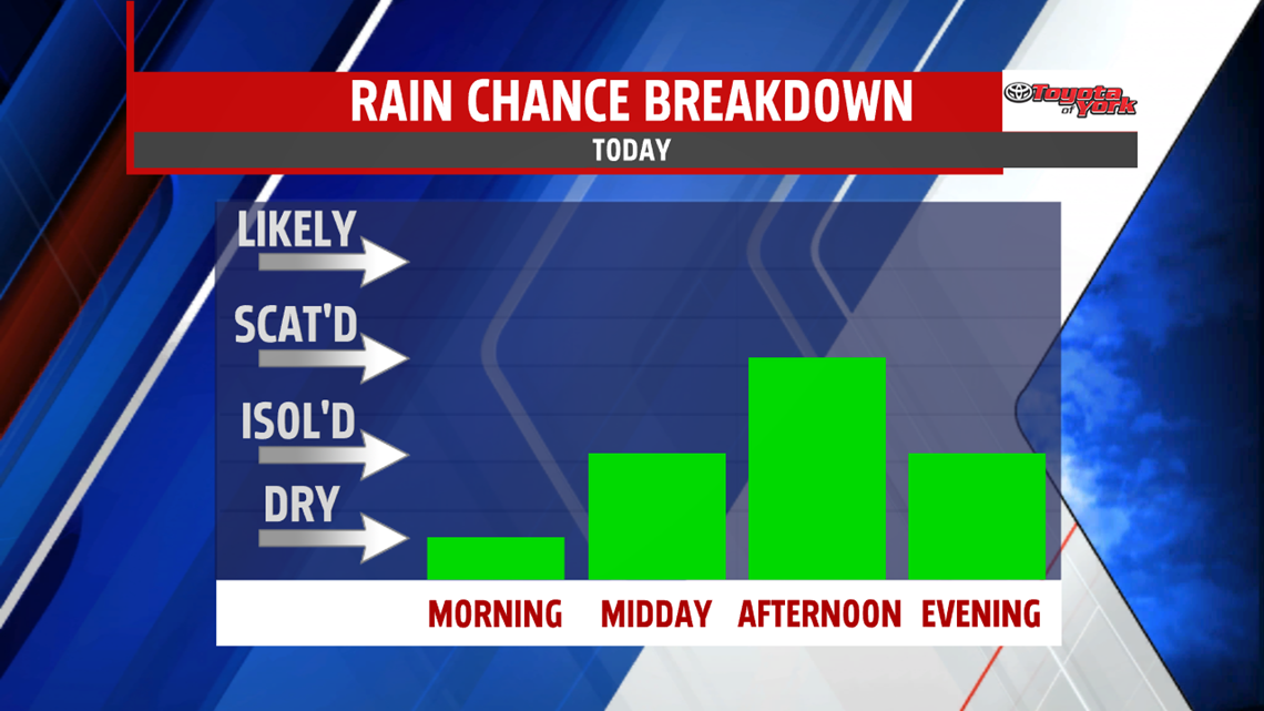
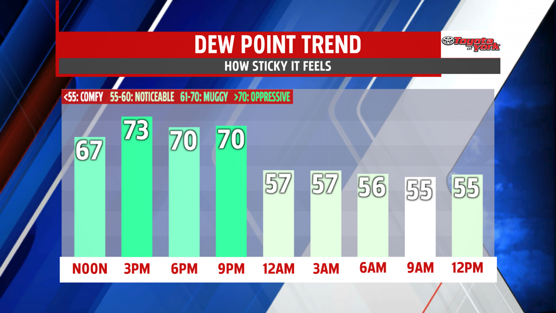
The next cold front moves through during the day today and it will shut down our heat and humidity from the past few days. For today, expect a mostly cloudy day with highs bumping back to the upper 80s. The muggy air stays in play for the daylight hours. As the front passes, storms will fire from 2-7PM.

Once the front clears, you’ll notice skies break and the humidity will begin to drop for late evening plans. Overnight, we drop to the middle 60s as more comfortable air slides into the state.

PLEASANT DAYS
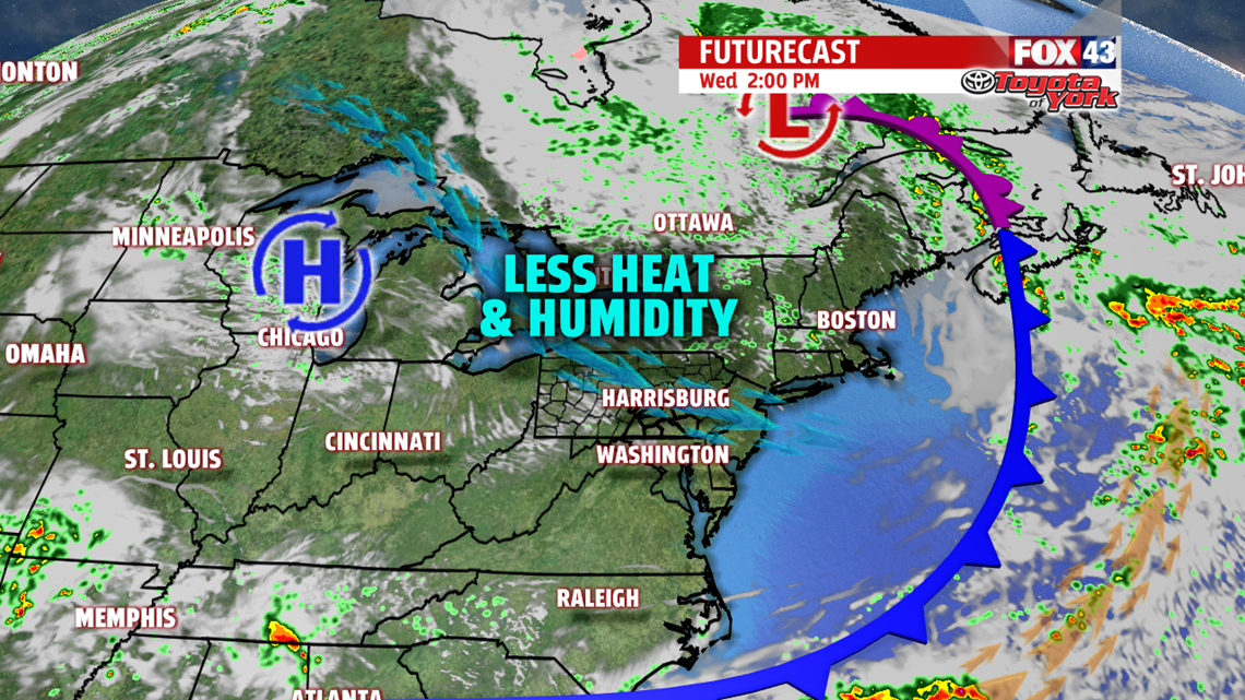
We’re in for a round of below average, lower humidity, sun filled days to end the week. Highs are in the lower to middle 80s through Friday. Enjoy!

WEEKEND
Saturday is another gorgeous day with near average highs in the middle 80s. It’s mostly sunny too with only a touch more humidity. Buy Sunday, we’re watching a weak system which could bring a chance for showers and storms. Highs are in the middle 80s with a bit more humidity.
Have a fantastic Tuesday!
“If you would like to know the value of money, try to borrow some.” – Benjamin Franklin
