

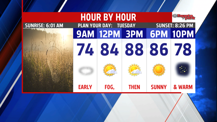
HOT END TO JULY
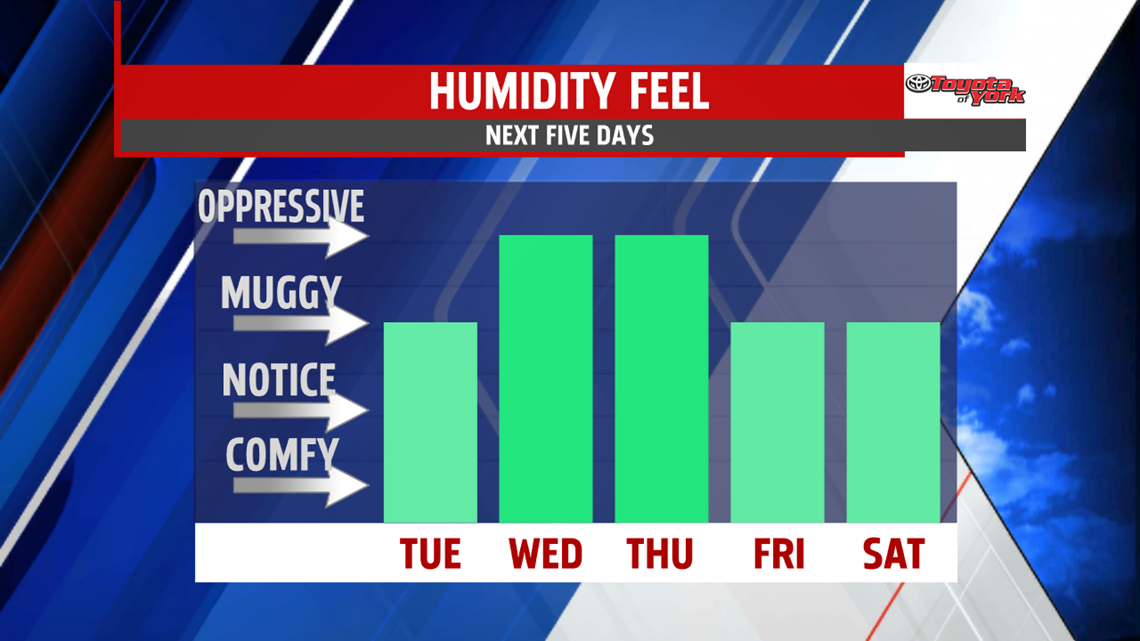
Hazy, hot and humid air. It’s a fitting way to end July. For today and tomorrow, expect mostly sunny skies after some morning fog, with a haze and rapid heat up during the day. Highs today near 90° while Wednesday we peak at 92°.

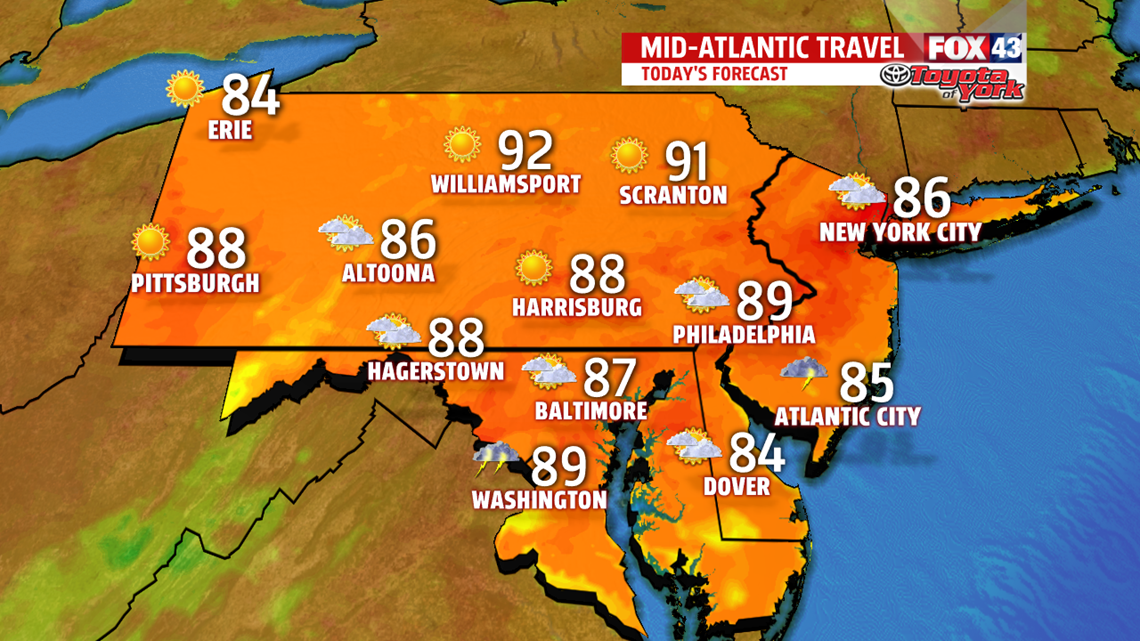
The humidity will add a few degrees to the feel of the heat, so be sure to stay hydrated and take breaks. Overnight hours will feature minimal relief from the heat too.

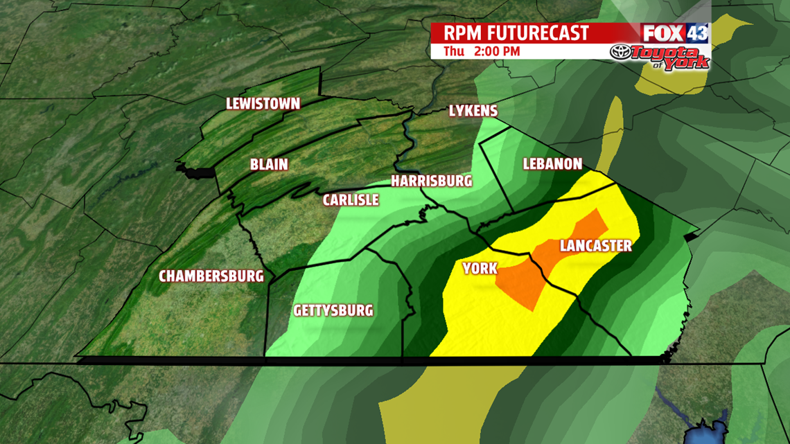
WEAK FRONT
We’ll run toward 90° for Thursday, but a front will add clouds and a threat for afternoon thunderstorms to the forecast. We should get a bit of a break for Friday when sunshine returns and highs are only in the upper 80s. It’s still warm and humid.

WEEKEND
More summery heat and humidity are back in play for the weekend. It’s mostly sunny with highs back near 90°. Storm chances remain limited.
Have a terrific Tuesday!
“Nothing diminishes anxiety faster than action.” – Walter Anderson
