

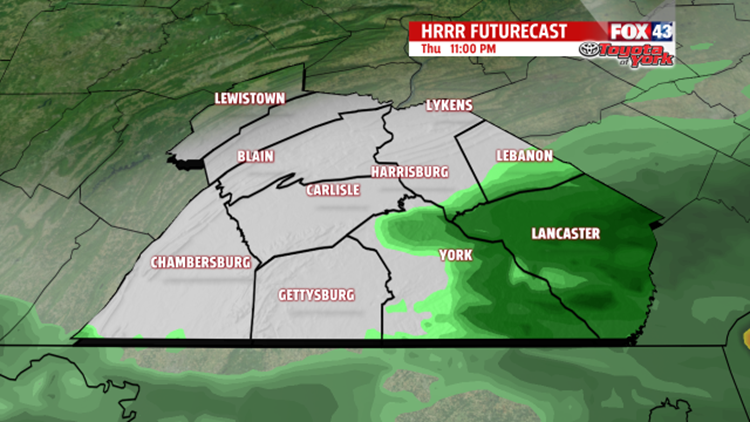

EVENING SHOWER CHANCES: A storm system tracking south of the region is bringing overcast skies this afternoon, and that stays with us into the evening. Showers associated with the system try to clip our region this evening. Overnight, this chance dwindles as the system pushes east. The clouds remain, with low temperatures bottoming out in the lower to middle 60s.


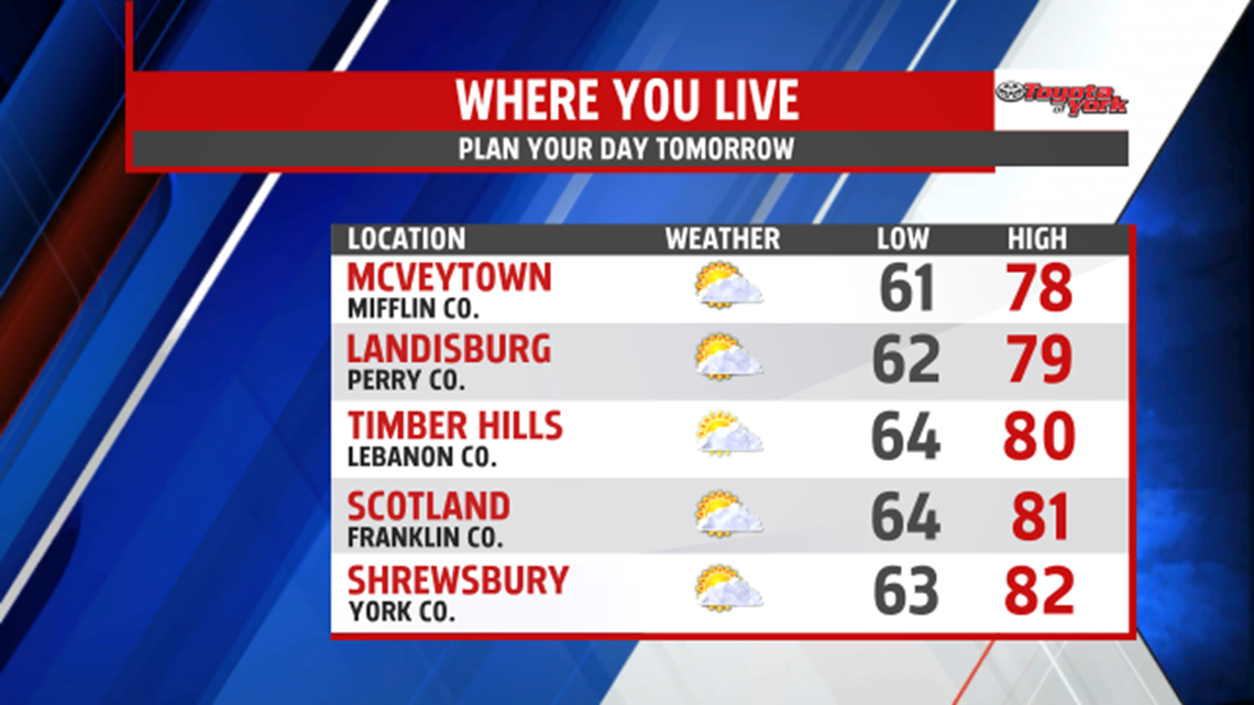
SLOW WEEKEND WARMING: The clouds hang throughout the region on Friday, however, they gradually fade through the afternoon. Otherwise, Friday is a quiet and comfortable day. High temperatures are in the upper 70s to lower 80s. The pattern remains quiet through the weekend. Slow warming and a gradual nudge in the humidity takes place Saturday into Sunday. Temperatures climb into the middle 80s through Sunday.
NEXT RAIN CHANCE: Our next cold front approaches late Monday through Tuesday. Depending on the timing of the front, a late day shower or storm could sneak into the region. Otherwise, the cold front crosses Monday night through Tuesday. It brings the chance of showers and thunderstorms. Highs are warm and muggy Monday, with readings in the middle 80s. Tuesday, the rain threat keeps temperatures a few degrees cooler, but the mugginess remains. Models are indicating a cool pool of air sliding into the region for the middle of the week. It’s sunnier and less humid. Highs are near 80 degrees Wednesday, and could fall into the 70s Thursday!
Have a great night!
