

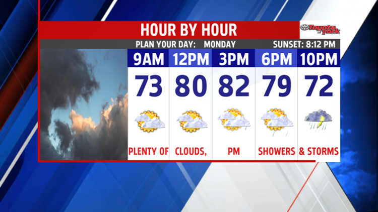

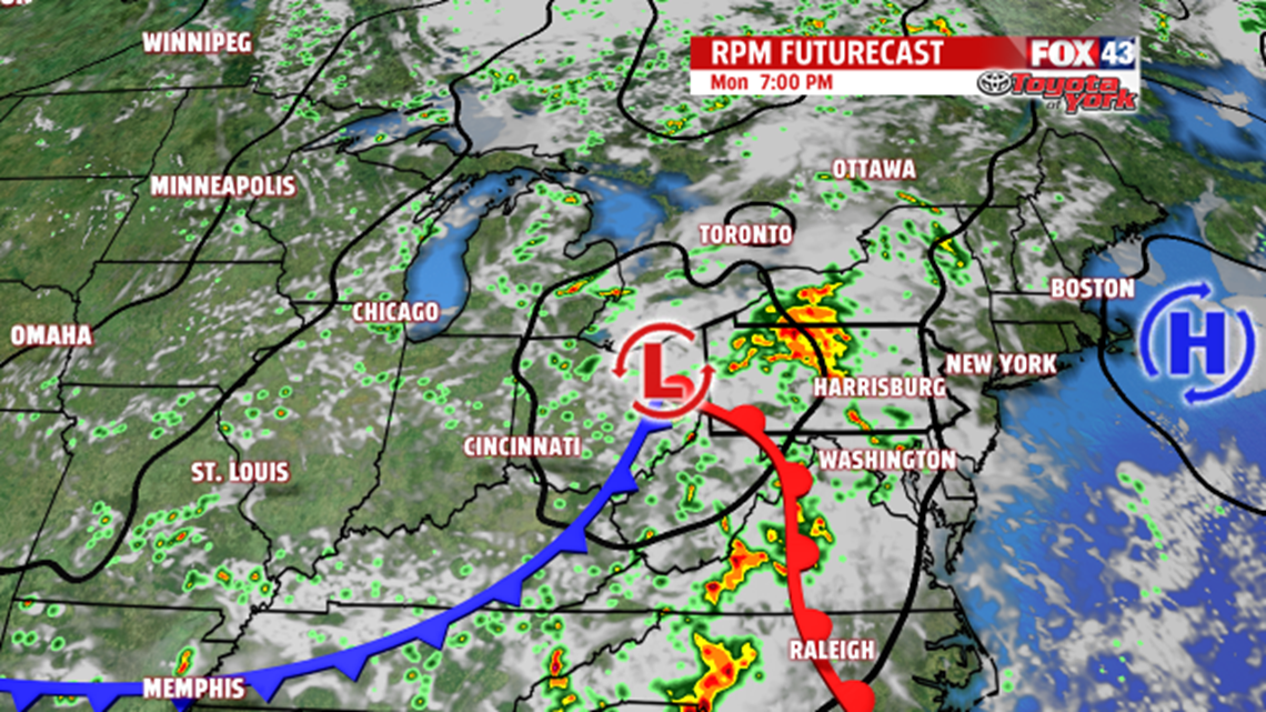

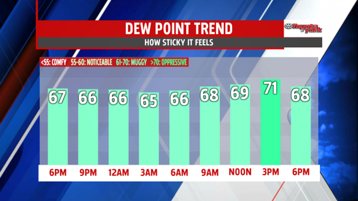
EARLY WEEK RAIN CHANCES: After a muggier Sunday with a few stray showers, the night is much drier overall. The mugginess, however, is here to stay along with the clouds tonight. Some hazy and foggy areas develop late as well. Overnight low temperatures fall into the middle to upper 60s. Our next cold front approaches late Monday through Tuesday. Though the first half of Monday stays dry, shower and thunderstorm chances are back during the afternoon and evening hours. Highs are warm and muggy Monday, with readings in the upper 70s to lower 80s. Tuesday, scattered showers and thunderstorms are expected to continue. The rain threat keeps temperatures close to Monday’s readings, and the mugginess remains.

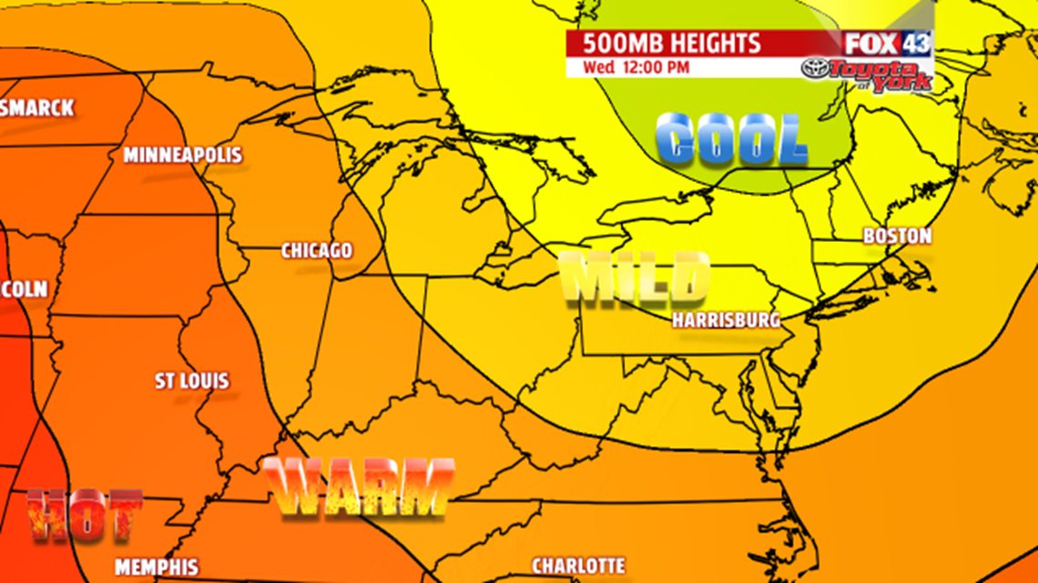
BRIEF MIDWEEK COOLING: Models are indicating a cool pool of air sliding into the region for the middle of the week. It’s sunnier and less humid through this stretch too! Highs are near 80 degrees Wednesday, and fall into the middle to upper 70s Thursday! Skies are partly sunny Wednesday as the cooler air arrives, but the clouds are gone Thursday. Even morning low temperatures are cool and comfortable.
WEEKEND WARMING: Friday the cool air begins to retreat, so afternoon temperatures jump back into the lower to middle 80s. Saturday, a weak cold front brings the chance for a couple thunderstorms. It’s a warmer and more humid day with afternoon temperatures in the middle 80s. Sunday is dry but still humid. Highs remain in the lower to middle 80s.
Have a great week!
