

COOLER, DRIER STRETCH TO ENJOY
Skies will clear once showers and storms end as a cold front slides off the coast this evening. Temperatures will drop to the upper 50s to the low 60s.


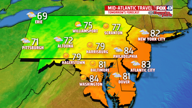
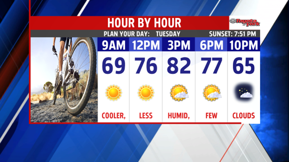
It will feel less humid and quite pleasant Tuesday. Highs will warm to the upper 70s to low 80s under mostly sunny skies. Nice breeze out of the west-northwest through the day.

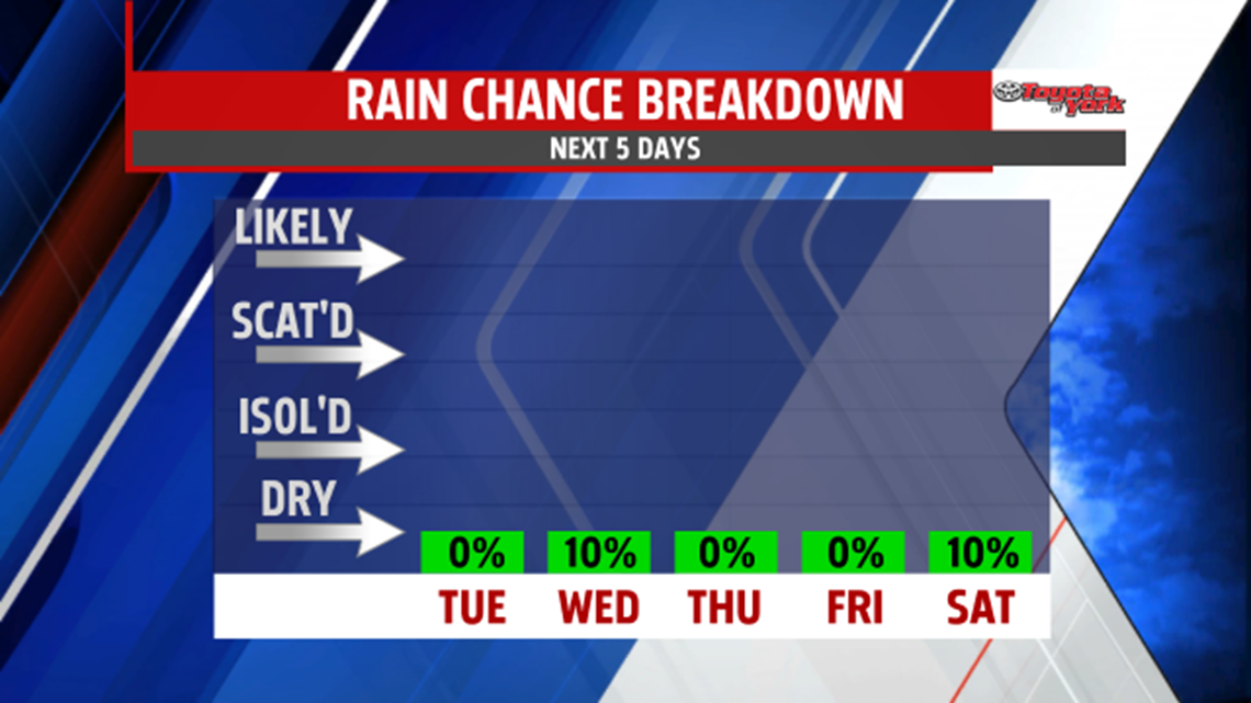
Skies will be clear overnight, and with the dry air in place, give the A/C a break and open the windows, lows will drop to the 50s Wednesday morning. An upper level trough will make home over the northeast, this means several days of cooler than average temperatures. There will be some upper level energy swing through reinforcing the cooler pool of temperatures aloft, which will result in cloud development during the afternoon and early evening. Some of the higher elevations may even get a sprinkle or brief shower. Highs will be held in the upper 70s. Morning lows will once again drop to the 50s Thursday morning and with mostly sunny skies, help to recover temperatures to the upper 70s to near 80. Friday, it warms a bit more and remains beautiful, comfortable and dry. In fact, rain chances are very low until we get into the second half of the weekend and evening then, the threat will be isolated.

Enjoy the nice change headed our way!
