

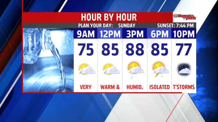


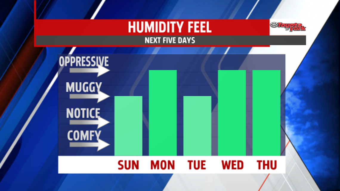
RETURN OF THE MUGGIES: It’s been another fantastic summer day for the Lower Susquehanna River Valley. The humidity crept up a bit, and it rises even more through the rest of the weekend. You can expect a milder and muggier night, with overnight low temperatures falling into the lower to middle 60s. It’s dry with some passing clouds. Warming temperatures continue into Sunday. Expect afternoon highs in the middle to upper 80s under partly sunny skies. A few isolated showers and thunderstorms are possible. However, it’s not a washout, and the day is mainly dry for much of the area. The humidity is back in full force as well.

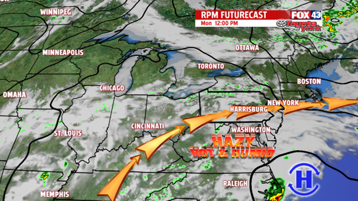
STEAMY SEPTEMBER START: Monday we end August with more of the same. A couple thunderstorms are still possible, and afternoon highs are in the middle to upper 80s. Tuesday welcomes September with a mixture of sunshine and clouds. Temperatures are near the 90 degree mark. A stray thunderstorm is a threat yet again. Wednesday temperatures rise into the lower 90s with a stray thunderstorm still possible.
STAYING HOT & HUMID: The first week of September stays steamy for our region. Thursday is another day many locations are in the 90s with plenty of humidity. Friday highs are still near 90 degrees. The humidity lingers too, keeping an uncomfortable feel to the heat in place. A stray pop up shower or storm is possible each day. If we manage three consecutive days of 90 degrees, it will be the first September heat wave since 2010! Heading into the first weekend of September, the heat is in no rush to leave. Saturday brings an isolated thunderstorm threat. It’s still warm and muggy, with temperatures above seasonable averages.
Enjoy the rest of your weekend!
