COOLER AIR SPILLS IN
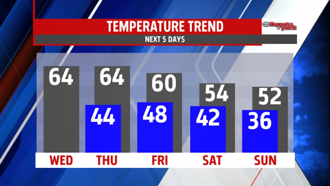
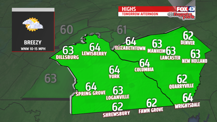
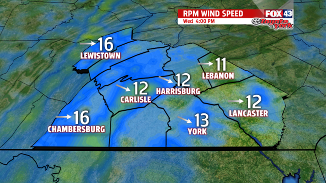
An upper level trough will dominate the weather for the rest of the week. Upper level energy swinging through the base of the trough will aid in producing clouds during the day. We’ll see them mix in and out of the sunshine before clearing in the late evening. The breeze will pick up out of the west 10 to 15 mph and will add to the chill as afternoon temperatures only warm to the low 60’s.

This is more seasonable but cooler than what we have enjoyed the past several days. High pressure builds in Wednesday night into Thursday bringing brighter skies. Morning lows will be chilly in the low 40s and with more sunshine expected highs will be near average in the low 60s. Our next rain chance will be Thursday night into Friday morning as a cold front with limited moisture pushes eastward. Some stronger upper level energy pulls in a chunk of colder Canadian air for the weekend. Highs Friday will be in the upper 50s to near 60 but much colder Saturday and Sunday. Highs will be some 10 degrees colder than average. Winds will be brisk both days.