

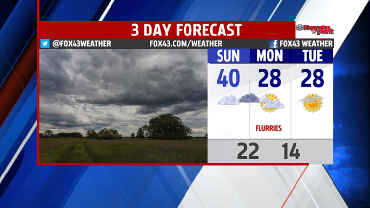
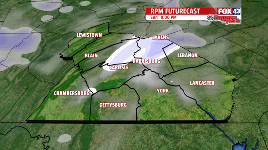
COLDER AIR COMING: On Saturday, we scored a high of 49 ahead of a weak cold front. We usually get our warmest weather before a cold front passes. Because the cold front has passed, expect 40 for your Sunday. Then, we drop to 28 on Monday because another cold front gets us Sunday night. Sunday night’s front brings some hit or miss flurries or snow showers between and 7 and 11 P.M. They’ll move across Central PA in a northwest-oriented line and move from west to east. Look for the snow showers in the mountains and high spots to the north and west of Harrisburg.

SUNNY MIDWEEK: The cold hangs on for Tuesday. Expect highs in the upper 20s with more sunshine than Monday. Mostly sunny skies continue on Wednesday as highs climb to the low 30s. Then, up to 36 on Thursday with partly sunny skies.

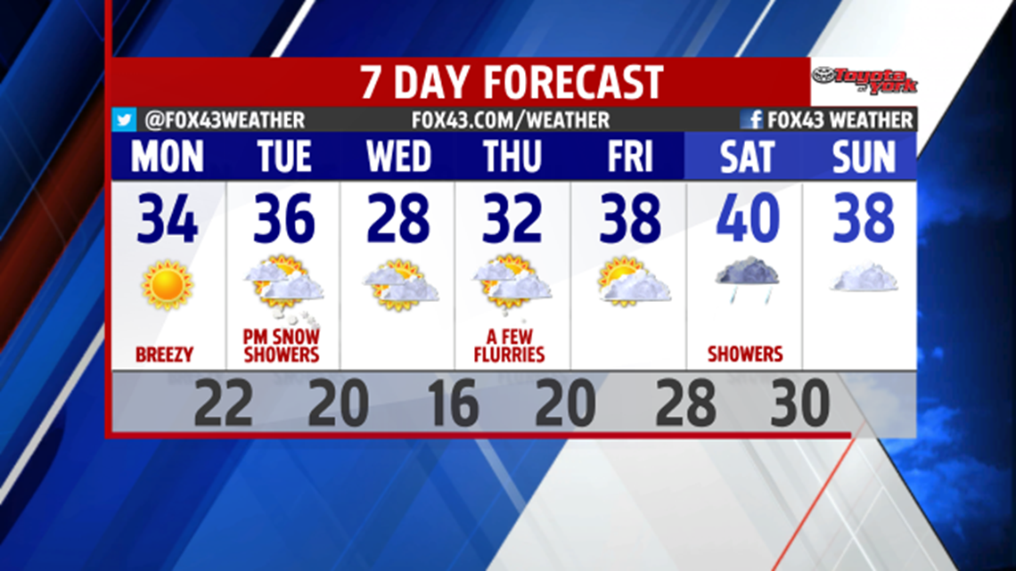
WATCHING A SNOW STORM: We have our eye on Friday afternoon into Saturday. The one model that does very well with forecasting snow storms keeps it off the coast and away from us. The American computer weather model, which we rely on a lot, has us getting plowable snow. Another less accurate computer weather model has the storm bringing us snow, too. Until the most reliable shows the same track as the American, we can’t give you a definitive answer. Just know we have our eye on Friday into Saturday, and we’ll keep you updated.
-Meteorologist Drew Anderson
