

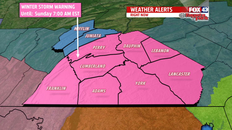
WINTER STORM WARNING
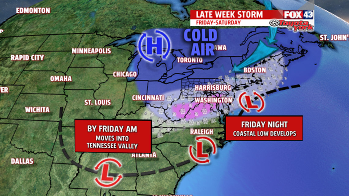
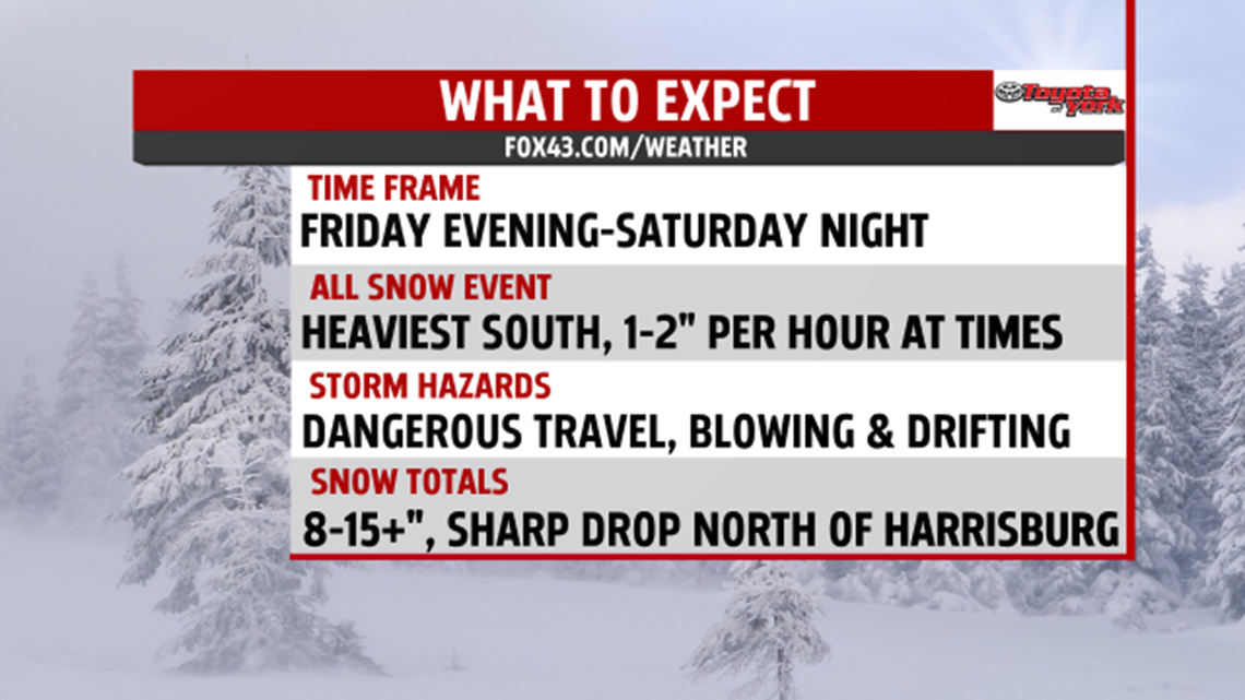
An area of low pressure will develop along the Carolina coast, and move along to the northeast just off the Delmarva Coast Friday into Saturday. It will deepen and strengthen causing snow to pick up in intensity across the area heading into the weekend.

The Winter Storm Warning is in effect from Friday at 7pm into early Sunday morning, at which time, the storm pulls away and snow tapers off.

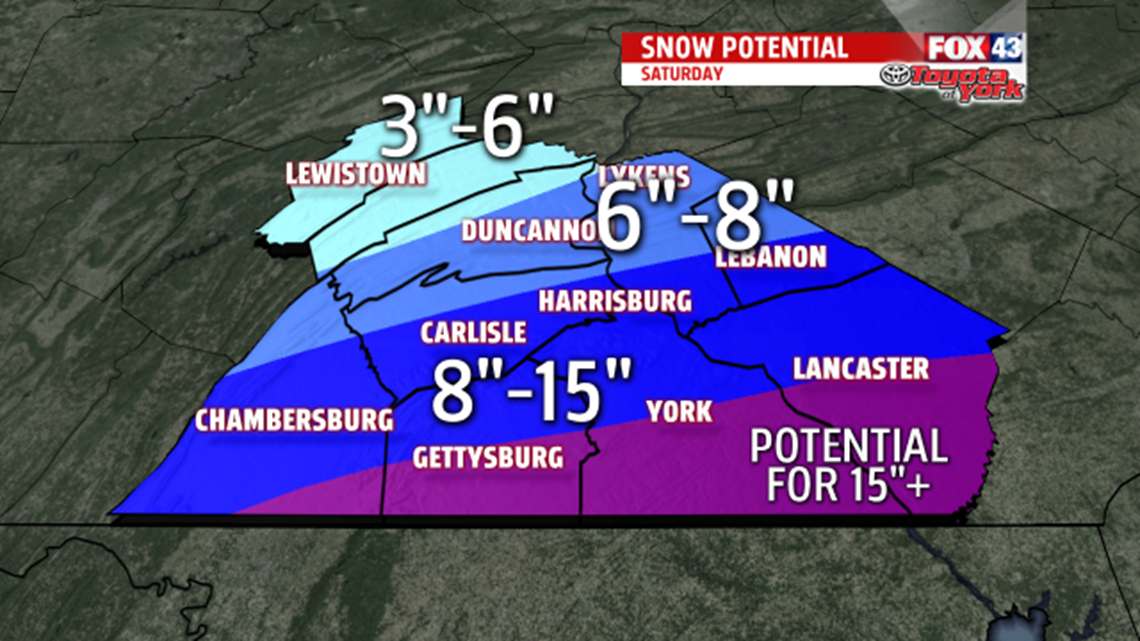
Amounts are still looking to be quite impressive south of the turnpike, especially across the southern tier counties along the Maryland, Pennsylvania border. Snowfall could reach double digits. There still looks to be a sharp cut off from the much higher snow amounts south to far less snow accumulations north and northwest. Blizzard like conditions are also possible across Lancaster County Saturday as the low deepens. This means winds will gusts 30 to 35mph, causing very dangerous traveling conditions. Blowing, drifting snow, and whiteout conditions, will lead to near zero visibility and make traveling almost impossible during the height of the storm.

By Sunday, the storm is pulling away and the snow comes to an end. Sunshine returns, but winds will be breezy and temperatures will be cold in the low 30s.
QUIETER WITH MODERATING TEMPERATURES NEXT WEEK
Heading into the work week, temperatures rebound to the mid and upper 30s, closer to seasonable averages. Our next system comes in Tuesday and brings a chance for rain and, or snow showers. Wednesday and Thursday look dry with high pressure dominating our weather.
It’s better to be safe and prepare for the worst.
MaryEllen Pann,
Chief Meteorologist
