

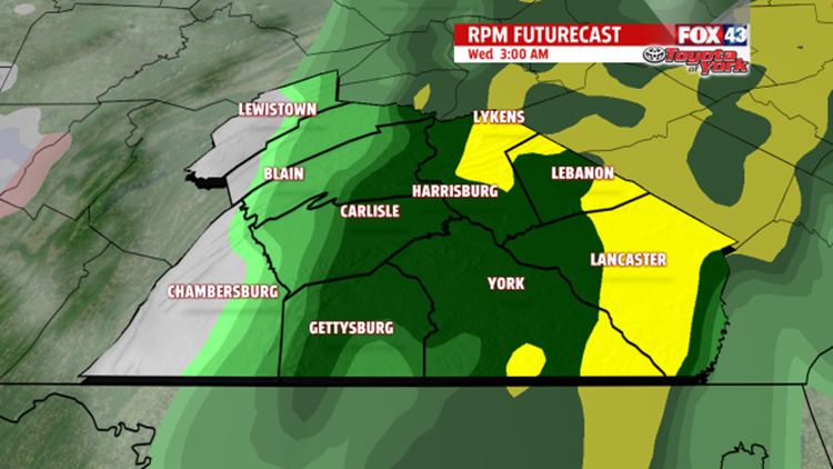

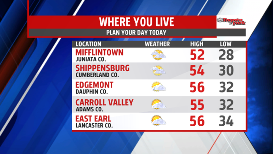

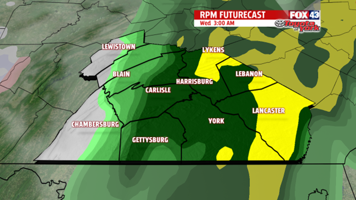

COOLING BACK DOWN: Chillier air filters back into the region for the end of the week. Clouds thicken Thursday as yet another system approaches. Highs are near 40. This system should pass us well to the south, but there’s the chance the northern fringe clips us through Friday. With temperatures in the 30s, some light snow or snow showers are possible. A couple inches of accumulation are possible.
THIS WEEKEND: Saturday is still on the chilly side, with perhaps a few snow showers overnight as a weak piece of energy passes through. Sunshine is back for Sunday, and temperatures begin to moderate. You can expect highs in the 40s. On Monday the warming continues with plenty of sunshine.
Have a great Tuesday!
