

ANOTHER WARM ONE BEFORE COOLING DOWN
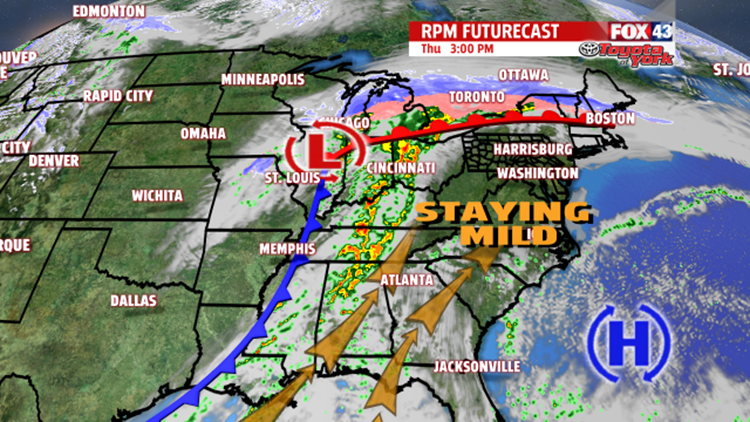
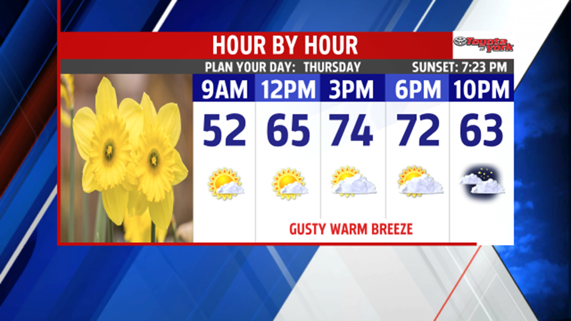
A warm front pushed to the north today. Skies continue to clear this evening. Temperatures will be mild in the 50’s. Overnight, the skies light up with the light of the bright, full moon. Another mild morning tomorrow with morning lows starting in the middle 40s. Expect plenty of sunshine for most of the day before clouds increase into the afternoon. Temperatures climb quickly to the upper 60s to lower 70s. The next system comes through overnight, bringing the threat for showers and possible thunderstorms. Temperatures remain mild overnight too. Rain amounts will range from a .10” of an inch to a .25”. Some isolated areas may pick up a bit more. We are drying out through the day Friday. After a mild start in the 40s, it won’t take long for temperatures to rise to the low 60s under partly cloudy skies. The breeze kicks up again too.

EASTER WEEKEND
We will enjoy a very a nice weekend, and a dry one too. Plenty of sunshine for Saturday with high temperatures topping out in the middle 50s. Easter Sunday begins with sunny skies, but the clouds will encroach on the area during the afternoon hours. Warmer temperatures expected in the lower 60s. Rain threat doesn’t return until Monday as the next frontal system slides through. We remain mild in the 50s. In fact, next week stays mild with a trend toward the 60s once again.


FLOOD SAFETY AWARENESS WEEK
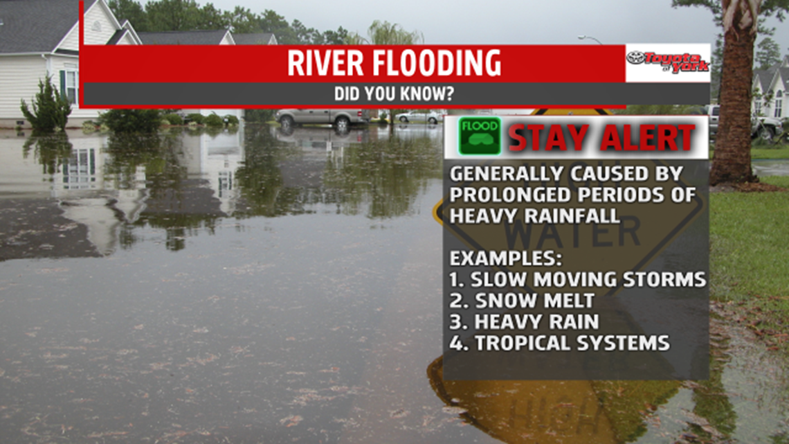
Flood Safety Awareness Week continues with topic #3 today. FLOODING – causes and severity. In Pennsylvania, there are two ways that flooding typically develops. Excessive rainfall and snow melt when combined with rainfall. Widespread rain ahead of a warm front, slow-moving thunderstorms and tropical cyclones are the main causes of excessive rainfall for our region. Tropical cyclones are significant contributors to inland flooding because of the intense rainfall they can produce. Slower moving cyclones are significant contributors to greater rainfall amounts and devastating flooding. During winter, snowmelt combined with rainfall, can lead to flooding too. Snow’s water content is released and run off into the waterways when it melts. The melting is due to rapidly warming temperatures, rain falling on the snow or both.

Stay with FOX43 Weather for more important flood information through the rest of the week.
Have a good day!
MaryEllen Pann,
Chief Meteorologist
