


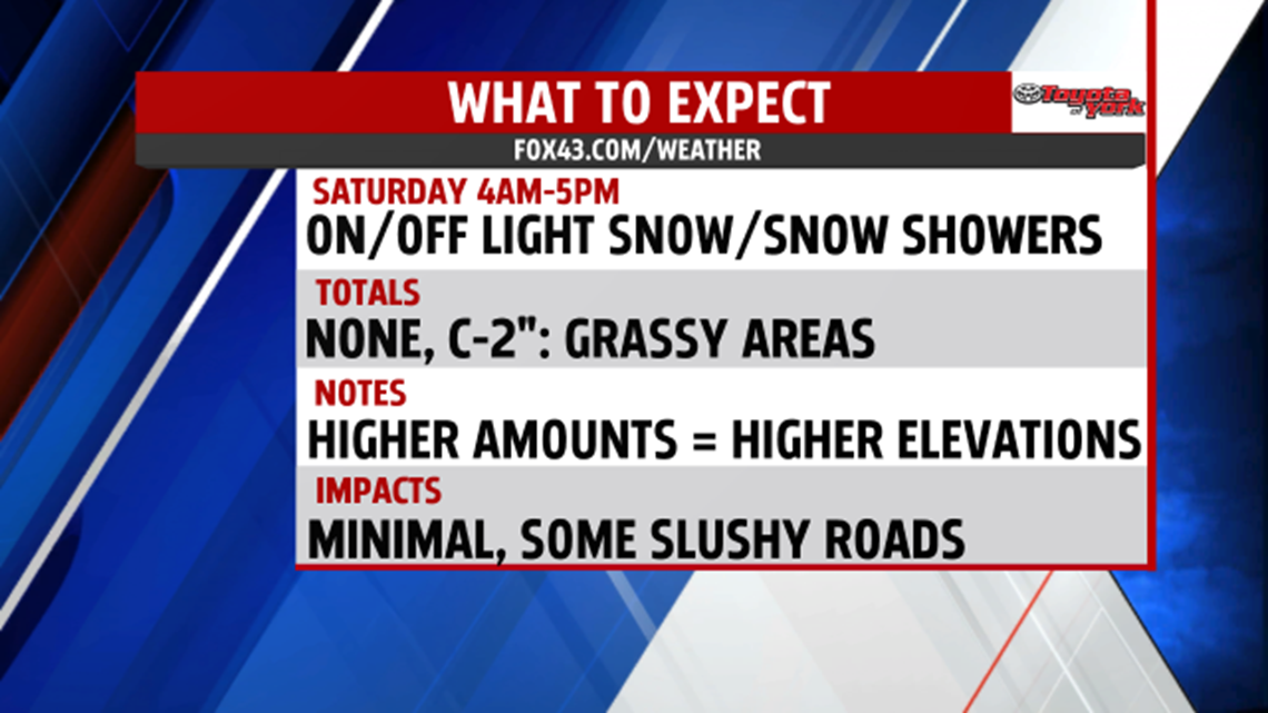
CHILL RETURNS: The chilly makes a comeback to the region starting Friday! There are a few lake effect flurries this morning, otherwise just plenty of clouds. Skies stay partly sunny to mostly cloudy through the afternoon. The breezes are quite strong too, with gusts up to 25 miles per hour! Temperatures are in the middle 40s to 50 degrees this afternoon. Clouds break apart a touch initially this evening, and the winds slowly take a break. A quick moving clipper quickly approaches, and this brings snow showers to our western most areas around 4am. Overnight temperatures range in the lower to middle 30s.


NEXT WEEK: Temperatures moderate through next week, but it won’t come without shower chances. We’re back to seasonable averages on Monday, but there’s plenty of clouds as our next cold front slowly arrives from the west. Even some showers are possible. Scattered showers, even a few thunderstorms, are likely Tuesday as the front moves through. Temperatures are near seasonable averages. We cool down a touch on Wednesday with increasing sunshine. It stays sunny and dry Thursday.
Have a great weekend!
