

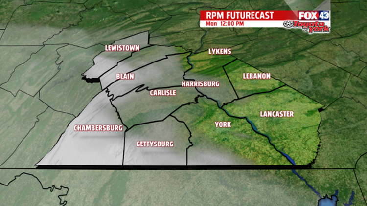
SUNSHINE ENCORES: How good did our Sunday sun feel? Enjoy more sun on Monday. Though, in the afternoon, you’ll see some more clouds in the sky south of the Turnpike in counties like Franklin, Adams, York, and Lancaster–enough to call the afternoon partly sunny. Eventually, we turn cloudy Monday night.
MORE CLOUDS: We’ve got a lot of clouds in the sky Tuesday through midday Friday. Look for all gray on Tuesday. Then, you’ll see some breaks of sun on Wednesday and Thursday between the thick, gray clouds. We’ll also have a few spotty showers on Tuesday, Wednesday, and Thursday. Then, on Friday, we all get showers and even a few thunderstorms as a cold front crosses over us. After widespread showers and storms for the first half of the day, some sun breaks through the clouds in the evening. We start out with sun on Saturday, but we turn cloudy in the afternoon as widespread scattered showers and a few thunderstorms sweep over us. The partly sunny skies return next Sunday.

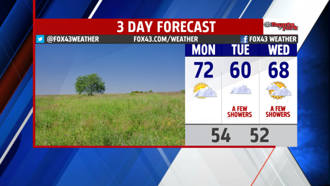
TEMPERATURES CLIMB: On Monday, we touch the low 70s with the help of a west wind. When our air comes from the west and falls down the Appalachian Mountains, it warms us up. Think of us living in a “sea” of air. We live at the bottom of the air “ocean.” When air falls to the bottom of the air ocean, it get squeezed and compressed because of the pressure of the surrounding “ocean” of air. Compression warms up air because the gases that makes up our air has less space to move. It bounces into other gases and starts moving faster. It’s like a pinball game. The ball moves faster when it hits those mushroom-like things. Well, temperature measures how fast the air moves, so when air moves faster, it has a higher temperature.
TEMPERATURES FALL: It’s surprising how big of a role the geography around Central PA affects the weather here. On Tuesday, we get an east wind all day. When that happens in Central PA, we have cloudy skies all day and some spotty drizzle. The east wind brings in air from right above the Atlantic Ocean to lock in the clouds and to bring the spotty drizzle. It also brings us air temperatures close to the ocean temperature. The ocean cools the air above it. So, the air above the ocean often has a temperature close to the ocean temperature. So, when we get an east wind, it brings in that ocean air temperature for our temperature. Expect highs near 60 on Tuesday.

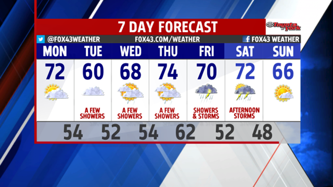
TEMPERATURES CLIMB: On Wednesday, we get the upper 60s. On Thursday, we get the mid 70s as our air comes up from the south, bringing up the milder air with it. The 70s stick around for Friday and Saturday, but mid 60s return on Sunday because a cold front comes with the showers and storms on Saturday.
-Meteorologist Drew Anderson
