

SHOWERS END: Tonight, the scattered showers and thunderstorms end. Because of all the moisture left in the air, we’ll have some patchy fog.
LESS HUMID: It will feel less humid on Tuesday. Highs top out in the mid 80s. We get warmer than Monday because a cold front drops down from the north. Anytime we get a south-moving cold front, it bumps up temperatures before it arrives. Often, cold fronts come from the west. As the cold front sweeps over us Tuesday afternoon, it will mainly bring more clouds to our sky. Though, a spot or two will see a quick pop-up shower in the evening. This cold front completely takes away the humidity. So, enjoy a very comfortable Wednesday. This front will also knock our temperature down to the low 80s on Wednesday.

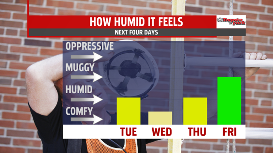
TRACKING SHOWERS: We’ll have a dry Thursday, but clouds will increase in the afternoon as a cold front approaches from the west. Before it gets here, we’ll get warmer and more humid air to come up from the south. This takes our Thursday afternoon highs up to the mid 80s. Thursday night, showers arrive. We’ll have a wet Friday. The clouds and showers keep our highs in the upper 70s.

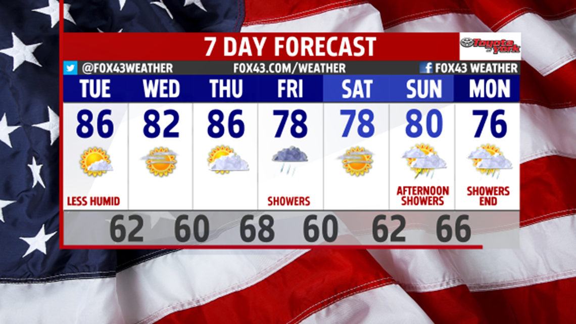
WEEKEND SUN: Enjoy mostly sunny skies and highs in the upper 70s on Saturday. On Sunday, we start out sunny. In the afternoon, scattered showers and thunderstorms arrive. Highs touch 80. The clouds and showers end Monday morning. They also wrap up with a cold front, so we get more seasonal highs in the mid 70s on Monday of next week.
-Meteorologist Drew Anderson
