

MORE SUN, NO RAIN THREAT
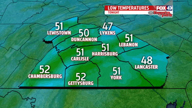
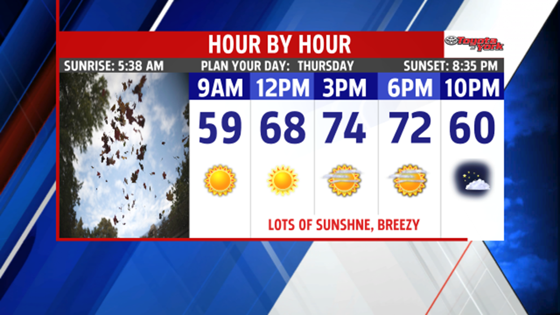
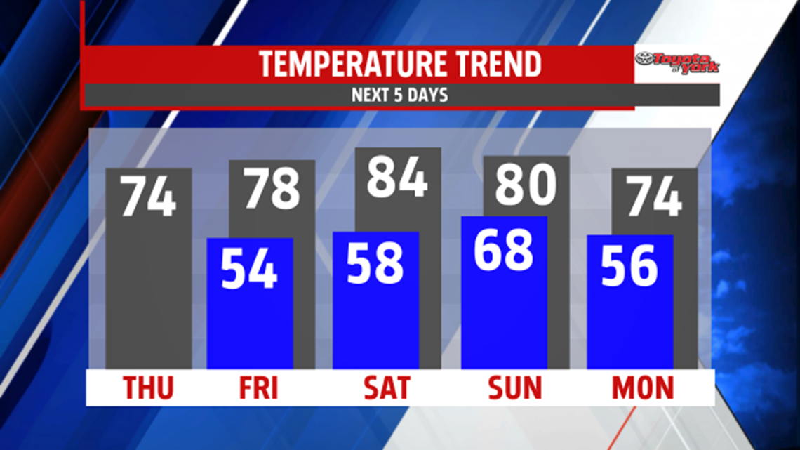
With the upper-level disturbance east of us, skies remain mostly clear. Temperatures fall through the 60s into the 50s this evening and the breeze adds a chill. There will be plenty of sunshine to enjoy. After a cool unseasonable morning, temperatures rebound to the lower to middle 70s under plenty of bright blue skies. It remains a bit breezy through the day but calmer conditions return towards the evening. Friday slowly warms to the middle and upper 70s under mostly sunny skies. A few more clouds expected but it is a dry day. We get a break from the breezy winds until the weekend.

WEEKEND OUTLOOK:
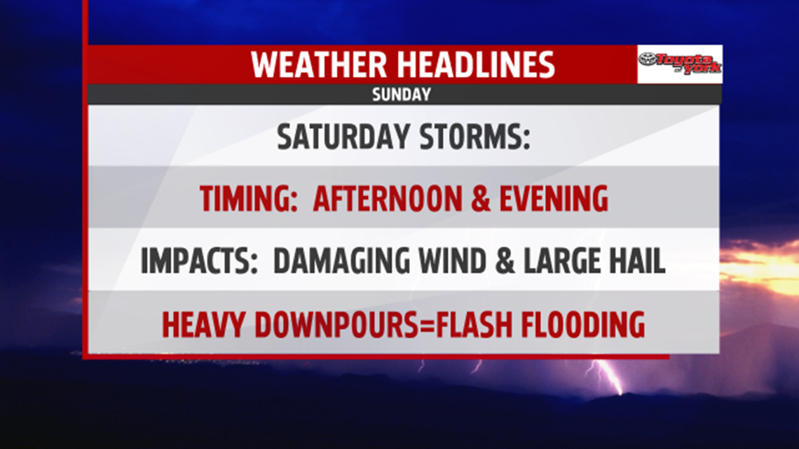
Next shower chance comes in over the weekend. For now appears the best chance will be later in the day into the evening on Saturday. The focus once again is for severe weather. We continue to monitor the situation. It is warmer with highs climbing to the lower to middle 80s. A warm front pushing through will trigger afternoon showers and thunderstorms. Expect storms to be strong, perhaps even severe. Cold front swings through in the early morning hours Sunday ushering in much drier air. Morning lows are mild in the 60s, and with sunshine breaking out, high temperatures will be warm in the upper 70s to lower 80s. Cooler air returns overnight Sunday.

NEXT WEEK:
A dry, cooler pocket of air settles in over the area for Monday. Skies are partly sunny, and highs fall back into the 70s. Plenty of sunshine, along with warming temperatures, expected Tuesday.

Stay with FOX43 Weather for updated changes to the forecast through the rest of the week!
Have a good day!
MaryEllen Pann,
Chief Meteorologist
