

HEAT WAVE CONTINUES
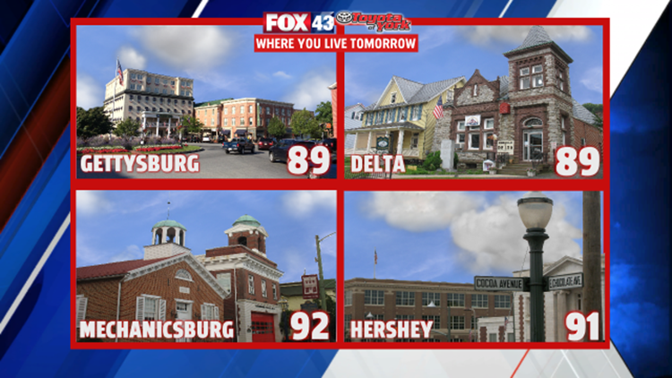
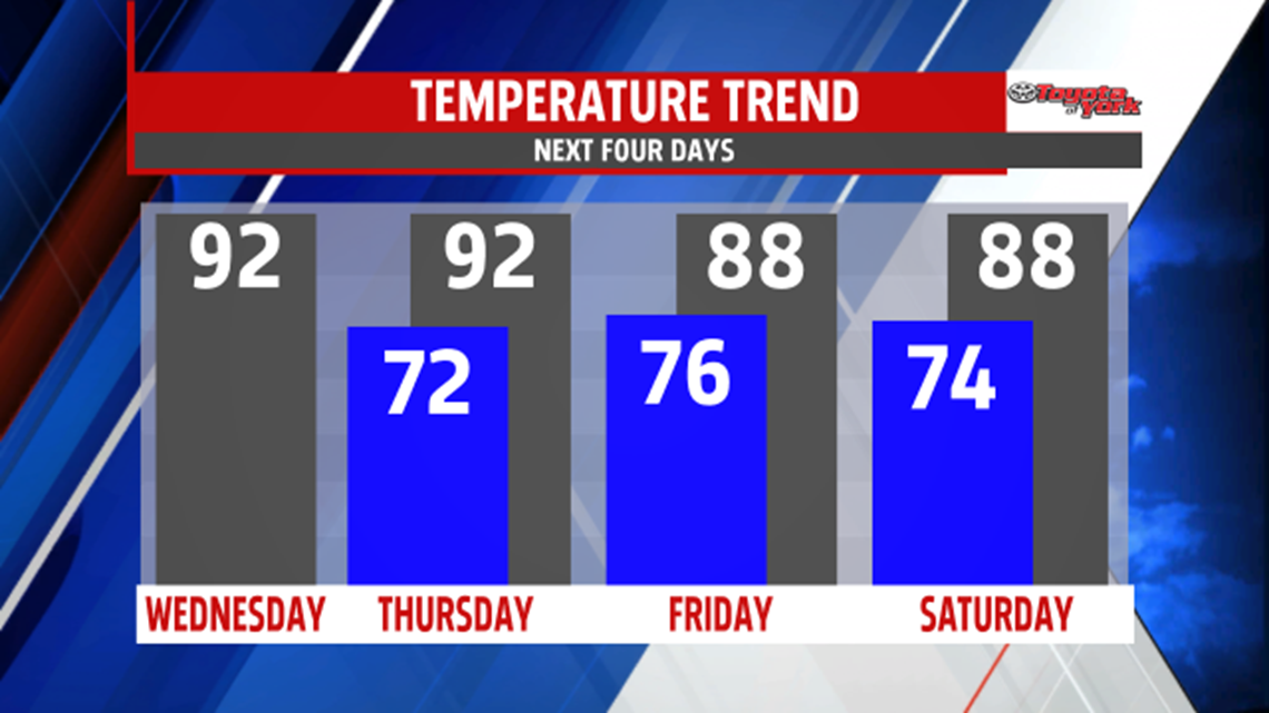
Humidity hangs around continuing the muggy feel. Temperatures Wednesday come down a few more degrees with highs ranging from the upper 80s to lower 90s. Clouds will mix with sunshine mid-week. More clouds for Thursday but winds shift more to the southwest pulling in more moisture and heat. Temperatures are back up to the lower and middle 90s and the humidity notches up too. A late day to early evening Thunderstorm cannot be ruled out. A better threat for scattered showers and thunderstorms is Friday as a cold from tracks eastward. Depending on the timing, we could manage another 90 degree day but plenty of areas are held in the upper 80s.


Showers and thunderstorms threaten the weekend, especially Saturday as a pesky frontal boundary remains. Highs back down into the 80s for both days. A few showers and thunderstorms are possible Sunday but plenty of dry hours expected under partly cloudy skies.

SEASONAL BEGINNING TO AUGUST
High pressure finally pushes a cold front well out of the area Monday leaving mostly sunny skies and pretty comfortable conditions. Highs are near average in the middle 80s with morning lows back into the 60s. Another dry, sunny day for Tuesday with highs in the mid and upper 80s.
Stay with FOX43 Weather for updated changes to the forecast through the rest of the week!
Have a good day!
MaryEllen Pann,
Chief Meteorologist
