


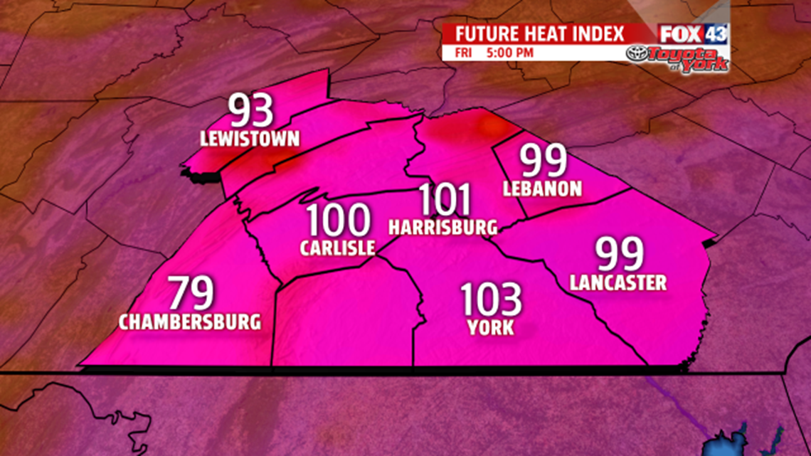

DANGEROUS WEEKEND HEAT: The weekend hangs onto the dangerous heat and humidity. Saturday is partly sunny, with a few isolated showers and thunderstorms possible. Our next cold front approaches Sunday, bringing more widespread showers and thunderstorms to the region. Highs are in the lower to middle 90s again on Saturday. It's also another day where heat indices could reach 100 degrees. Sunday's shower and thunderstorm chances keeps highs less hot, with readings near 90 degrees.
NEXT WEEK: The cold front slowly crosses through, meaning shower and thunderstorm chances carry over to early next week. Monday continues the chance for widespread showers and thunderstorms. Highs are still near 90 degrees. Tuesday temperatures fall back into the 80s. The chance for showers and thunderstorms likely still remain. Wednesday and Thursday still look unsettled, with temperatures still in the 80s. The humidity levels come down a bit, but it is still quite sticky.
Have a great weekend!
