

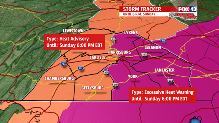
HOT & HUMID: Parts of our area have a Heat Advisory or Excessive Heat Warning in effect through Sunday evening. The National Weather Service has issued these Advisories and Warnings because the combination of heat and humidity will make it feel over 100 again tomorrow afternoon.

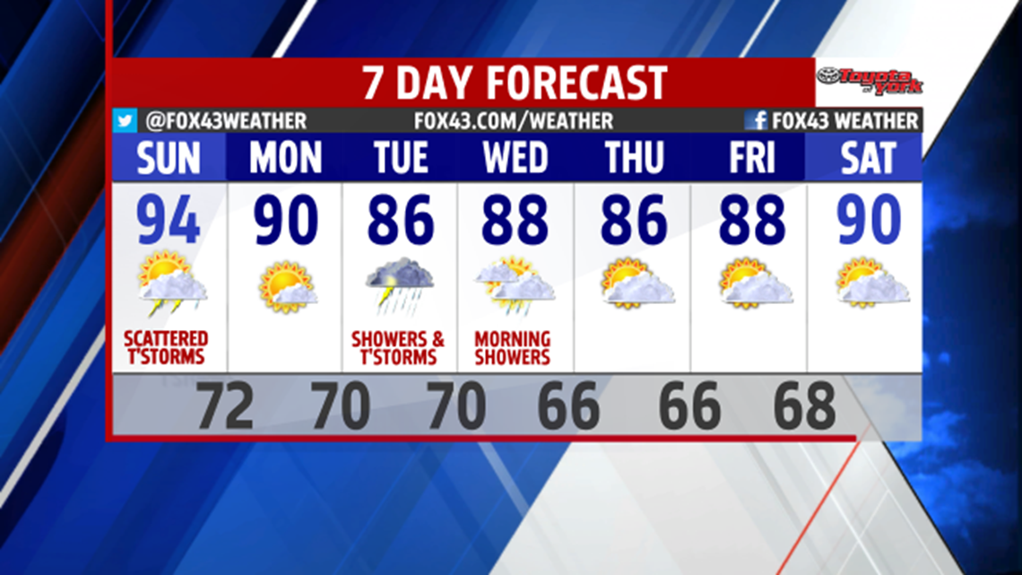
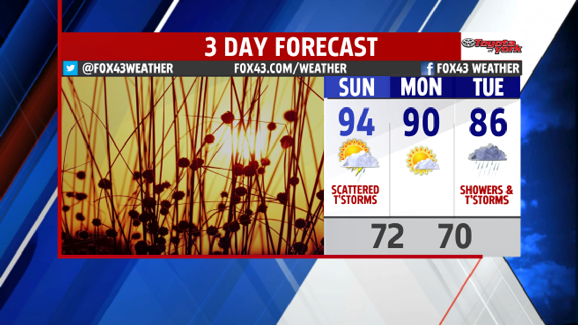
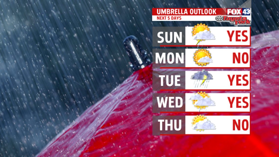
SUNDAY THUNDERSTORMS: On Sunday, we’ll have more widespread scattered showers and thunderstorms in the afternoon. These showers and storms will also have heavy rain. Look for them to cross from west to east between 2 and 8 P.M.
LESS HEAT: The Sunday evening showers and storms cross with a weak cold front. As a result, we’ll get highs in the low 90s on Monday and feel a bit less humid. With that said, it will still feel humid on Monday, but just not as bad as this weekend. Enjoy sunny skies.

MORE RAIN: We’ll have a cloudy and rainy Tuesday. The clouds, showers and storms will keep us out of the 90s. Look for highs in the mid 80s.
MORE STORMS: On Wednesday, we’ll start with the clouds and a few showers and storms. Then, we dry out and become partly sunny by the afternoon. Highs hit the upper 80 because of the afternoon sun. On Thursday, we’ll stay partly sunny and have highs in the mid 80s.

WEEKEND WEATHER: Next weekend, we stand to see just a few hit or miss thunderstorms Friday and Saturday afternoons. Then, we’ll have more widespread scattered showers and thunderstorms next Sunday. Highs climb each day, too. We go from 88 on Friday to 92 on Sunday.
-Meteorologist Drew Anderson
