

WELCOMED CHANGE OVER THE WEEKEND
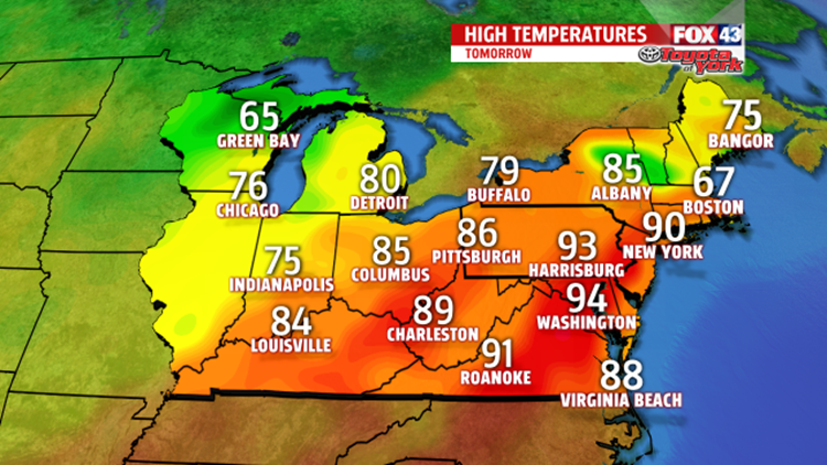
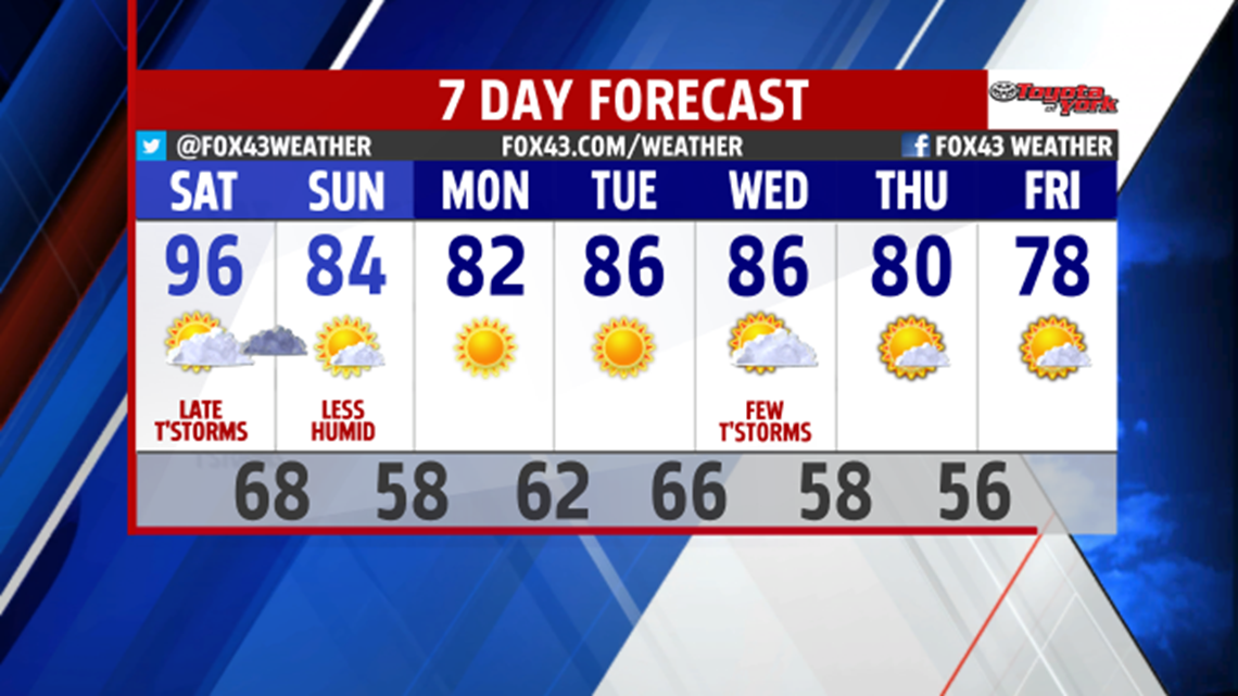
It’s a scorcher for the first half of the weekend. High temperatures quickly climb to the lower to middle 90s.

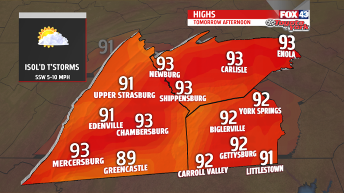
With the higher humidity, it will feel hotter, as heat indices near 100 during the afternoon. Our relief arrives when a cold front swings through overnight. While most of the day stays dry, isolated showers and thunderstorms are possible during the late afternoon, with more of a chance during the evening hours.

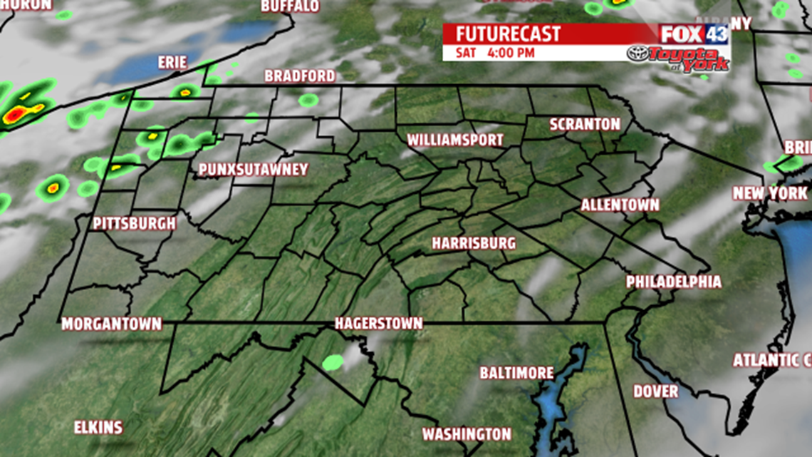
Once the front shoves south, a drier, more comfortable air mass settles in for the second half of the weekend. Highs are cooler in the lower 80s too. Plenty of sunshine is expected as high pressure builds in across the area.


NEXT WEEK
The high will dominate for a couple of days bringing sunshine and quiet weather. Highs are still above seasonable averages in the lower to middle 80s. The humidity starts to creep back up by mid-week. Our next frontal system arrives late Wednesday bringing our next threat for a shower or thunderstorm. Nothing widespread is expected. Highs are in the middle 80s. Temperatures and humidity drop behind the front. High temperatures settle in the upper 70s to near 80 degrees for both Thursday and Friday under mostly sunny skies.

Stay with FOX43 Weather for updated changes to the forecast through the rest of the week!
Have a good day!
MaryEllen Pann,
Chief Meteorologist
