

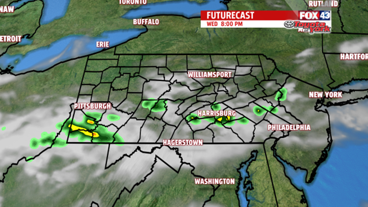
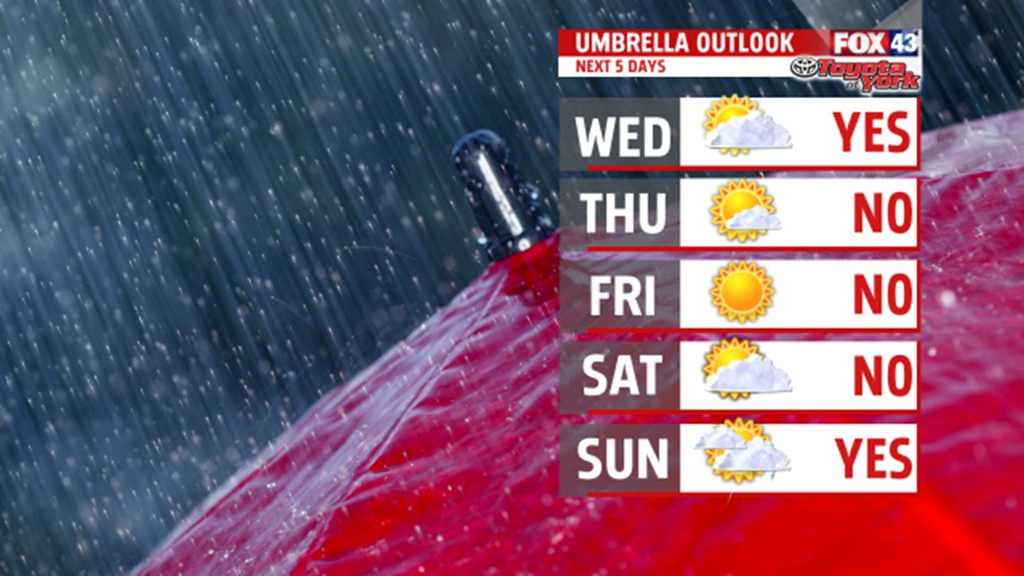
SLIM RAIN CHANCE
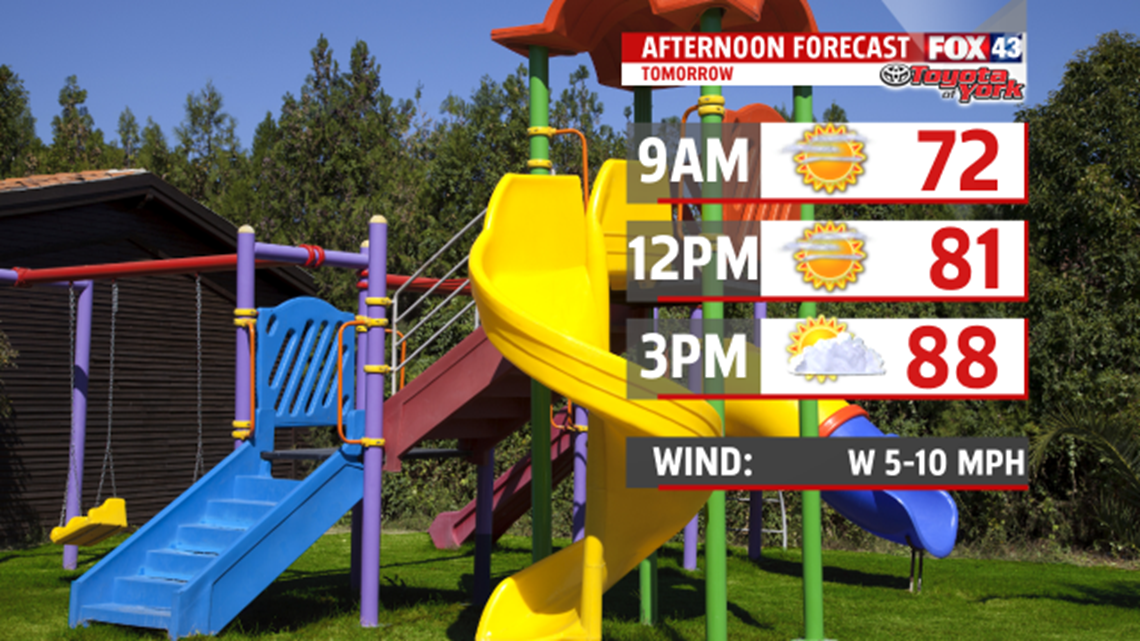
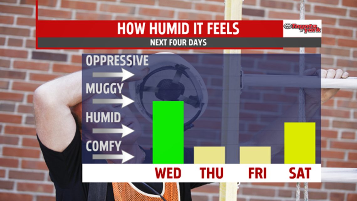
High pressure tracks east of us shifting our winds to the southwest bringing a muggier day Wednesday. Despite more clouds, it is much warmer in the upper 80s to near 90 degrees.

The next cold front arrives towards evening but is weak and doesn’t bring much in the way of showers. A few are possible, perhaps even a thunderstorm but not much more. Most areas stay dry. Skies clear by morning leaving abundant sunshine for Thursday. Temperatures are cooler in the 70s once again and drier air in place makes it more comfortable. The sunshine and low humidity are with us through Friday. Expect highs in the upper 70s to lower 80s.

WEEKEND OUTLOOK
You can expect half of the weekend to be dry with showers threatening the other half. Saturday is the dry day with partly sunny skies. It is mild and more humid with highs in the lower to middle 80s. A cold front swings in for Sunday bringing our next best shot at showers and thunderstorms. High temperatures are held in the upper 70s and lower 80s.

EARLY NEXT WEEK
High pressure builds back in across the area bringing drier air and sunshine. After morning lows in the lower 60s, temperatures top out in the upper 70s to lower 80s. Temperatures continue above average into Tuesday with highs in the lower 80s under partly cloudy skies.
Stay with FOX43 Weather for updated changes to the forecast through the rest of the week!
Have a good day!
MaryEllen Pann,
Chief Meteorologist
