

Who doesn’t love a report card? Well, OK, some people might not, but it’s a good way to get an idea of how things are going — whether it’s the middle of the semester at school or the middle of the season for your favorite sports team.
How about the middle of the Atlantic basin’s hurricane season? September 10 marked the peak of that season, with a large majority of storms occurring between mid-August and mid-October. So how is this season stacking up?
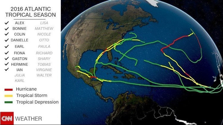
So far, the 2016 season has had nine named storms, with Tropical Storm Ian, named on Monday, the most recent. This is a slightly faster pace than average, as we would typically have seven named storms by now. This shouldn’t come as a surprise, since the National Oceanic and Atmospheric Administration said before the year started, and in its August update, that this could be the busiest season since 2012.
In terms of hurricanes, we are also ahead of the curve with four, compared with an average to date of three.
Numbers don’t tell the whole story
Most meteorologists agree, however, that the best measuring stick for tropical activity is Accumulated Cyclone Energy, or ACE. Without getting into the complex details, ACE is a measure of the total energy over the lifetime of a storm. The stronger the storm and the longer the duration, the higher the ACE value will be.
For example, a storm like Wilma in 2005 had a very large ACE. Not only was it a very strong storm, but it was strong for a long period of time. Wilma was a hurricane for over seven days and it spent four entire days as a Category 4 or 5 storm.
Despite 2016 being ahead of where we usually are with named storms, the ACE value through September 12 is about 20% below average.
Similar to the past few years, the Atlantic has had a lot of weak storms that fail to make significant headlines. In fact, well over half of this season’s ACE is from one storm: Gaston. It was the only major hurricane in the Atlantic this year and spent several days at Category 3 status, but it moved harmlessly through the central Atlantic and was never a threat to land.
A few noteworthy storms
Hurricane Hermine was the United States’ most noteworthy storm in 2016 to date, as it was the first hurricane to hit Florida in over a decade. It traveled up the Eastern Seaboard and even threatened the Northeast, affecting Labor Day plans for millions.
The deadliest storm in the Atlantic basin this year has been Hurricane Earl. It made landfall in Belize and then briefly emerged in the Bay of Campeche before bringing tremendous amounts of rain to southern Mexico. That led to landslides that killed at least 40 people.
Three other storms also have made landfall this season: Bonnie in South Carolina, Colin in Florida and Danielle in Mexico. All were fairly weak tropical storms at landfall.
Don’t let your guard down
So, what can we conclude from our mid-season report card? Though we have seen roughly average activity across the Atlantic, and there have been a few US landfalls, we continue to dodge the bullet, with no major hurricane landfalls.
The most important thing about the mid-season report card is that it is just that: the middle of the season. There is still a long way to go, and everyone along the coasts should be prepared for the remainder of the season.
