


MATTHEW’S TRACK: Matthew luckily has yet to make landfall, technically, along the east coast. And by technically, we’re talking by less than 10 miles off the coast. Every mile matters!

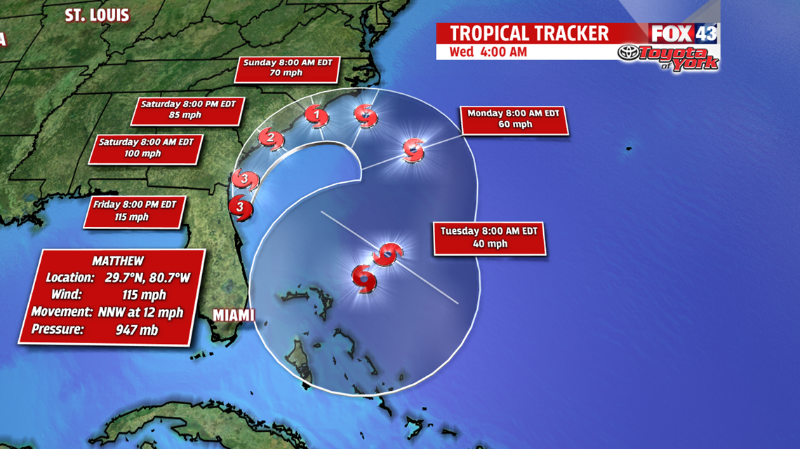
He still brought devastating storm surge and wind to nearly all of the eastern coast of the state and will continue to track northward just off the coast of Savannah by tomorrow morning, with expected landfall near the Georgia/South Carolina border as a weak category 3 or strong category 2 hurricane.

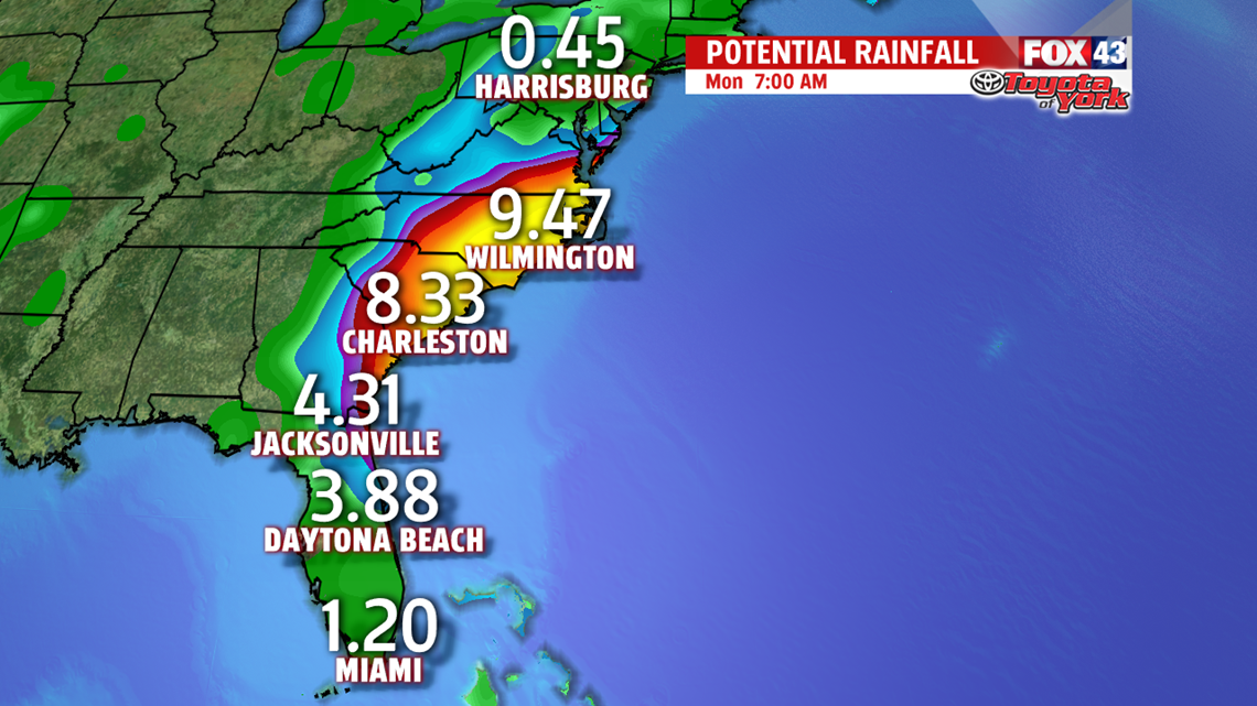
Flooding and storm surge along the coastline continues to threaten the coasts, with up to a foot of rainfall possible and 4-9 feet of storm surge likely.
BACK HOME IN PA: A cold front moving through tonight and into the overnight brings rain back into Central Pennsylvania, with scattered showers possible starting in the early morning hours and lasting throughout the majority of the day Saturday. Temperatures will stay cool in the mid 60s and will hover just below 70 for the next several days.

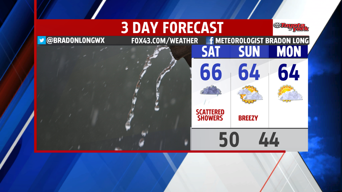
Sunday clouds start to clear a bit, but the rain chances diminish significantly. Sunday is your day for outdoor activities, so don’t cancel any plans for the later part of the weekend.
Have a great rest of your Friday!
-Meteorologist Bradon Long
