

FANTASTIC WEEKEND AHEAD
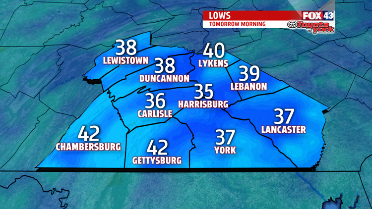
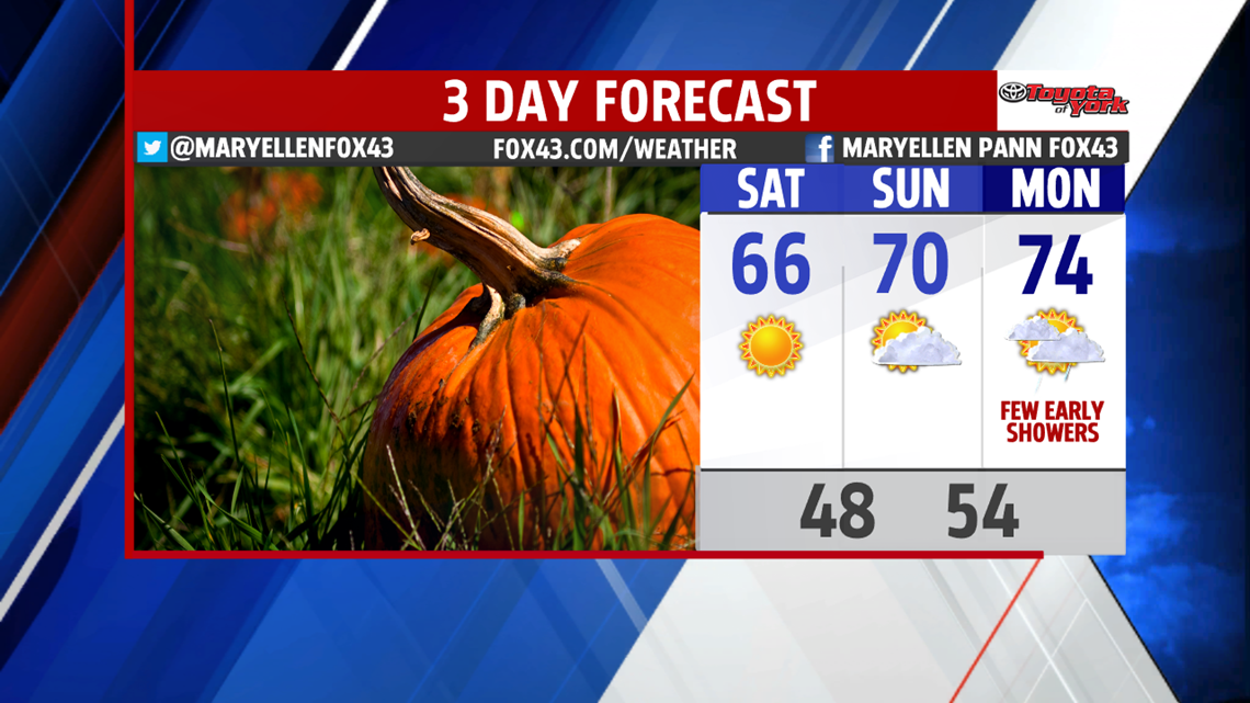
A wonderful, fall weekend is in store for us. High pressure dominates, bringing abundant sunshine. After a frosty start in the 30s, temperatures rebound into the afternoon, topping out in the middle 60s. Sunshine continues Sunday, although clouds increase later in the day towards evening. High temperatures are warmer in the middle 60s to near 70 degrees.

HSFF FOOTBALL FORECAST
Get ready for a chill! You may want to bring a jacket or sweatshirt if you are heading to one of the area football games this evening. Temperatures fall out of the 50s into the 40s quickly once the sun sets at 6:27. Warwick is visiting Manheim Township in our game of the week!


WARMER WEEK
A few showers begin the week Monday, otherwise, expect a mix of clouds and sunshine. Temperatures are mild in the lower 70s. It is even warmer Tuesday, with highs middle 70s under mostly sunny skies. The next system doesn’t arrive until mid-week and it is moisture starved. We enjoy another day well into the 70s for Wednesday. The end of the week becomes unsettled with shower chances both Thursday and Friday. Temperatures fall from the 70s back to the 60s by Friday.

Have a good day!
MaryEllen Pann,
Chief Meteorologist
