


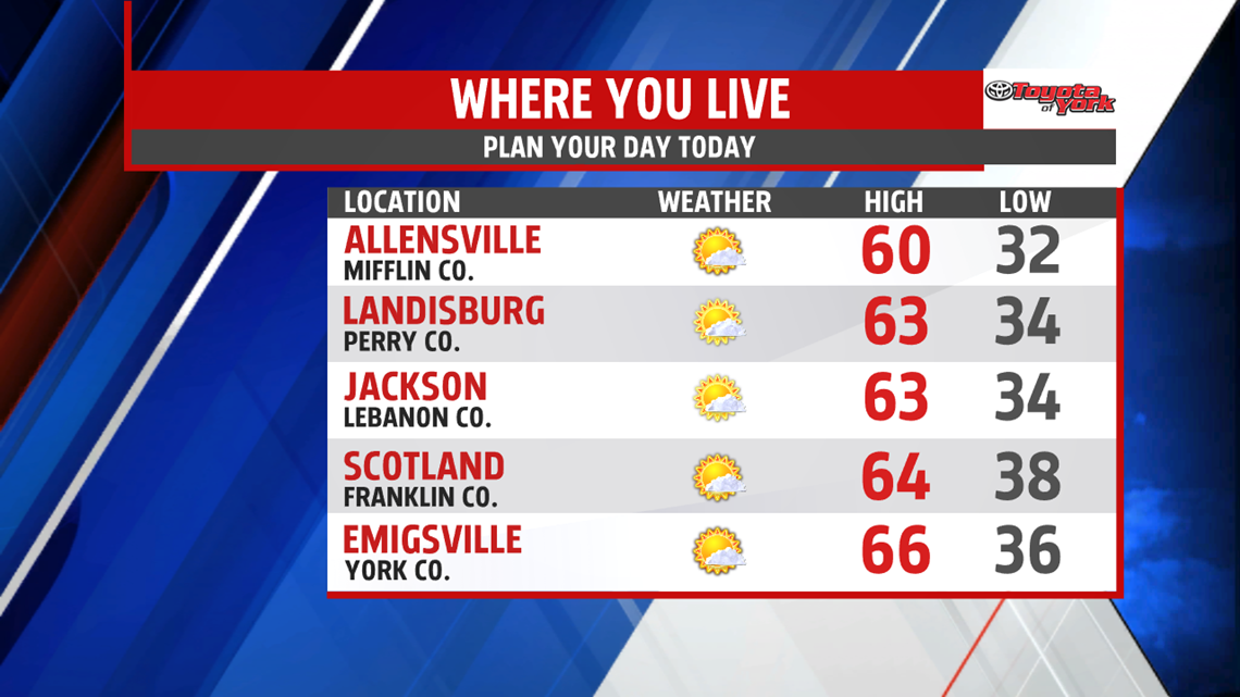


SUN RETURNS: High pressure has taken full control in the wake of Thursday’s cold front. The morning forecast starts chillier with sunny skies. Temperatures are in the upper 30s to middle 40s. Winds are light. Bountiful sun is expected through the afternoon. The winds remain light. Temperatures are in the lower to middle 60s, seasonable readings for this time of year. Clear skies allow temperatures to tumble quickly this evening. A cold night is ahead, with widespread frost likely to the region. Overnight low temperatures are in the middle to upper 30s.

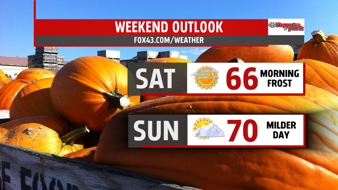
FABULOUS FALL WEEKEND: The weekend outlook remains wonderful! After a frosty start, temperatures quickly bounce back through Saturday under plenty of sunshine. Afternoon readings are in the middle 60s under partly cloudy skies. A bit of warming takes place by Sunday. Expect temperatures in the middle 60s to near 70 degrees under a mixture of sunshine and clouds.

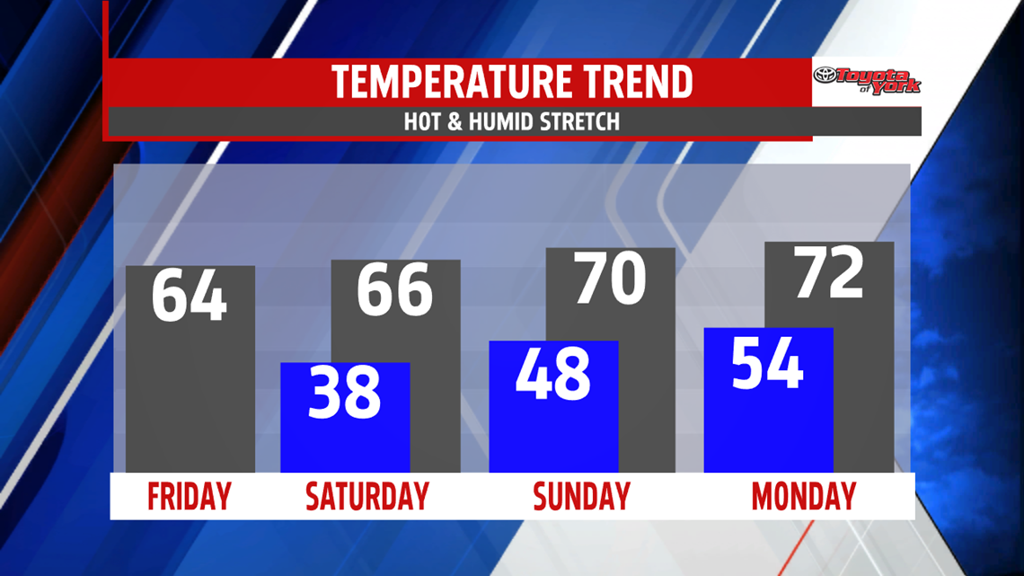
MILD NEXT WEEK: Monday brings a chance for showers. Temperatures remain above seasonable averages, with readings near 70 degrees. Tuesday is even milder, with plenty of sunshine and temperatures in the lower to middle 70s. Wednesday is even milder, with temperatures reaching the middle to upper 70s. A shower is possible. A better chance for showers comes on Thursday. Temperatures cool down as well.
Have a great weekend!
