

SUNDAY THUNDERSTORMS
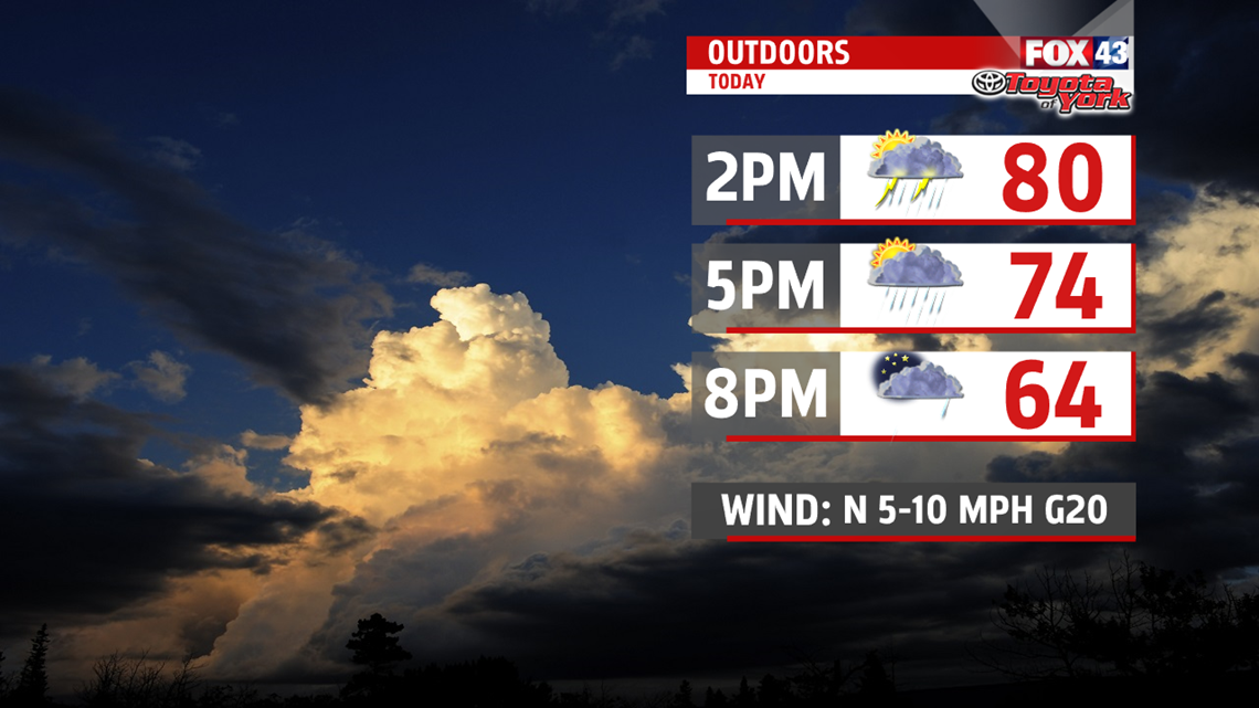
A cold front swinging in this afternoon brings the threat for showers and thunderstorms. With highs near 80 this afternoon, some storms could be quite strong and may contain gusty winds around 50mph and pea size hail. They arrive as early as 2pm in our northwest counties and continue to track across the area. Showers should end around 8pm this evening.

BRIEF COOL DOWN
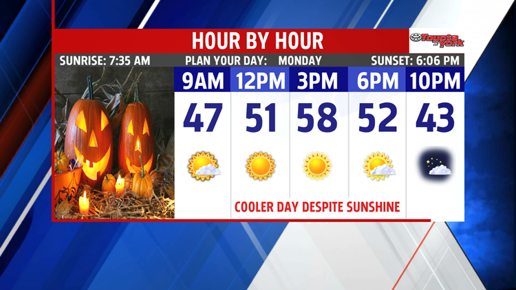
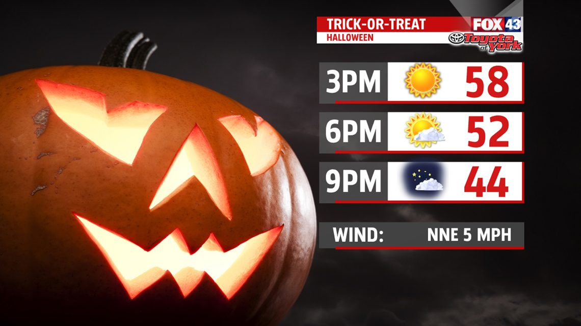
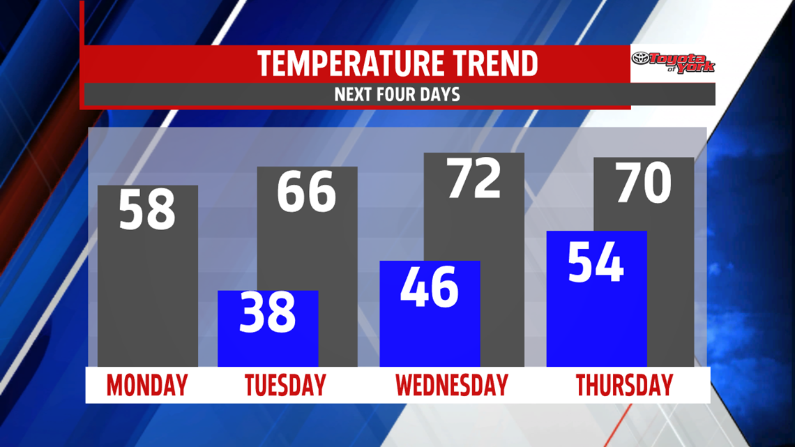
After a mild weekend, temperatures fall back to the 50s for Halloween and the last day of October. Plenty of sunshine as high pressure dominates the day. Trick-or-Treaters prepare for chilly temperatures once the sun sets. Temperatures fall out of the 50s to the 40s.

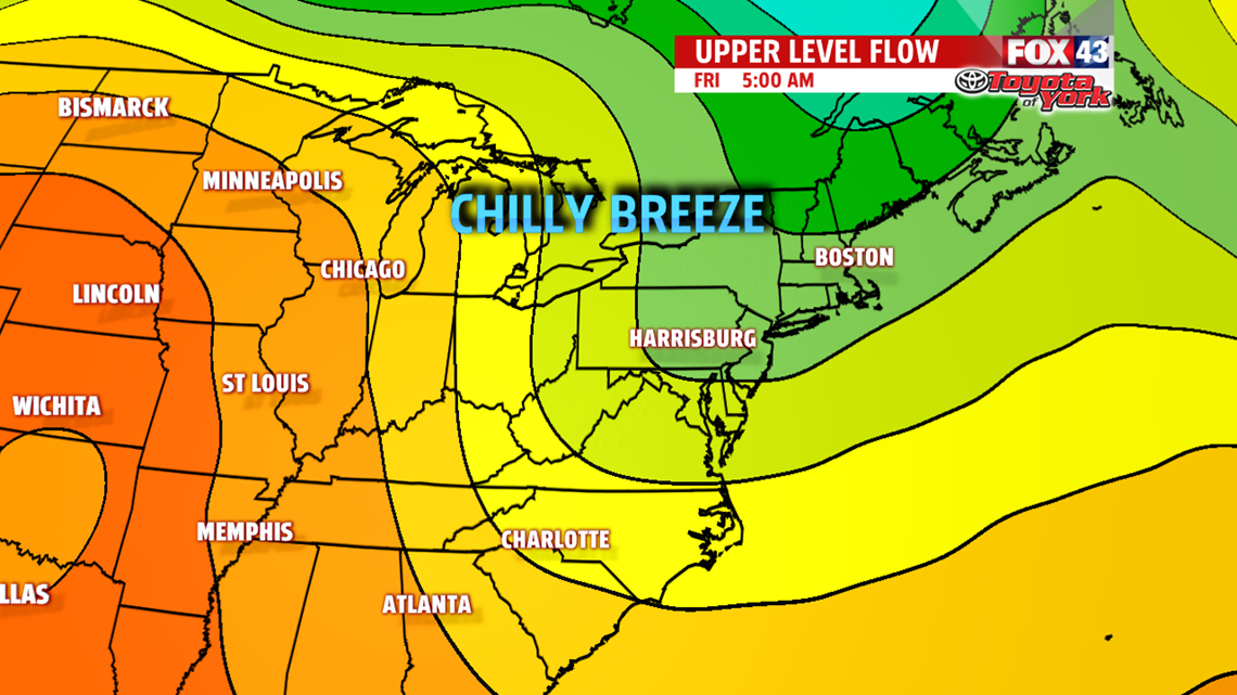
Few more clouds Tuesday with a wind shift more to the south but temperatures actually warm above seasonable averages in the lower and middle 60s. Sunshine returns along with milder air for Wednesday. Highs are in the 70s once again. Our next system arrives afternoon Thursday with showers. It is still mild near 70 before we cool back down. It’s a dry end to the week under mostly sunny skies. But a stiff northerly breeze brings in much cooler air Friday. Highs struggle to warm through the 50s!!

WEEKEND OUTLOOK
It is mainly dry for the weekend but a couple of disturbances on Saturday then again Sunday keeps the clouds around. Highs are seasonable near 60 for Saturday, however, they fall back into the 50s for the second half of the weekend.

Stay with FOX43 Weather for updated changes to the forecast through the rest of the week!
Have a good day!
MaryEllen Pann,
Chief Meteorologist
