

TEMPS CONTINUE TO WARM
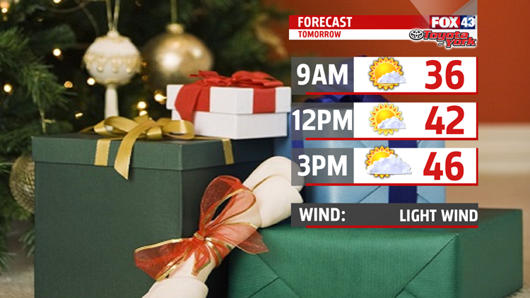
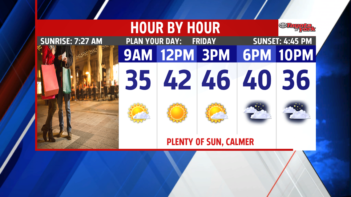
High pressure is back and bringing plenty of sunshine for Friday. A great day to get your last minute holiday shopping complete! Highs climb to the middle 40s.

CHRISTMAS WEEKEND
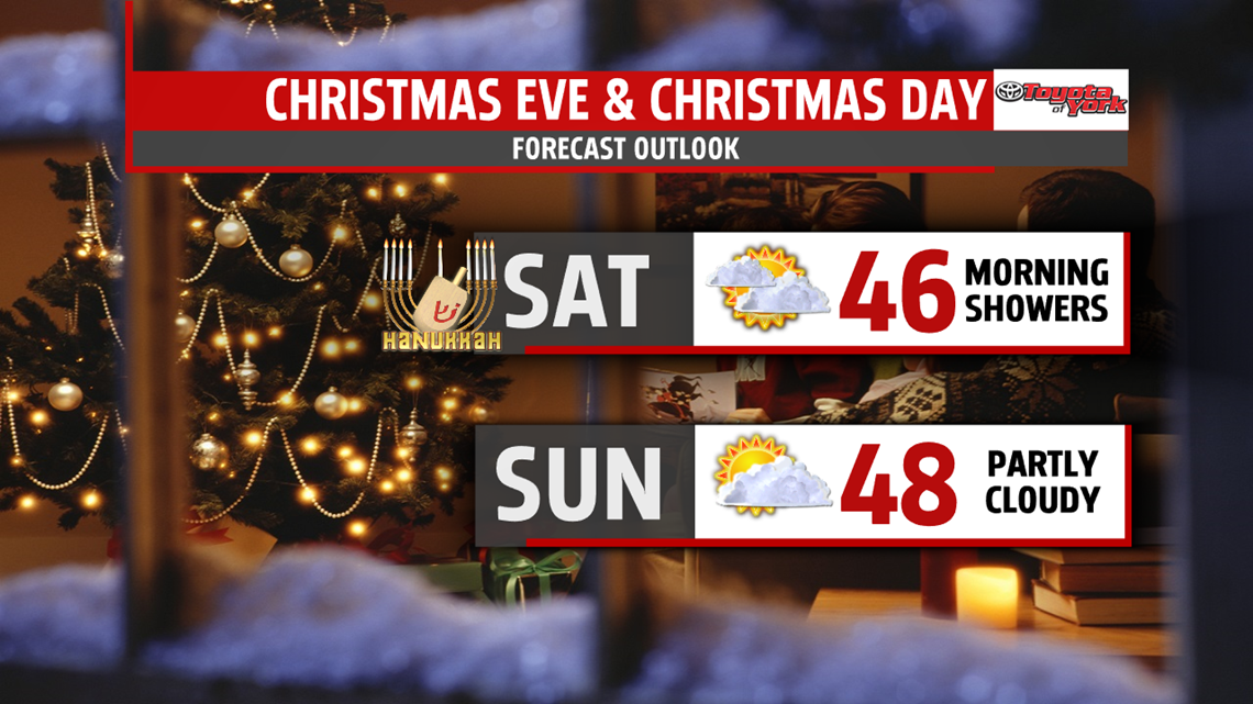
Santa’s travels shouldn’t encounter any issues Christmas Eve night. However, a weak frontal system swings through early in the day bringing our best threat for rain showers in the upcoming days. Sadly no white Christmas this year. The rest of the weekend is dry so no worries if your plans are to travel to see loved ones for Christmas Eve or Christmas Day. High temperatures are mild both days in the middle and upper 40s.

NEXT WEEK
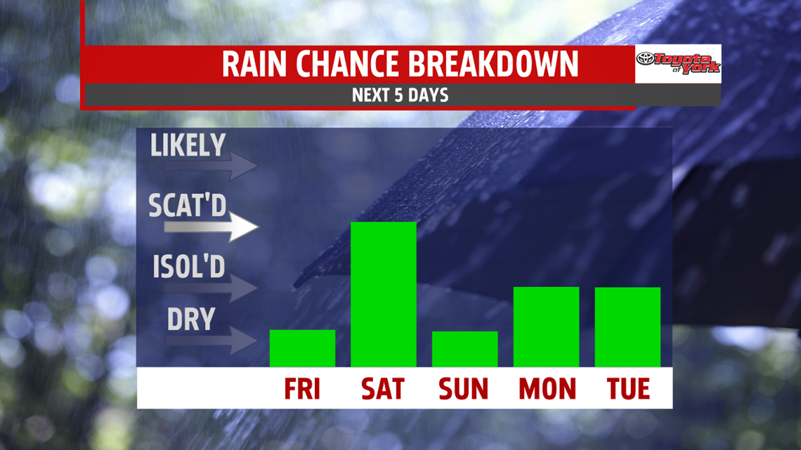
Temperatures are even milder to begin the week. A stray shower can’t be ruled out but most of the day is dry. Temperatures jump to the upper 40s and lower 50s. A better threat for showers expected Tuesday as the next system moves through but anything we get is light and gone early. Highs are in the 40s. It is drier with chillier air returning under mostly sunny skies mid-week. It is the coolest day of the next 7 with readings are in the upper 30s to lower 40s. Next chance for showers returns Thursday. Temperatures are mild in the mid 40s. Some areas north and west of Harrisburg may see a little mixing.

Stay with FOX43 Weather for updated changes to the forecast through the rest of the week!
Have a good day!
MaryEllen Pann,
Chief Meteorologist
