

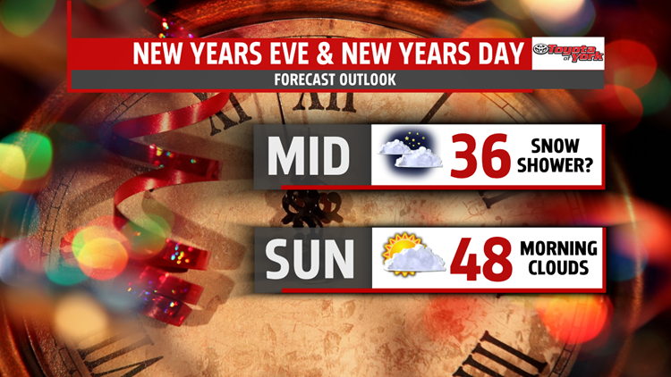
NEW YEAR’S EVE AND NEW YEAR’S DAY
After a gusty day, winds should fade through the late evening but will pick back up again Saturday. The difference will be wind direction out of the south instead of the north.


NEXT WEEK
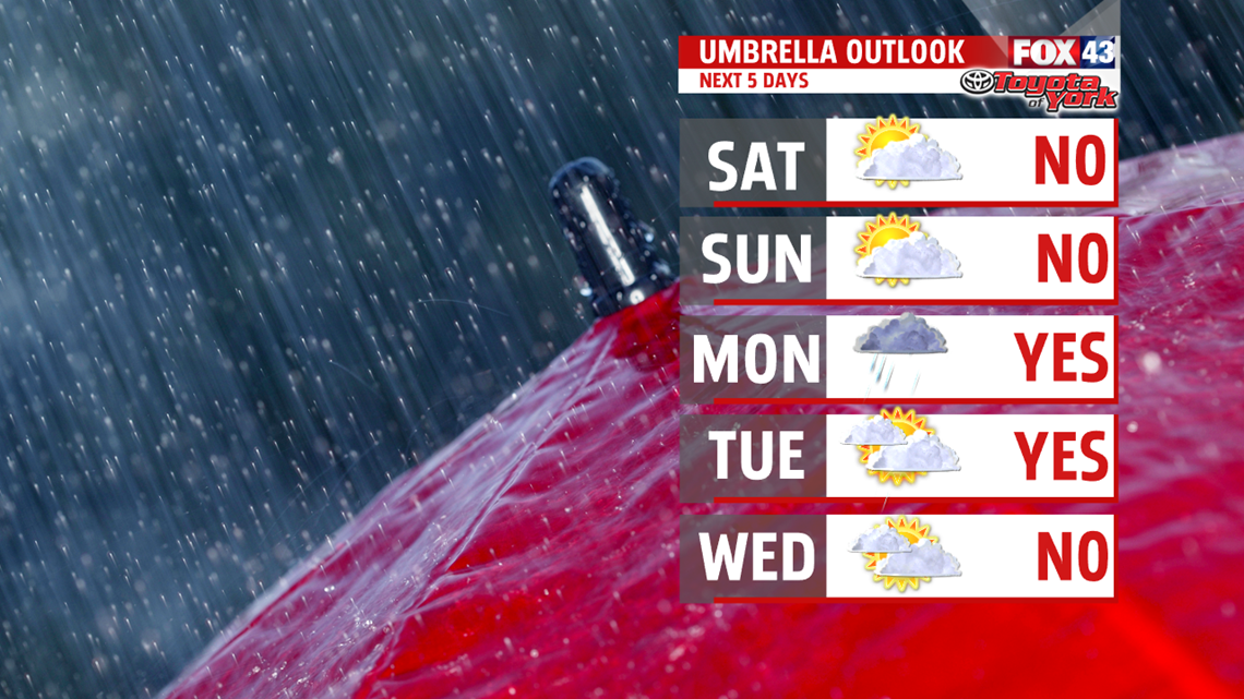
Our next best threat for wet weather arrives for Monday. Keep the umbrella handy for widespread showers throughout the day. With morning lows near freezing or below in spots, there is a chance for a wintry mix initially before changing over to rain showers the rest of the day. Highs are slow to rise into the lower 40s. Showers may linger early Tuesday then we are drying out the rest of the day. Breezy with sunshine increasing through the afternoon. Highs are mild in the 50s. Unsettled weather continues for Wednesday. Another cold front brings the threat for a few showers. Temperatures still remain above average in the 40s to near 50 degrees, however, temperatures turn much colder behind this system for Thursday. Friday continues cold in the 30s with a chance for rain and snow showers.

May 2017 bring you a year of good health and happiness. Happy New Year!
MaryEllen Pann,
Chief Meteorologist
