

DRYING OUT
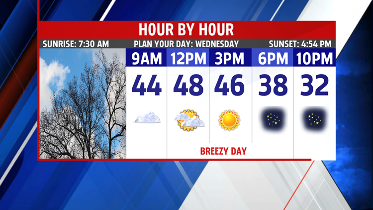
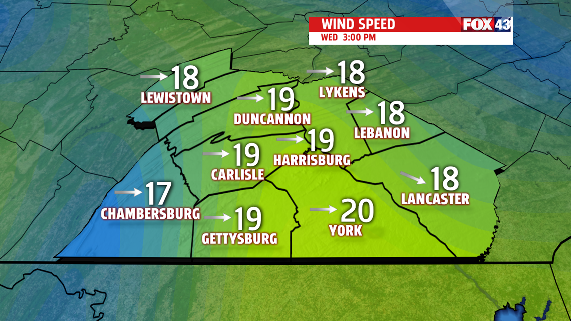
Very early in the morning fog and low clouds are possible but increasing winds help to draw in drier air breaking up the low-level clouds. The breeze out of the northwest also brings a chilly change in the air. Temperatures are mild early in the upper 40s, before tumbling through the late afternoon and evening. Thursday is a quiet but chilly day in the 30s under partly to mostly sunny skies. More clouds and a few light snow showers end the week Friday with highs again in the lower 30s. An Arctic boundary late Friday into the weekend brings even colder air to the area.

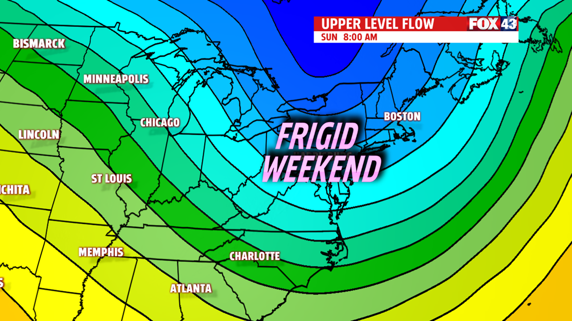
EXTRA LAYER WEEKEND
A frigid weekend is in store for us. Partly cloudy with morning lows in the teens and highs only climbing to the upper 20s Saturday. With clearer skies and calmer winds Saturday night, temperatures dive once again to the lower and middle teens Sunday morning. Plenty more sunshine for the day but temperatures remain in the middle and upper 20s.

NEXT WEEK
Morning lows are quite cold to start in the low teens. Skies are sunny with a bubble of high-pressure overhead. Temperatures begin to recover as an upper-level trough lifts out of the area allowing temperatures to moderate. By afternoon, temperatures are able to rebound to the lower 30s. Tuesday, morning lows are not as frigid in the lower 20s. Plenty of sunshine with a few more clouds and highs are more seasonable in the upper 30s to near 40 degrees.
Have a wonderful day!
MaryEllen Pann,
Chief Meteorologist
