


QUICK SHOT OF SNOW
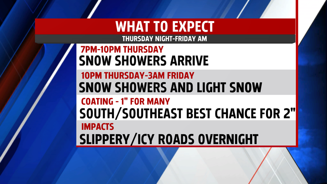
With our next system expected to move in this evening, the colder air ensures the precipitation is snow. The first flakes begin to fall as early as 6pm but will be spotty. It takes much of the evening for light snow to spread in so not everyone seeing them initially, especially areas farther east. The last of the snow looks to exits before the morning rush begins around 4am. With that said, the snow could make the commute slippery. With temperatures only in the 20s, icy areas are likely. Allow for extra travel time Friday morning.


EXTRA LAYER WEEKEND
It’s a frigid morning in the teens Saturday. Winds are northerly through the day, and despite sunshine it’s a very cold afternoon in the upper 20s. An area of low pressure along the southeast coast hugs closely as it tracks to the northeast. Right now, an area of strong high pressure keeps it to our east. However, a shift to the west would mean snow for Saturday. We’ll continue to monitor for changes. With the high bumping up against the coastal low, the pressure gradient tightens for Sunday increasing the breeze. It’s another morning in the middle teens and again, it is an extra layer day with highs in the middle 20s. The breeze keeps wind chills in the teens both days.


NEXT WEEK
Morning lows are quite cold to start in the low teens. Skies are sunny with a bubble of high-pressure overhead. Temperatures begin to recover as an upper-level trough lifts out of the area allowing temperatures to moderate. By afternoon, temperatures are able to rebound to the upper 20s and lower 30s. Tuesday, morning lows are not as frigid in the lower 20s. There are more clouds around as a warm front lifts through the area. It may be accompanied by a brief mix of precipitation before changing to a few rain showers. Highs slowly climb to the middle 30s. A warmer surge of air ahead of our next cold front boost temperatures into the 40s for Wednesday. Shower threat continues through the afternoon as the front slides east. It is followed by drier air for Thursday.
Have a wonderful day!
MaryEllen Pann,
Chief Meteorologist
