

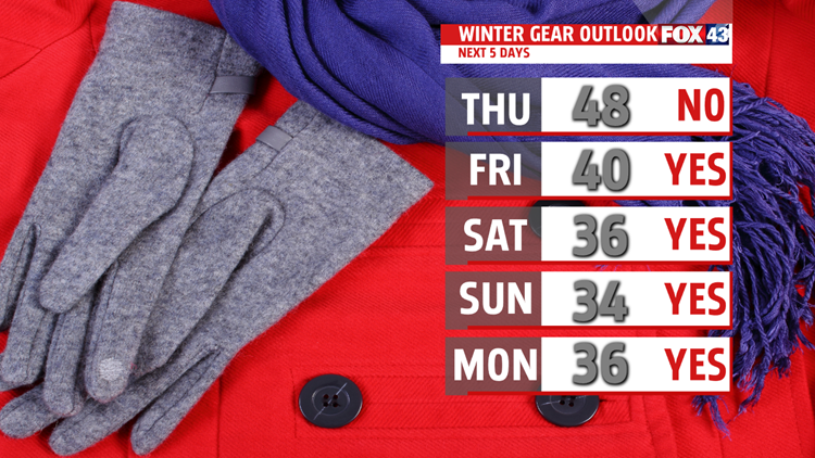


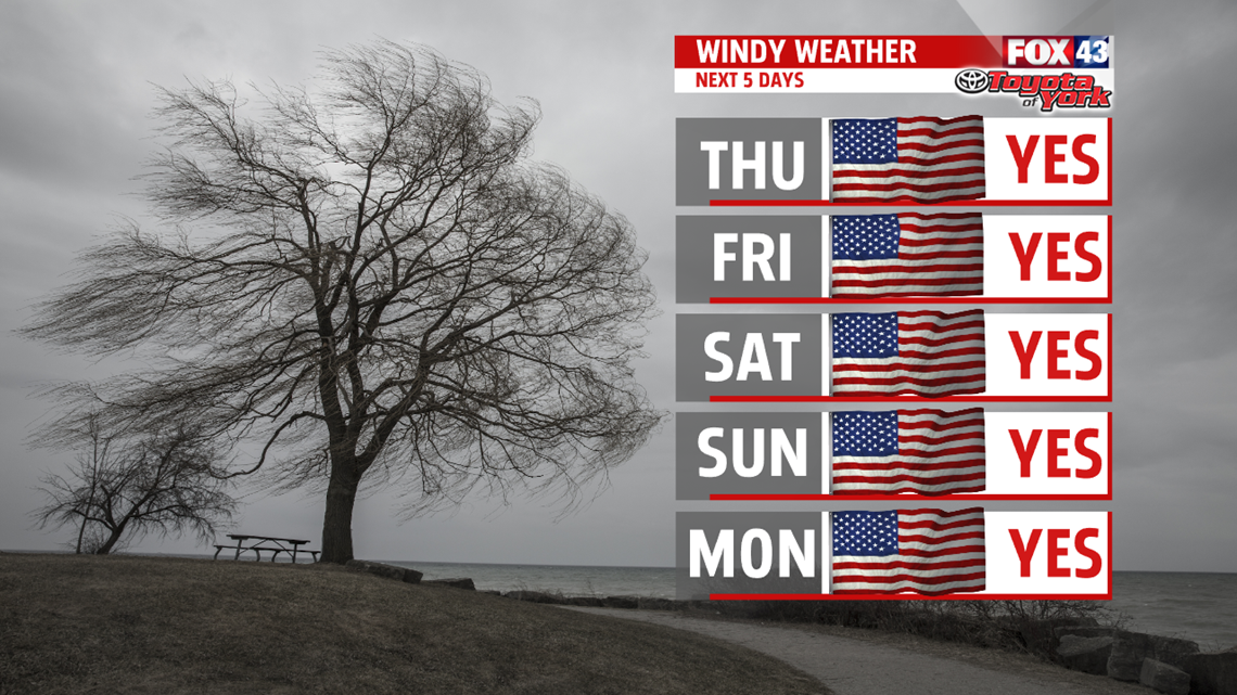
upper 40s but with the strong breeze, wind chill values feel like the 30s. Temperatures dip more Friday. Plenty of areas stay in the 30s to near 40 degrees. The breeze continues producing wind chill values in the 20s at times. A few sprinkles or flurries are possible too.
WINTER RETURNS FOR WEEKEND
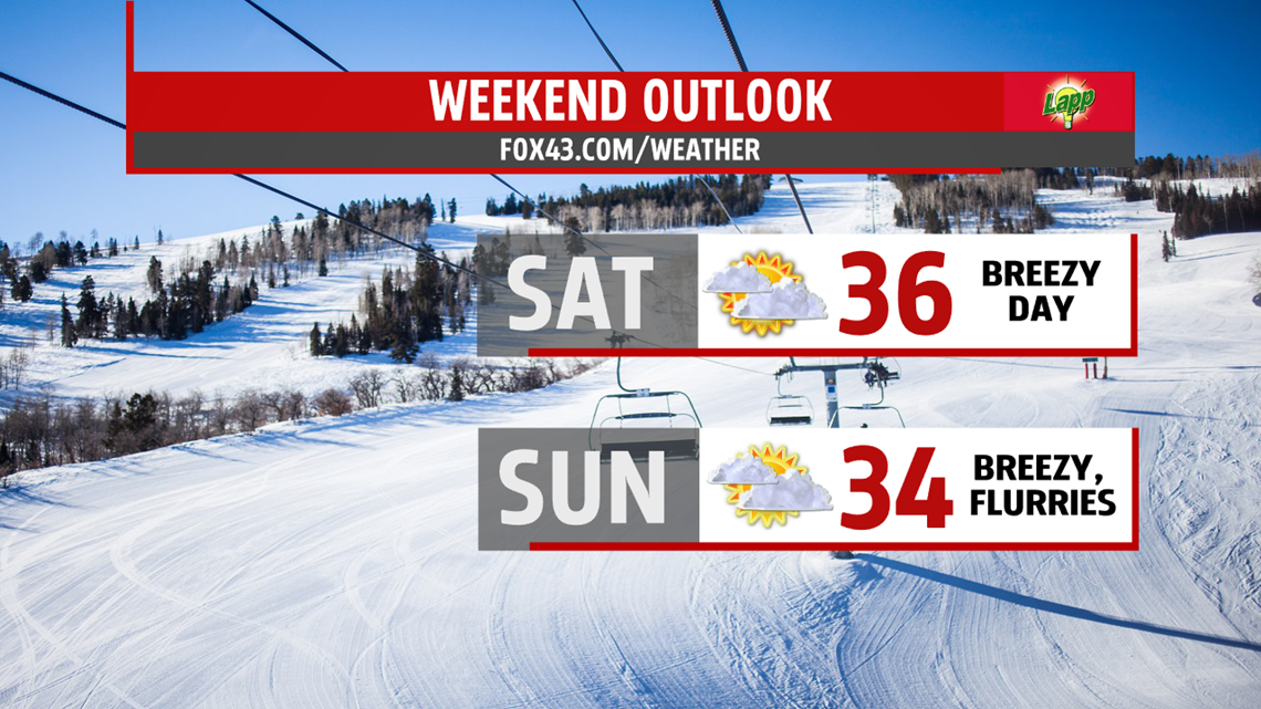
Average high temperatures are in the upper 30s, and most areas over the weekend won’t even warm to near average. There are plenty of clouds both days limiting sunshine. Temperatures climb to the lower and middle 30s, and with the continuing breeze, wind chill readings are in the 20s. Strong winds over the Great Lakes get the lake effect snow machine going. A few flurries could reach areas north and west of Harrisburg. A stronger piece of energy and weak clipper swing through Sunday bringing a better chance for a few light snow showers.

BRIEF WARMING
Seasonable cold continues into Monday with morning lows starting in the lower 20s and highs only recovering to the middle 30s. It’s another breezy day with the possibility of flurries. The winds finally subside overnight as high pressure builds in. We are milder Tuesday with less cloud cover and readings topping out in the lower 40s but our next front quickly arrives Wednesday, bringing rain and or snow showers. Highs in the 30s.
Have a wonderful day!
MaryEllen Pann,
Chief Meteorologist
