

LIGHT ACCUMULATING SNOW

TEMPERATURES FLIP FROM MILD TO COLD AGAIN
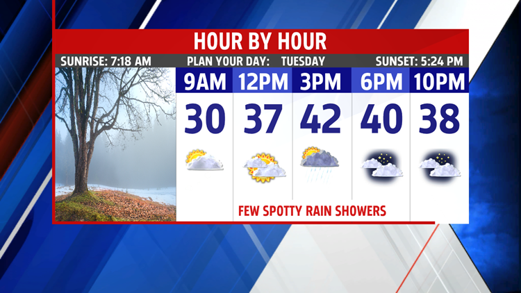
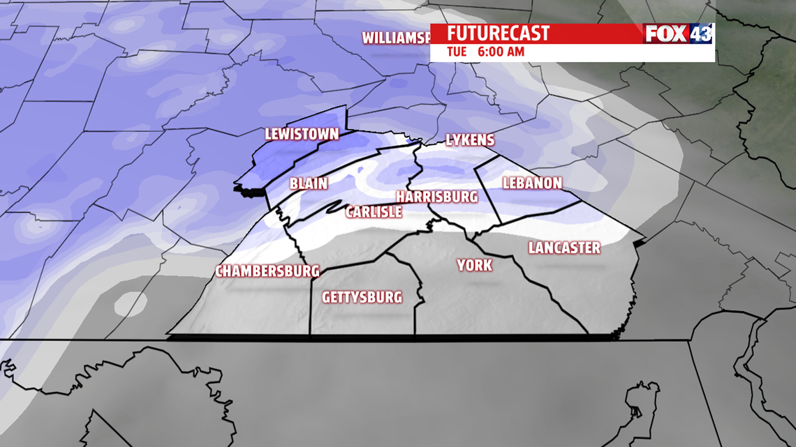
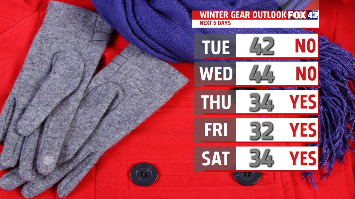
Expect 40-degree temperatures the next couple of days. Highs climb to the upper 30s in our northwest counties, however, lower and middle 40s expected elsewhere Tuesday. And it’s still mild Wednesday with a bit more sunshine and highs in the middle 40s. I still can’t rule out a few rain and or snow showers as some energy rotates through the region. Skies are mostly cloudy Thursday with a few flurries. The breeze kicks in too. Afternoon temperatures fall back to the 30s. It turns even colder Friday despite more sunshine. Temperatures only climb to the upper 20s and lower 30s.

WEEKEND OUTLOOK
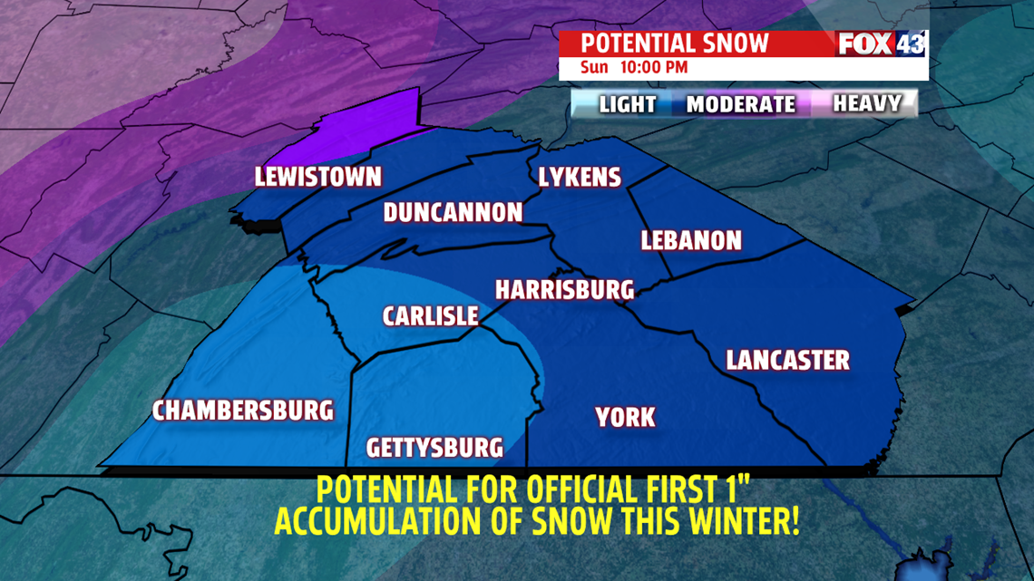
It is more seasonable over the weekend, meaning temperature readings are typical for this time of year in the lower and middle 30s Saturday and Sunday. We are tracking the possibility of our first official inch of snow at Harrisburg International Airport. Not all of the model data agrees but right now it appears light snow would spread in early Sunday, picking up in intensity during the afternoon. There could be several inches of snow from the system by the time it ends.

Have a super week!
MaryEllen Pann,
Chief Meteorologist
