


TEMPERATURES FLIP FROM MILD TO COLD AGAIN

WEEKEND OUTLOOK
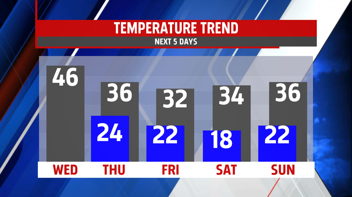
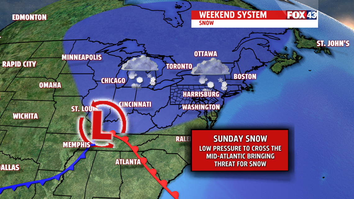
The winter feel continues into the weekend. Partly to mostly sunny skies Saturday with highs in the lower 30s after a very cold morning in the teens. It’s a few degrees better Sunday however, the clouds quickly race in as our next system brings light snow showers for the day. We continue to watch the daily updates with this system. They still indicate minor accumulation of snow.

TEMPERATURES SWING BACK UP NEXT WEEK
We see the up and down pattern of temperatures continue into early next week. Mild air advances on the area Monday with highs returning to the lower and middle 40s. Showers arrive overnight with a warm front and exit early Tuesday leaving the rest of the day very mild in the upper 40s and lower 50s. More showers expected with the front Wednesday.
Have a super week!
MaryEllen Pann,
Chief Meteorologist
