


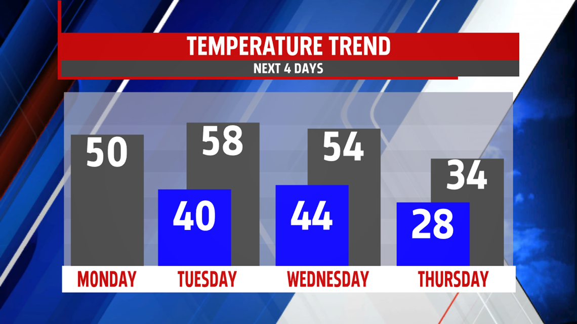


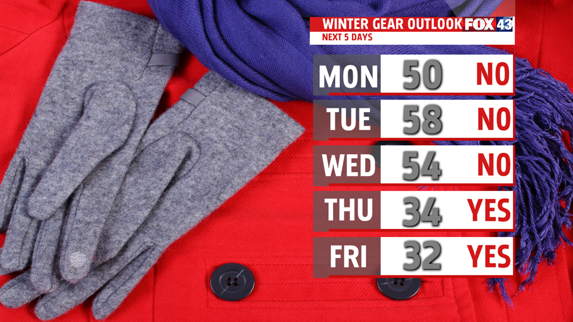
COLD BLAST ENDS WEEK: Wednesday night, cold air continues settling into the region, and it’s timing is crucial in the overnight forecast through Thursday morning. Normally the colder air takes some time settle back into the region, so we’ll be watching this closely. Depending on timing, we could see some light snow or snow showers, but the setup does not look too favorable at this point in time. It’s a trend we’ll monitor over the next few days for changes. Otherwise, the rest of Thursday is partly sunny, breezy, and colder. Readings are in the lower to middle 30s. Friday is partly sunny as well, and a bit colder. Readings are in the upper 20s to lower 30s.
WEEKEND OUTLOOK: A warming trend is expected to take place through the weekend, but it won’t come without some shower chances. Saturday sees temperatures back into the 40s, and a few light showers are possible. A better chance for some showers is on Sunday. By that point, temperatures very likely are well into the 40s and pushing the 50 degree mark.
Have a great Monday!
