

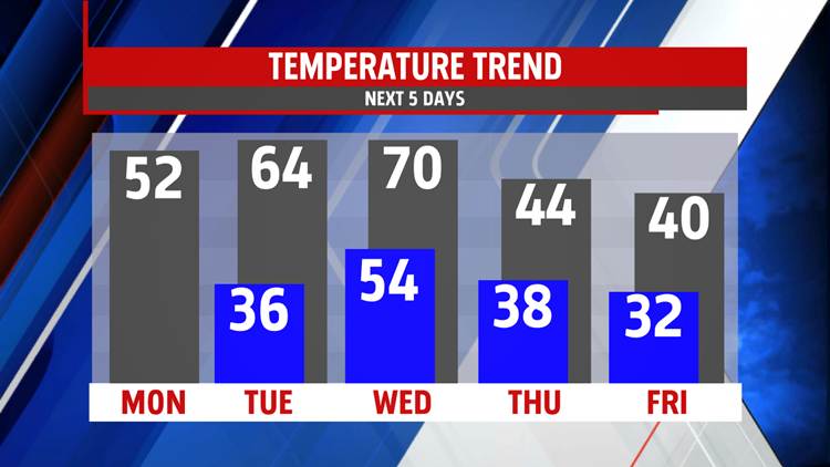

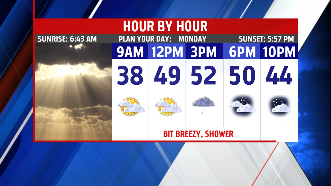


WARMING BACK UP: Temperatures increase once again after a brief chill on Sunday. The morning sees increasing clouds, and it’s a chilly start. Readings begin in the middle to upper 20s. Temperatures spike quickly with a bit of a southwest breeze despite the increase in clouds. Readings reach the upper 40s to middle 50s. A couple showers are possible, but the day is not a washout. Clouds briefly break apart tonight. Low temperatures are not as chilly, with readings in the middle to upper 30s. A warm front approaches Tuesday, and this quickly brings a return to the clouds. Winds turn quite breezy as well during the afternoon, and there’s the chance for a few showers. Temperatures are even milder, with readings in the lower to middle 60s.


WEEKEND OUTLOOK: A warming trend is expected for the weekend as a warm front approaches. It brings clouds, and perhaps a sprinkle, but most look dry at this time. Temperatures are a little higher, in the lower to middle 40s. A mixture of sunshine and clouds is expected for Sunday. It’s even milder, with temperatures in the lower to middle 50s.
Have a great Monday!
