

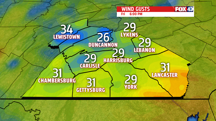

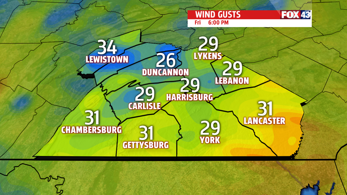
TOMORROW’S SNOW CHANCE: The chance for snow on Friday has trended downward heading into late Friday morning. A few flurries and a snow squall are possible with the high winds gusting to 30mph for Friday. Any accumulations will be light at a coating or less on grassy surfaces.

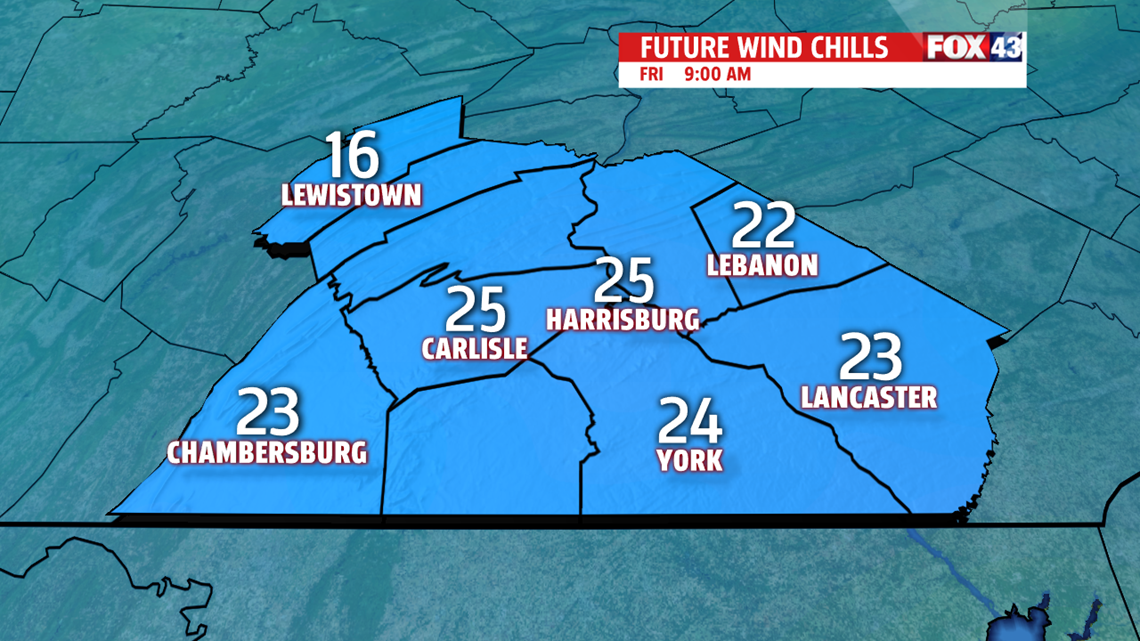
WIND STAYS WITH US: Winds stay strong out of the northwest tomorrow, keeping wind chills down in the upper 20s and low 30s. Breezy conditions continue into Saturday with highs in the mid 30s. The clouds clear out and the breeze calms down until next Tuesday.

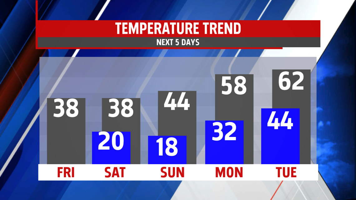
TEMPS RISE, SHOWERS TOO: We stay chilly all weekend as the cooler air will be tough to push out of the area by Sunday. Temperatures rise only to the mid 40s by Sunday, but recover into the mid to upper 50s to start next work week. We stay warm as breezes return on Tuesday, with the chance of showers likely Tuesday with another weak cold front on the way. Temperatures don’t drop far with the passing of the front. Mid 50s this time next week.
Have a great one!
-Meteorologist Bradon Long
