


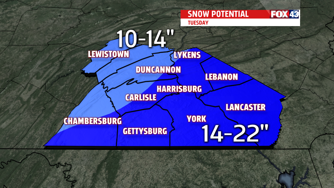
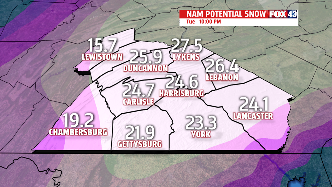
Snow totals right now bring over a foot of snow to a large portion of Central PA. 14 -22″ looks likely with higher local totals possible. Areas to the north and west can expect to see a bit less, but still heavy accumulations. Gusty winds will likely create blowing snow and near-blizzard conditions at times. Snow will fall at 1-2″ per hour in the early morning hours of Tuesday.

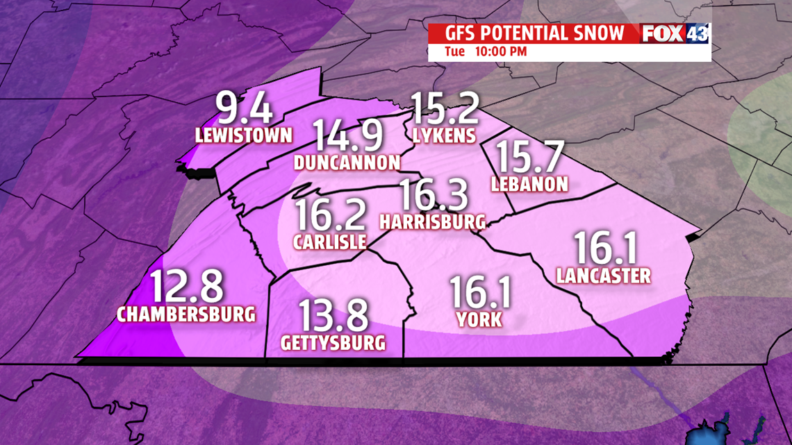
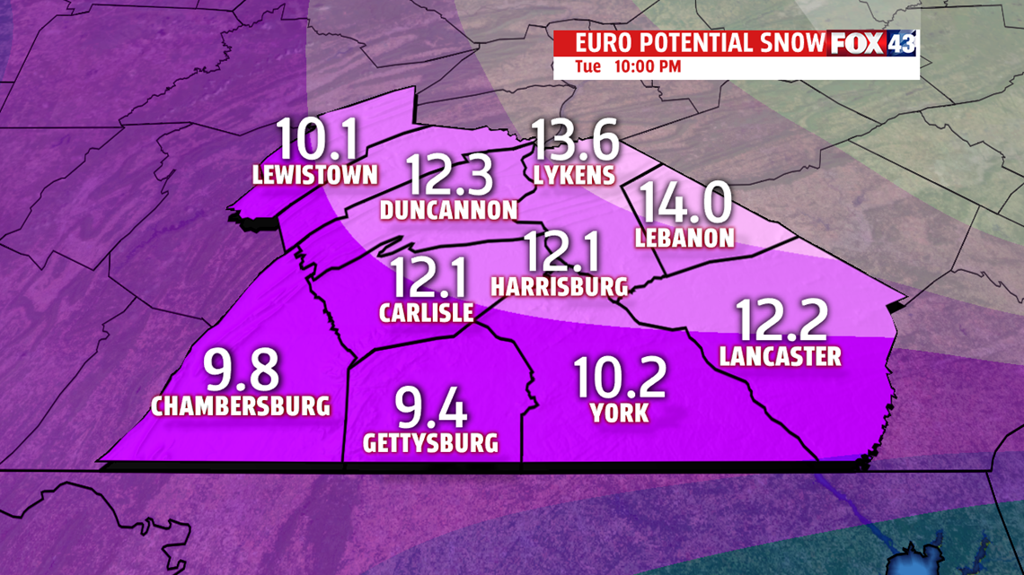
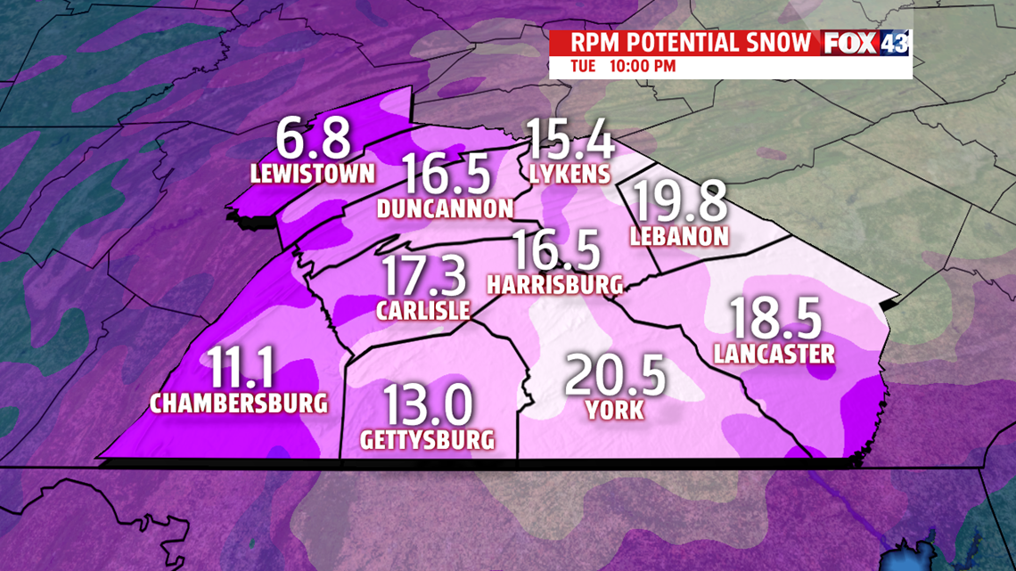
With a couple days left, many things can and likely will change as the systems move closer to the area. Right now four of the main models we look at show very different snow totals for Central PA. Each time the models are run, you can expect to see a different result with systems as strong as these. Here are the totals of what we’re looking at to make our official forecast of what we believe you will see out your door.


The FOX43 Weather Team will be watching to give you the latest up-to-date information on what you can expect out your door as you prepare for hazardous winter weather. Stay with FOX43, we’ll give you the tools you need to be Weather Smart.
