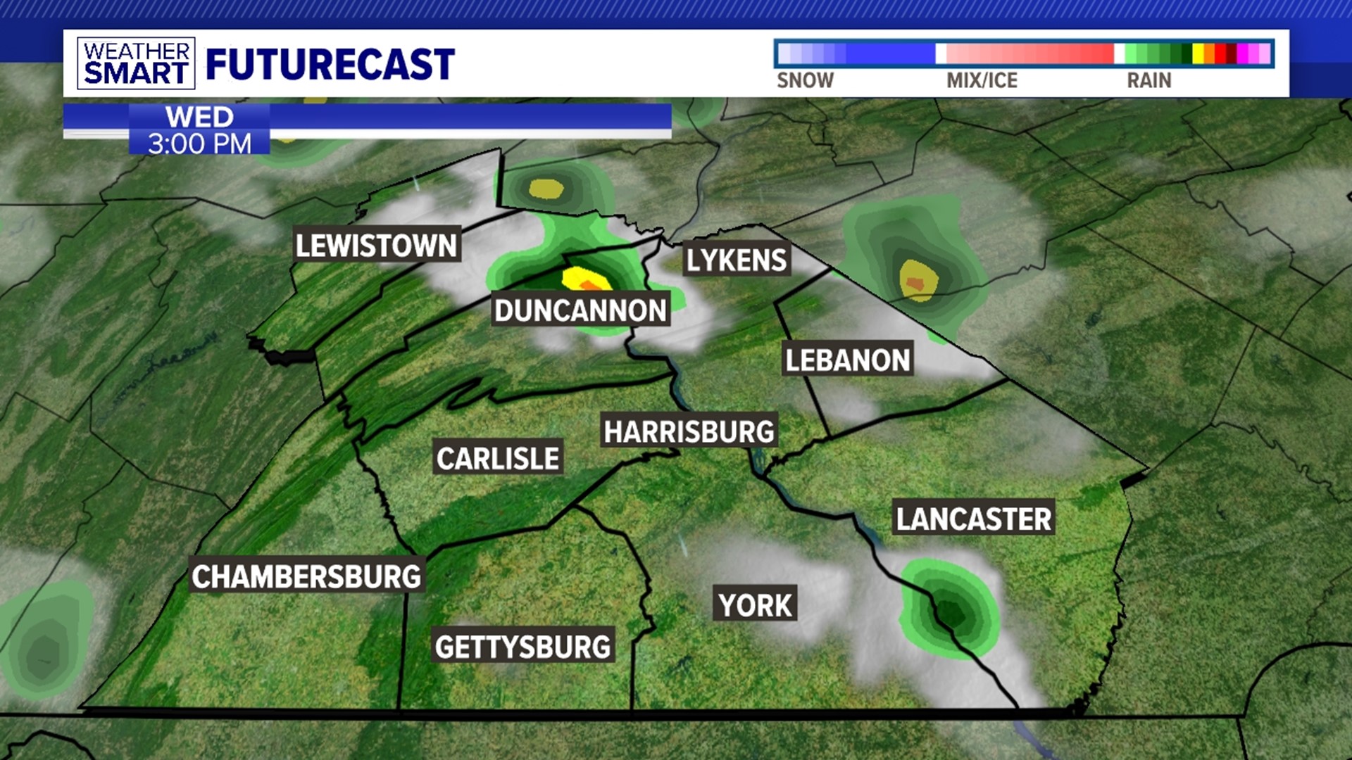


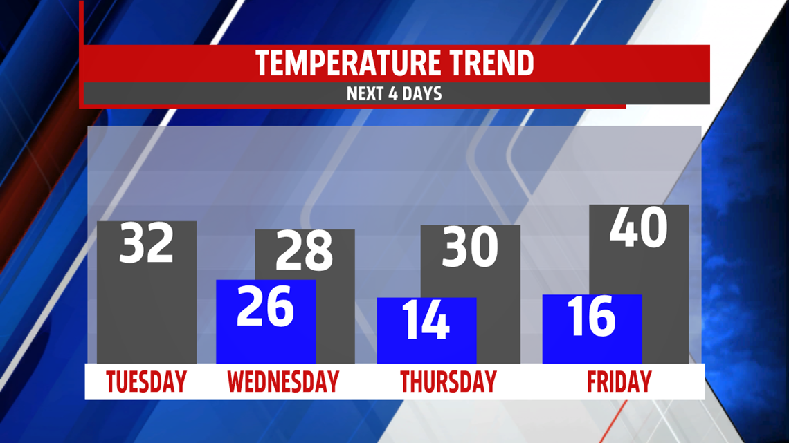
COLD MIDWEEK: Frigid air and breezy conditions remain in place for the middle of the week. Wednesday is mostly cloudy and windy with flurries and snow showers. Temperatures are contained into the 20s with wind chill values in the teens. Thursday brings a little more by way of sunshine, but the frigid temperatures are still in place. Readings are just a touch higher, near the freezing mark. Friday is a good bit milder, though it is still on the cool side for this time of year. Readings are near 40 degrees. After a sunny start, clouds increase through the day.
MILDER WEEKEND OUTLOOK: The weekend still looks a good bit milder than the start of this week. However, readings still run a bit on the chilly side for this time of year. Saturday brings mostly cloudy skies and flurries. Readings are in the upper 30s to lower 40s. Sunday is partly cloudy with temperatures near the 40 degree mark. Monday brings plenty of sunshine to start, with increasing clouds later in the day. It’s a bit milder, with readings crawling higher into the 40s.
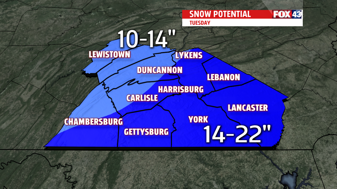
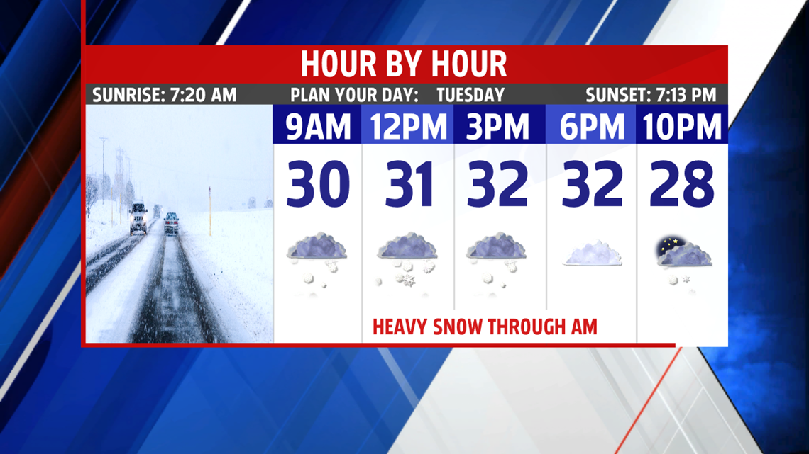
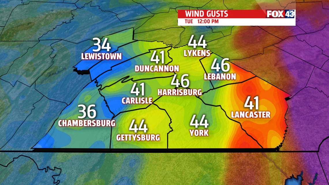
Have a safe Tuesday!