

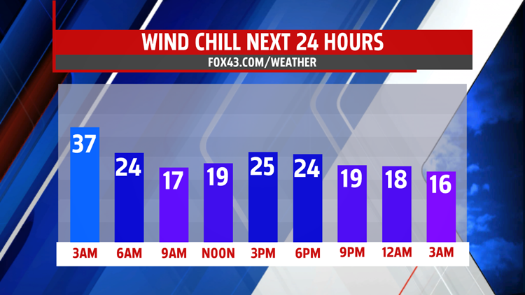


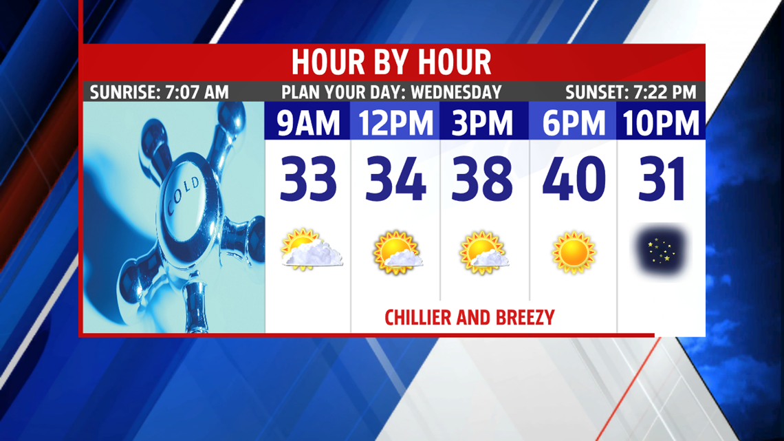
BACK TO THE CHILL: Cold air continues to rush into the region this morning, bringing a midweek temperature swing. Readings fall into the middle 20s to lower 30s by daybreak with a breeze. Skies turn partly cloudy briefly for the morning, then expect more blue skies for Wednesday afternoon. The winds turn quite blustery, with gusts at times up to 35 miles per hour. Readings are in the middle 30s to near 40 degrees. Expect wind chill values to feel like the upper teens to middle 20s through the afternoon. The winds ease tonight, and skies remain mostly clear. Expect overnight low temperatures to fall into the upper teens to middle 20s, quite the frigid one for a March night.

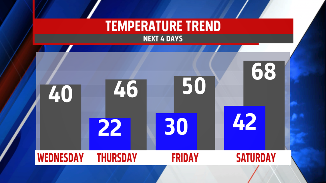
SLOWLY TURNING MILDER: Temperatures begin to recover Thursday, but slowly. The winds are quiet, and there’s mostly sunny skies. Temperatures make it into the lower to middle 40s. Friday, a warm front lifts north. This brings a few showers and plenty of clouds as it crosses the region. Expect even milder temperatures despite the clouds and showers. Readings are in the upper 40s to lower 50s.


WARM START TO WEEKEND: Saturday is dry and warm before the weekend turns unsettled. Expect clouds to increase later during the day. Otherwise, it’s warm with plenty of sunshine. Temperatures reach the middle to upper 60s, but 70 might not be out of the question! Our next system arrives for Sunday, bringing plentiful clouds and a return to rain. Afternoon temperatures reach the lower 50s. Monday still brings the chance for some showers, and shower chances are even expected to last through Tuesday. Highs are in the lower to middle 50s.
Have a great Wednesday!
