


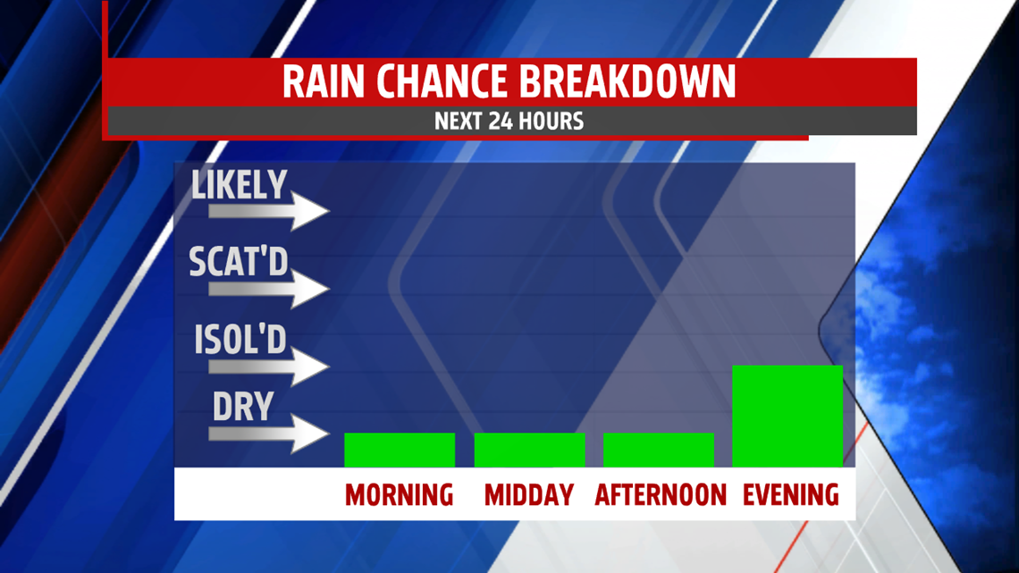

EVEN WARMER TUESDAY: A strong ridge of high pressure remains in place for another day, ensuring warm conditions Tuesday. It’s a milder start to the day, with temperatures in the upper 40s to lower 50s. Winds are light to quiet, and there’s plenty of morning sunshine to start the day. Plenty of sun continues through the midday hours, then some clouds build for the rest of the afternoon ahead of a cold front. There’s the chance for a few late day showers, perhaps a strong, gusty thunderstorm toward sunset. Best chance is northwest of Harrisburg. Expect readings in the upper 70s to lower 80s, just a few degrees under record breaking warmth. A couple overnight showers continue, with readings dropping into the middle 50s to lower 60s.


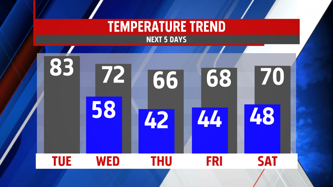
EASTER WEEKEND: The Easter Weekend forecast isn’t look too bad at this time! Saturday features partly sunny skies, with temperatures in the 60s, perhaps near 70 degrees in some spots. We’ll watch for a late day shower. A better chance for a few showers, even a couple thunderstorms, arrives on Easter Sunday. It’s very warm again, with temperatures reaching the middle 70s to near 80 degrees despite the shower chance.
Have a great Tuesday!
