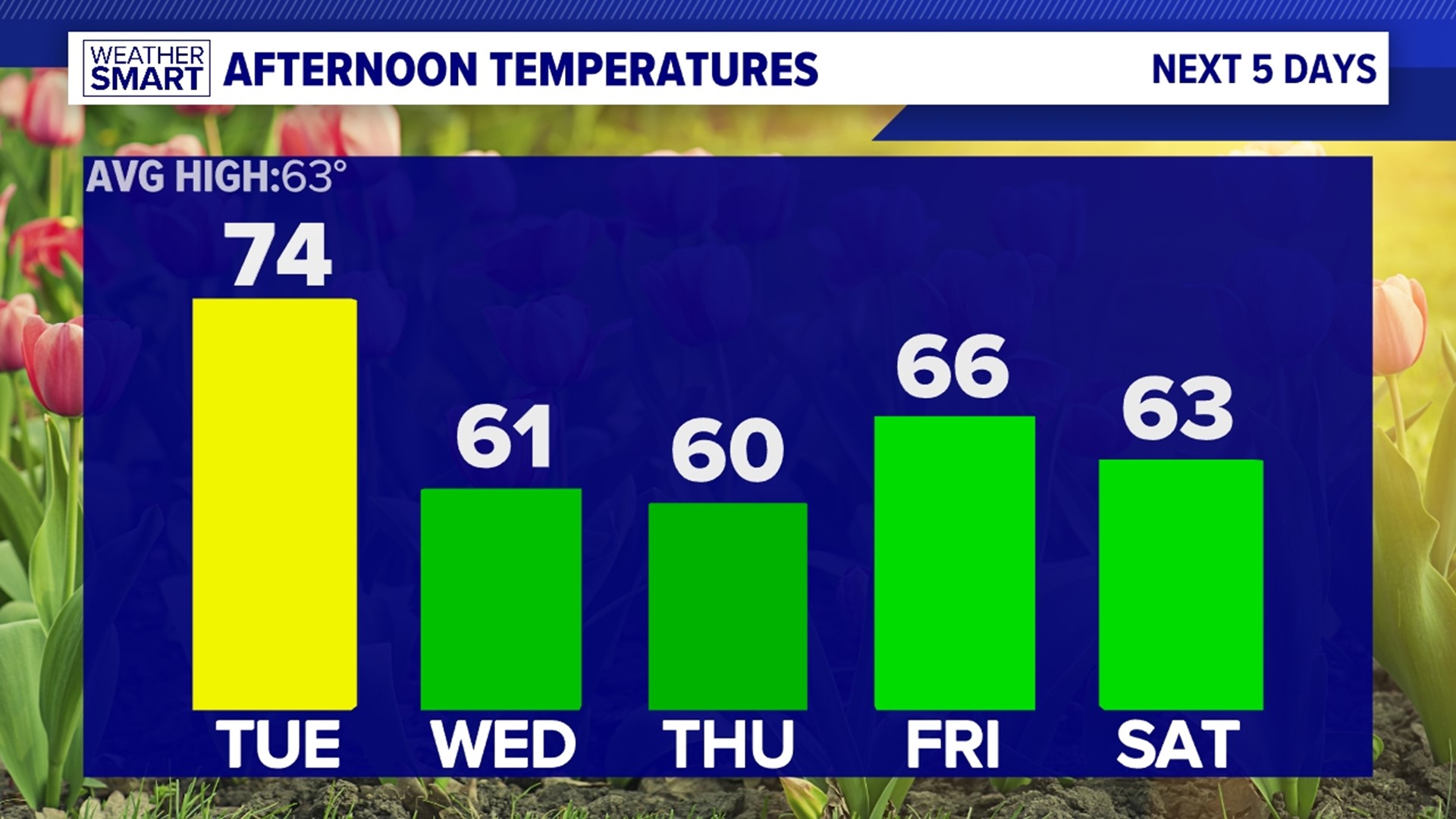


WARMING UP: Skies are slow to clear Wednesday. Clouds linger through most of the day, but by about mid to late afternoon, some sunshine should be able to break through. Temperatures are highly dependent how soon the clouds move out, but it should be enough to boost most well into the 60s, perhaps near 70 degrees. Summer warmth is in place for Thursday. Temperatures reach the lower to middle 80s under partly sunny skies. Friday isn’t as warm, but it’s still well above average. A front crosses, and brings the chance for a few thunderstorms. Highs are near 80 degrees.
TASTE OF SUMMER: Even warmer temperatures are anticipated into the weekend. It feels like the middle of summer, in fact. Readings reach the middle 80s Saturday as a strong front amplifies over the region. As it builds, a few afternoon thunderstorms are possible. Sunday, temperatures are in the middle to upper 80s! We’ll watch the potential for the first 90 degree day of the year! There’s partly cloudy skies, and the chance for an isolated thunderstorm.
Have a great Monday!
SEVERE WEATHER AWARENESS WEEK
Severe Weather Awareness Week is back in PA! Each day through Friday, there’s a topic of discussion to better inform and prepare the public for this year’s severe weather season. Monday’s topic is tornadoes.
Tornadoes do occur in Pennsylvania, though usually not as strong as our friends in plains. Pennsylvania ranks in the top 25 for tornado occurrence, averaging about 20 tornadoes per year.
If conditions are favorable for tornado development, the National Weather Service issues a Tornado Watch. This only means that conditions are favorable for a potential tornado; a tornado may not actually happen. However, it is important to be vigilant, follow the forecast much closer that day, and be ready to seek shelter if a Tornado Warning is issued. With that said, a Tornado Warning means that Doppler Radar has indicated rotation in a storm that can produce a tornado OR there is a confirmed tornado on the ground. Whether confirmed or not, it is the time to take action and seek shelter.
If a Tornado Warning is issued, remain calm, but act quickly. Always head to the lowest floor in a building. Safe places at home include basements or interior rooms without windows. These spots include closets and bathrooms. Covering you head with a helmet or even a thick blanket for protection is encouraged. Leave mobile homes and take shelter in a substantial structure.
Stay with FOX43 Weather for more important information through the week!


