

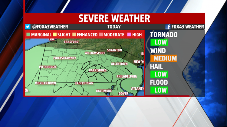


A warm front hanging just north of the region Saturday brings the potential for isolated thunderstorms this afternoon, a couple of which may be strong to severe. Damaging winds and hail are the primary threats, along with dangerous lightning and heavy downpours likely as well with any thunderstorm that develops, whether severe or not. An isolated tornado cannot be ruled out, but it’s on the very low end of probabilities. The Storm Prediction Center has placed the region in it’s Marginal Risk category for severe weather, the lowest risk category for determining severe weather threat. In short, it’s a very minimal threat, but be alert through the day.
Otherwise, Saturday is another warm day, and it’s more humid compared to Friday afternoon. Afternoon readings should manage the lower to middle 80s despite plenty of clouds through the day. Winds are breezy out of the west/southwest at 5 to 15 miles per hour.
Stay with the FOX43 Weather Smart Team for more updates throughout the day. We’ll keep you up-to-date on the latest through the afternoon to ensure you can safely enjoy your Saturday plans!
