

SHOWERS RETURN LATE THURSDAY

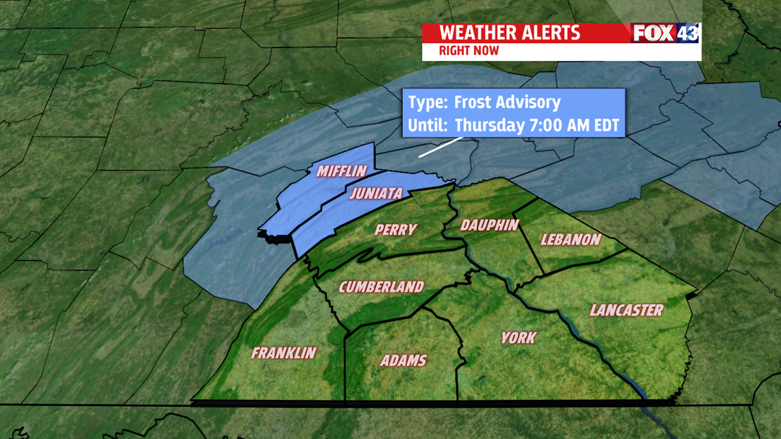
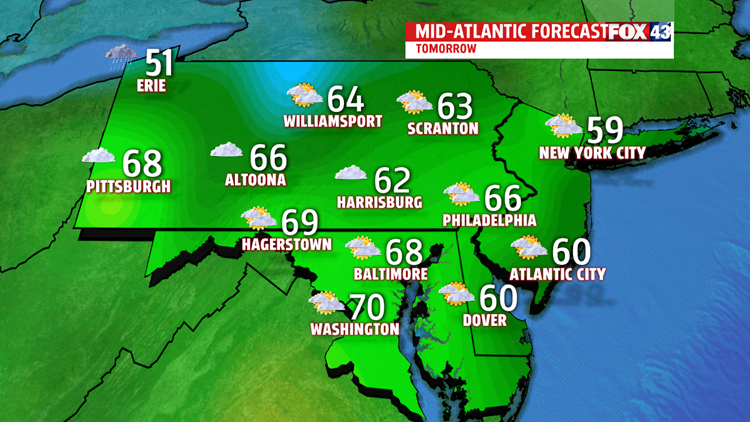
Skies briefly clear out this evening and overnight, and winds die down. This leads to a much chillier night for the area. In fact, across the central portion of the state and higher elevations to the northwest, like Mifflin and Juniata county, lows could drop into the 30s. A FROST ADVISORY has been issued for these two counties from 2 A.M. to 7 A. M. Be sure to protect any potted plants or tender vegetation which may freeze. Southeasterly flow sets up and pulls the moisture back across the area, so clouds thicken back up for Thursday. High

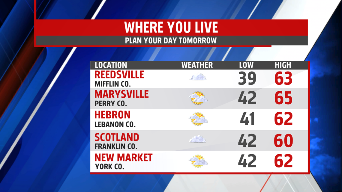
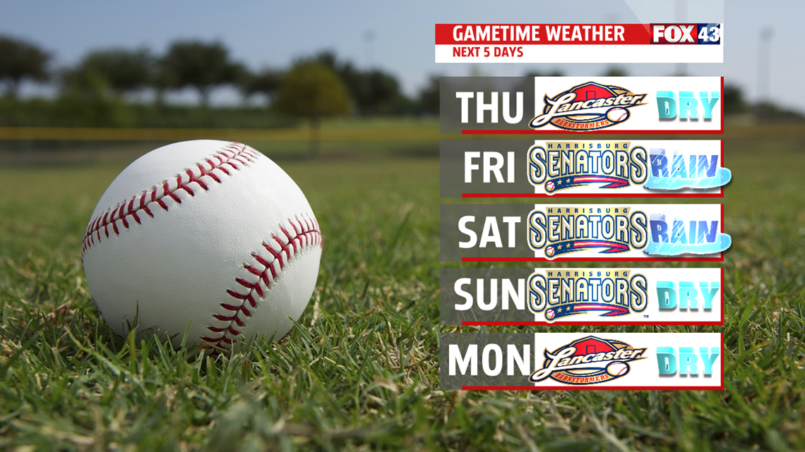
temperatures manage to climb to the lower 60s. Other than a late day isolated shower, most of the area remains dry until late evening, when rain chances increase. Widespread rain continues overnight into late morning Friday. Allow for extra travel time for the morning rush hour. Heaviest rain expected early in the day, with more scattered showers falling for the afternoon. High temperatures jump a bit into the middle and upper 60s, and depending on if there are any breaks in the clouds to allow peaks of sunshine, there may be a few spots hitting 70 degrees.

UNSETTLED, COOL WEEKEND
Upper level system stalls over the northeast and pieces of energy pivot through the area. This keeps the threat for a few showers around Saturday, and an isolated shower chance for Sunday. Plenty of clouds with limited sunshine. Readings are cooler in the upper 50s to near 60 degrees to start the weekend. Highs Sunday stay in the 50s. Breezy conditions are expected too.
NEXT WEEK
Upper level system starts to lose it’s grip on the area Monday. We’ll see a bit more sunshine mixing in and out of the clouds. An isolated shower is possible but chance is very low. Temperatures remain on the cooler side in the upper 50s. Finally, a dry day with more sunshine arrives Tuesday. With the added sunshine, temperatures are warmer in the lower 60s. This still falls short of average for this time of the year. Rain threat returns early Wednesday.
Have a wonderful day!
Be “Weather Smart” and watch FOX43 for all your weather and news updates.
MaryEllen Pann,
Chief Meteorologist
